Historic and Contemporary Images of Brighton and Hove
Based on the Regency Society James Gray Collection
  • Home page
    • James Gray
    • Project volunteers
    • Acknowledgements and copyright
    • Contact us
  • Master map
  • Street Index
  • Find a place
    • Neighbourhoods
    • Images of the seafront
    • Parks and Open Spaces
    • Redeveloped areas
    • Street Index
    • Royal Pavilion Estate
CHURCHILL SQUARE

Churchill Square

Central Brighton

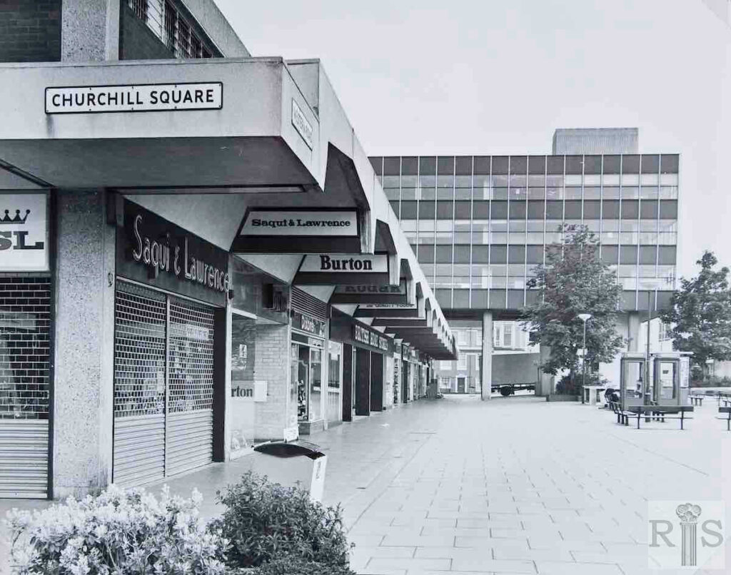
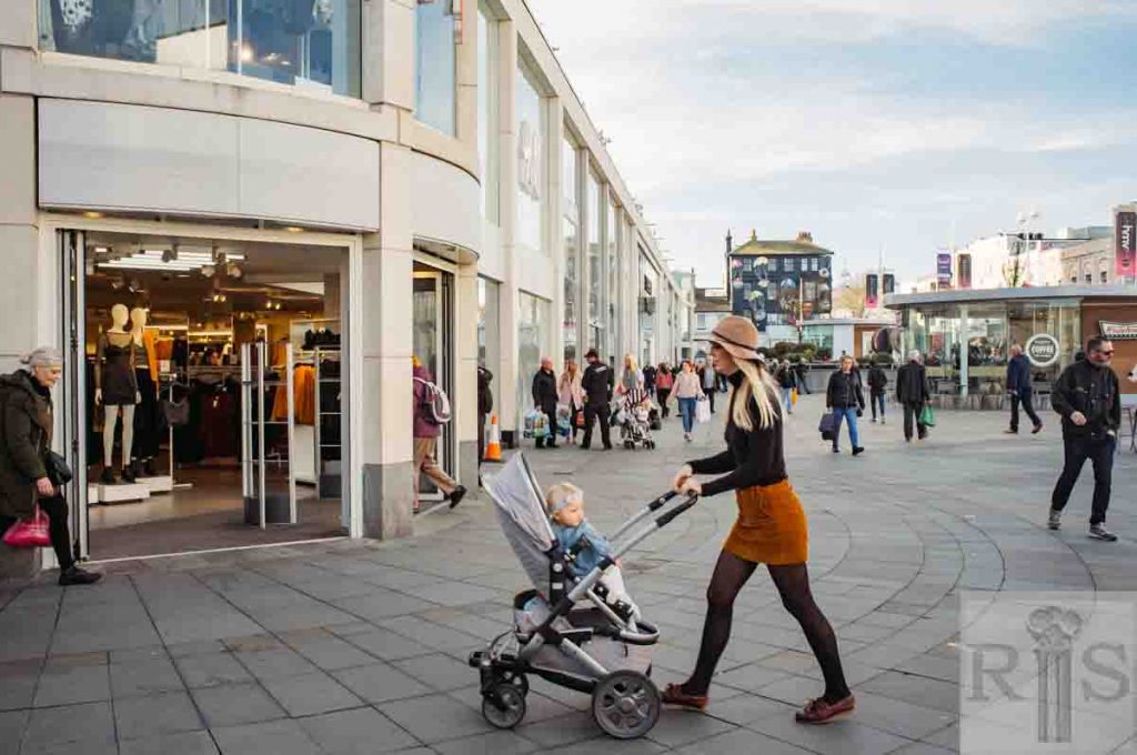
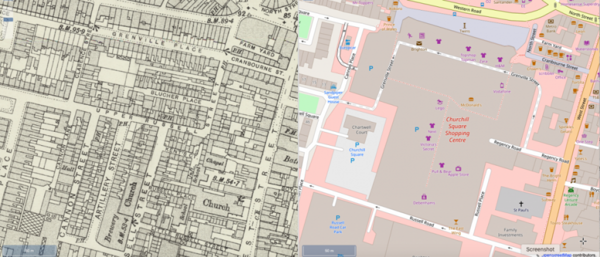
Churchill Square is a shopping centre in central Brighton built to replace a crowded area of small streets demolished in the 1960s. The James Gray Collection contains several images of these disappeared streets. Each historic street in the Churchill Square area has its own ‘historic streets’ page (see below).(Please note that general practice in this website is to name streets using their current name. Historic streets are included  only in areas of exceptionally complex development where it is impossible to locate images using a current street name. )

The map on the left is Ordnance Survey 25 inch 1892 - 1914.  That on the right is Open Street Map in 2019. These maps are reproduced with the permission of the National Library of Scotland and are of the same area to the same scale. (click on the map to see the NLS ‘Side by side’ interactive map).

Comparison map: Historic streets alongside 2020 layout.

The map on the left is Ordnance Survey 25 inch 1892 – 1914. That on the right is Open Street Map in 2019. These maps are reproduced with the permission of the National Library of Scotland and are of the same area to the same scale. (click on the map to see the NLS ‘Side by side’ interactive map).

Churchill Square historic street links:

Artillery Street

Blucher Place

Cannon Lane

Cannon Street

Clarence Street

Grenville Place

Kent’s Court

Milton Place

Russell Place

Russell Street

Upper Russell Street (1): North-South Section

Upper Russell Street (2): East – West section

Wellington Place

General images of Churchill Square

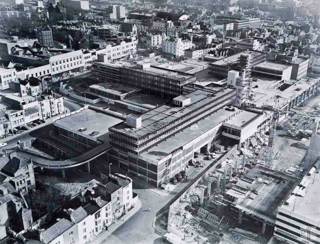
1968
2018

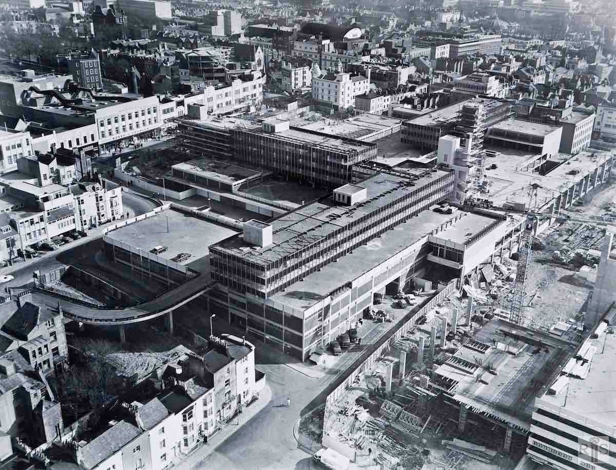
James Gray: Progress of this vast development, February 1968. Still a great deal to be done, the office blocks to be finished and the tower block (right foreground) just being started. jgc_29_210

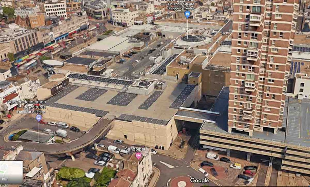
2018: On the left (west) of both images is the ramp leading to the roof car parking area of Churchill Square. The offices of the Post Office service (the reverse L-shaped structure in the 1965 image) have disappeared and the whole of the shopping area has been roofed over.

The road leading out of Russell Square (bottom centre) has been bridged to link up with more car parking spaces around the lower floors of Chartwell Court, which was under construction in 1965. In Western Road, the façade of Marks and Spencer and the entrance to Imperial Arcade remain largely unaltered. (Photographer: Suzanne Hinton)
More
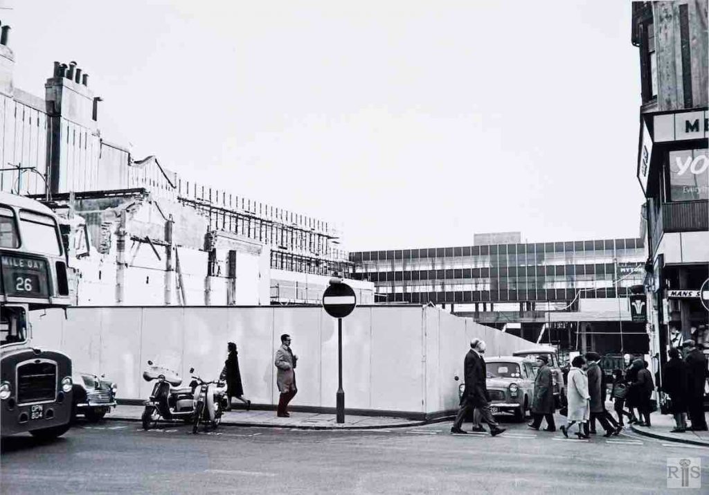
1967
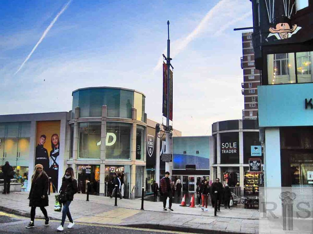
2019

James Gray: Two photographs [jgc_29_208 and jgc_29_209] of March 1967, showing, from the north, the clearance in Western Road at the corner of Clarence Street. jgc_29_208

2019: The sign of the Prince of Wales public house can be seen to the west (right) of each image. To the east, virtually nothing remains of the ‘first’ Churchill Square (late 1960s – late 1990s).

The British Telecom offices have been replaced by an indoor shopping mall. The high-rise block of flats, Chartwell Court (1967), now towers above the new Churchill Square. It is built over the car park to the original square. (Photographer: Google maps)
More
1980s
2018

James Gray: My collection would be incomplete without including at least one photograph of Churchill Square which covered the mass of small streets, courts and alleys which were formerly here and which can be seen in the West Brighton album. I do not know when this photograph was taken but most of these buildings will disappear during the complete rebuilding of the square now in progress. jgc_19_042

2018: Churchill Square was first opened in 1967. It was heavily redeveloped in the late 1990s and the facade has been revamped more than once since then. (Photographer: Nick Eastham) 

c1910
2019

James Gray: On the south side of the road and nearer the Clock Tower. This is the site now occupied by Barratt’s boot and shoe shop, erected here in 1924. jgc_19_044

2019: Barrett’s at No 17 Western Road would have been almost in the centre of the shops between North Street and Clarence Street. They occupied the area where the pavement and bus layby is now. See jgc_19_154 on the Western Road (1) page for a clear picture of the shops, including Barratts shoe shop, just before demolition. The 2019 image shows the frontage of  Churchill Square directly behind where No 17 stood. (Photographer: Nick Eastham) 

1965-66
2018

Text is being prepared or edited for this entry. It will be available soon.

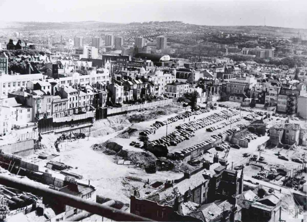
James Gray: Another of the many photographs showing the progress of this extensive rebuilding of this former densely populated area. Possibly taken from high up on the flats being built here, the year is most probably 1965 or 1966. Many of the landmarks can be picked out. Marks and Spencer in Western Road, the Union Church in Queens Square, Regent Cinema and Dance Hall and many others.
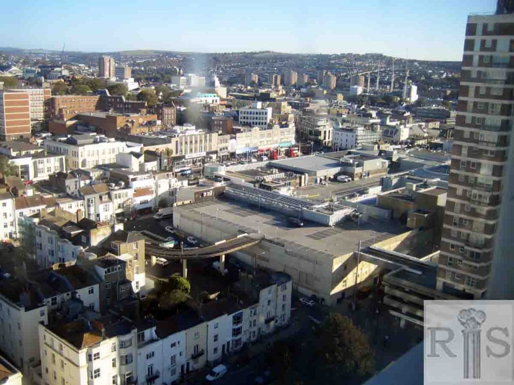
The north side of Grenville Place is seen but not the south side, demolished in January 1965, while the line of the completely empty Upper Russell Street can clearly be traced, as can those of Cannon Street and Cannon Lane. jgc_29_204

2018:  The 2018 photograph was taken from the 17th floor of Sussex Heights.  The Marks and Spencer store is roughly in the centre of the photograph. The white house behind the scaffolding pole in the James Gray image is No 11 Russell Square, Nos 1 – 10 having already been demolished. The same building is on the right-hand (east) end of the range of buildings at the bottom of the 2018 photograph.

The oblique range of houses at the bottom of the 1965 image were Nos 1 (the Cannon pub), 2and 3 Russell Square, and  Nos 26 and 25 Cannon Place. All had disappeared by 1966. The monolith of the Churchill Square shopping centre and car parks rose in their place. Chartwell Court towers over where the Cannon pub once stood.
 
In the distance, the six tower blocks of the Carlton Hill clearances have been joined by several more, notably Theobalds House and the Metropolitan College, both to the left (north) of the modern photograph.  (Photographer: Suzanne Hinton) 
More
Historic and Contemporary Images of Brighton and Hove
This website has been prepared by the Regency Society of Brighton and Hove. All historic maps are provided with kind permission of the National Library of Scotland (https://www.nls.uk/) regencysociety.org

Search