Historic and Contemporary Images of Brighton and Hove
Based on the Regency Society James Gray Collection
  • Home page
    • James Gray
    • Project volunteers
    • Acknowledgements and copyright
    • Contact us
  • Master map
  • Street Index
  • Find a place
    • Neighbourhoods
    • Images of the seafront
    • Parks and Open Spaces
    • Redeveloped areas
    • Royal Pavilion Estate
    • Brighton Station
    • Street Index
A STROLL AROUND NORTH LAINE AREA – QUEENS GARDENS

Queen’s Gardens

Neighbourhood:
North Laine
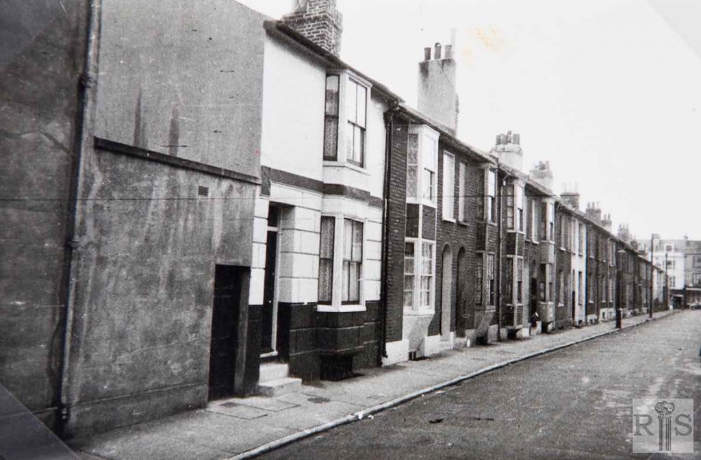
1958/61
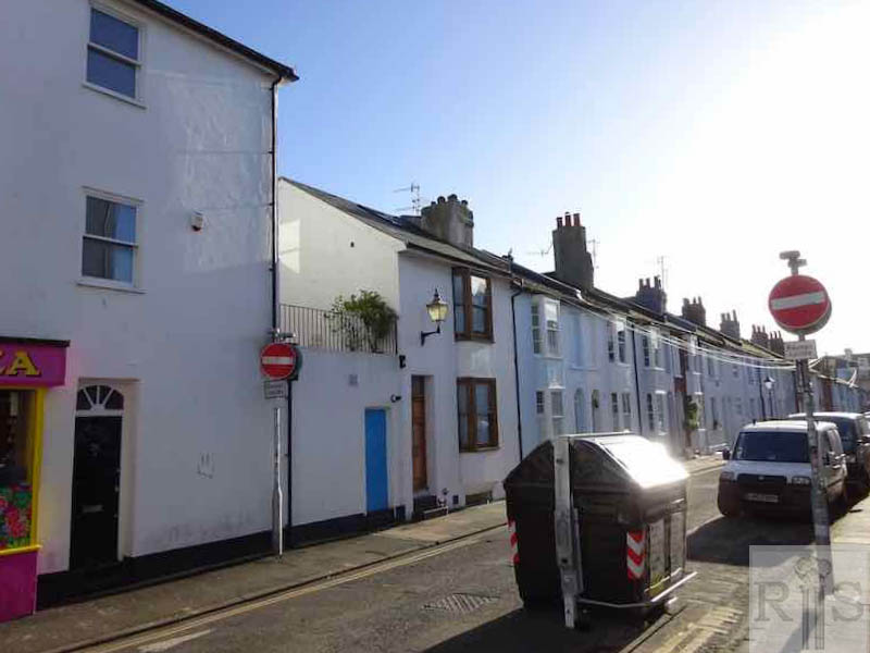
2018

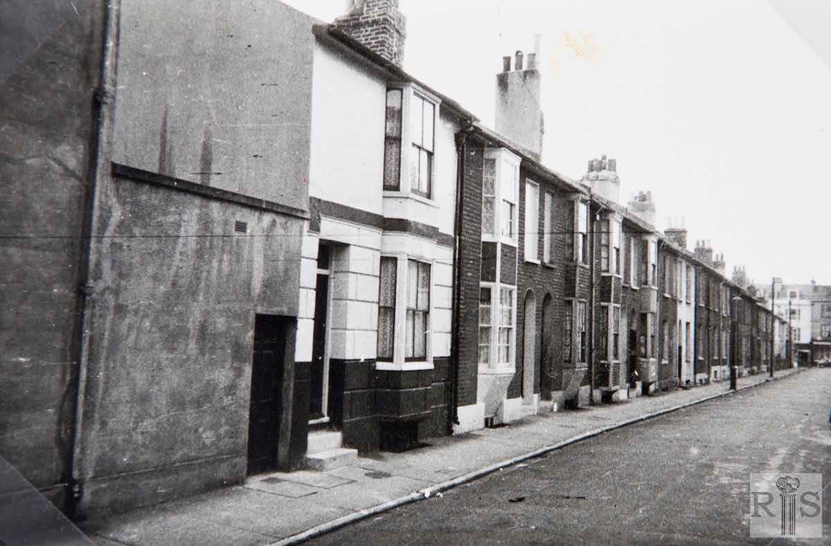
James Gray: Dates of these photographs are not known, but it is thought that all were taken in the period 1958/61, a view that is supported by the almost complete absence of motor vehicles in the residential streets. The complete east side looking from Gloucester Road to North Road, in distance. jgc_25_184

2018: Queen’s Gardens is largely unchanged, apart from the addition of stucco to some facades and the street signs and the communal refuse bins. (Photographer: Geoffrey Kavanagh)

More
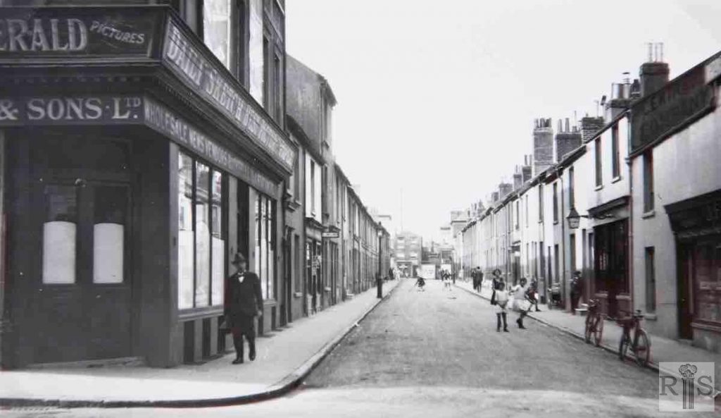
1928
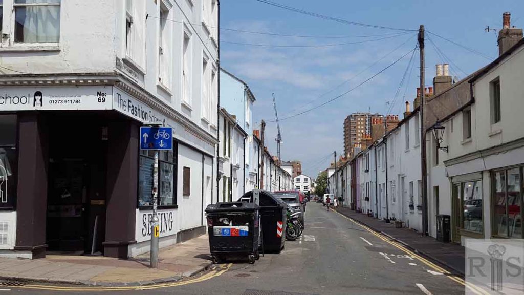
2018

James Gray: Hardly changed today, nearly 30 years later. jgc_25_228

2018: Looking north along Queen’s Gardens from North Road, this shows another relatively unchanged scene except for the ugly bins, parked cars and absence of children playing. (Photographer: Chrissie Beglin)

Historic and Contemporary Images of Brighton and Hove
This website has been prepared by the Regency Society of Brighton and Hove. All historic maps are provided with kind permission of the National Library of Scotland (https://www.nls.uk/) regencysociety.org

Search