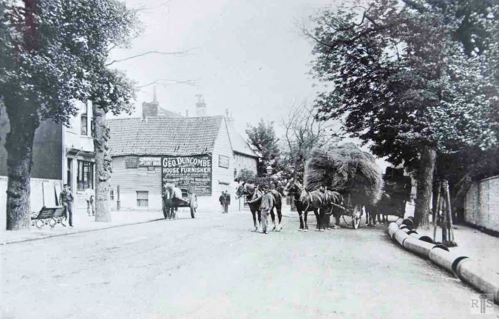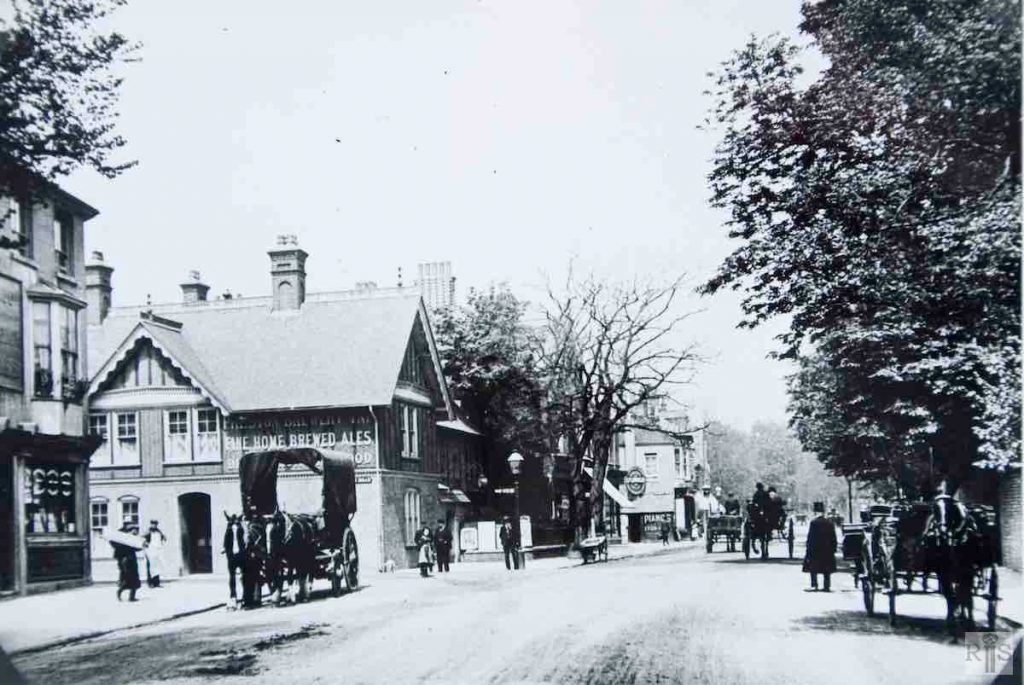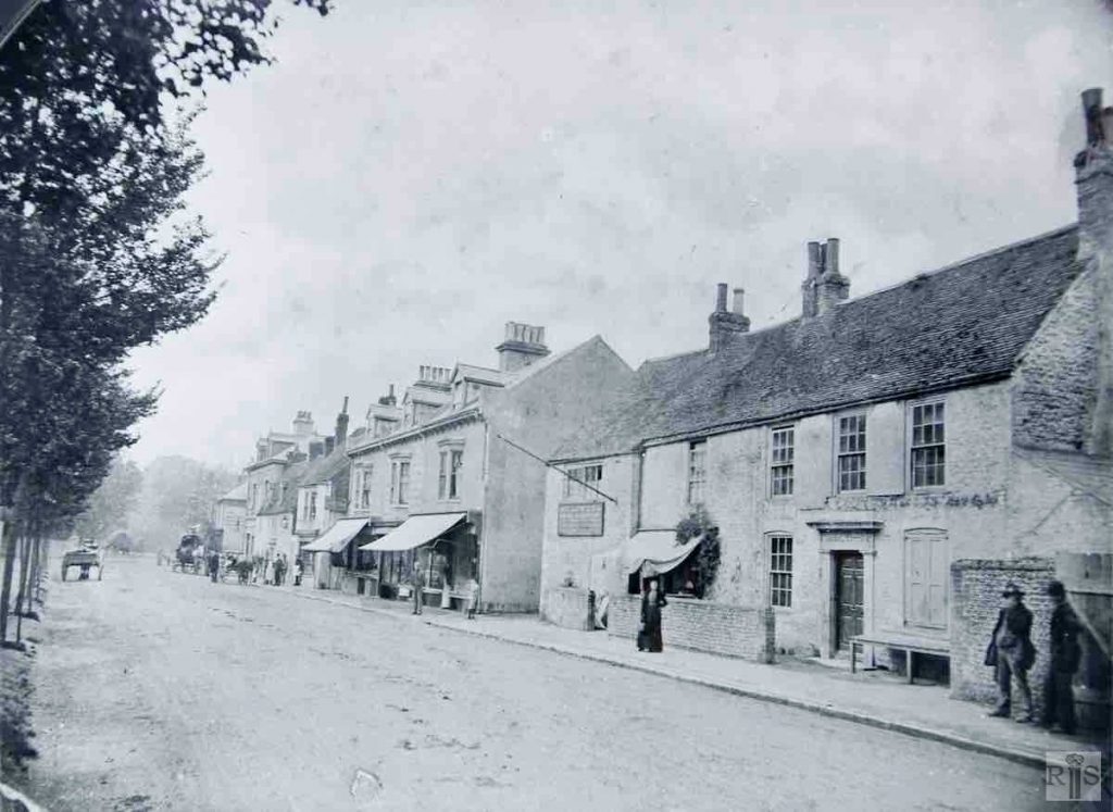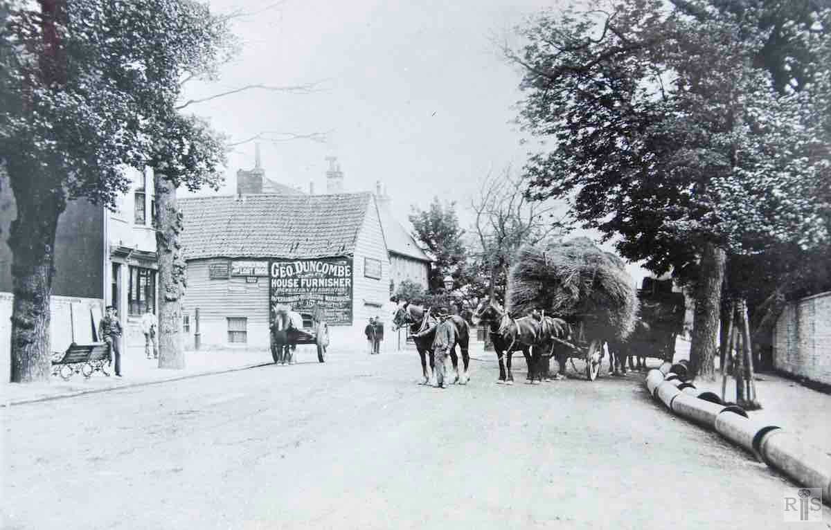
James Gray: A different view with haycart in the road. Note the reference to the Sussex Home for Lost Dogs in Robertson Road. Additional Information: Geo. Duncombe house furnisher. jgc_18_185
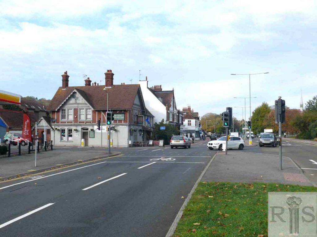
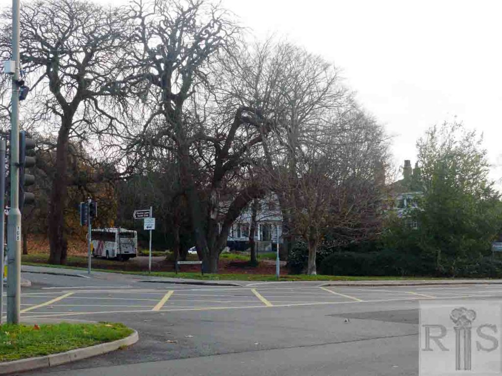
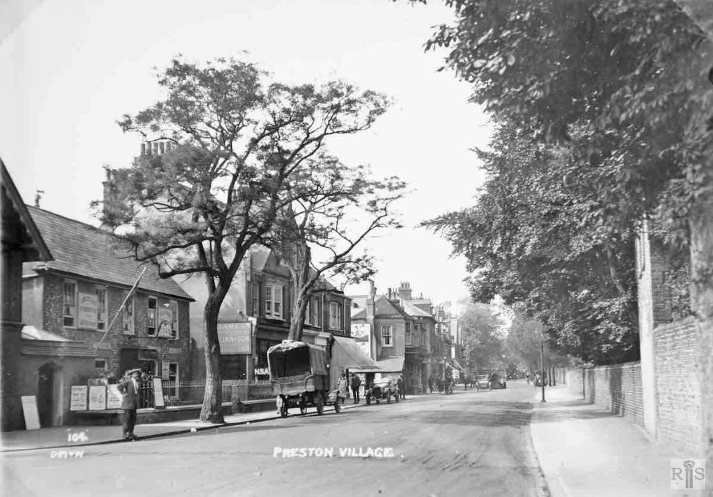
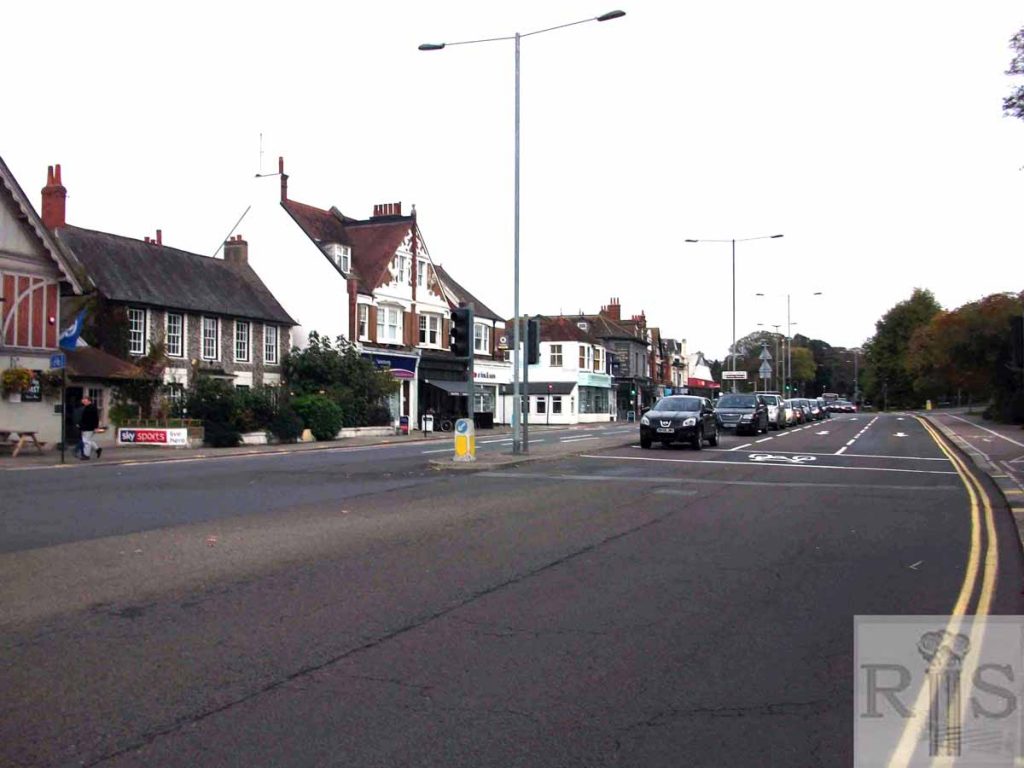
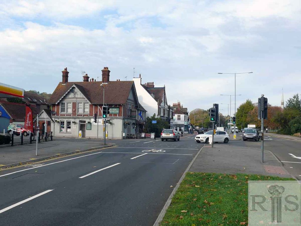
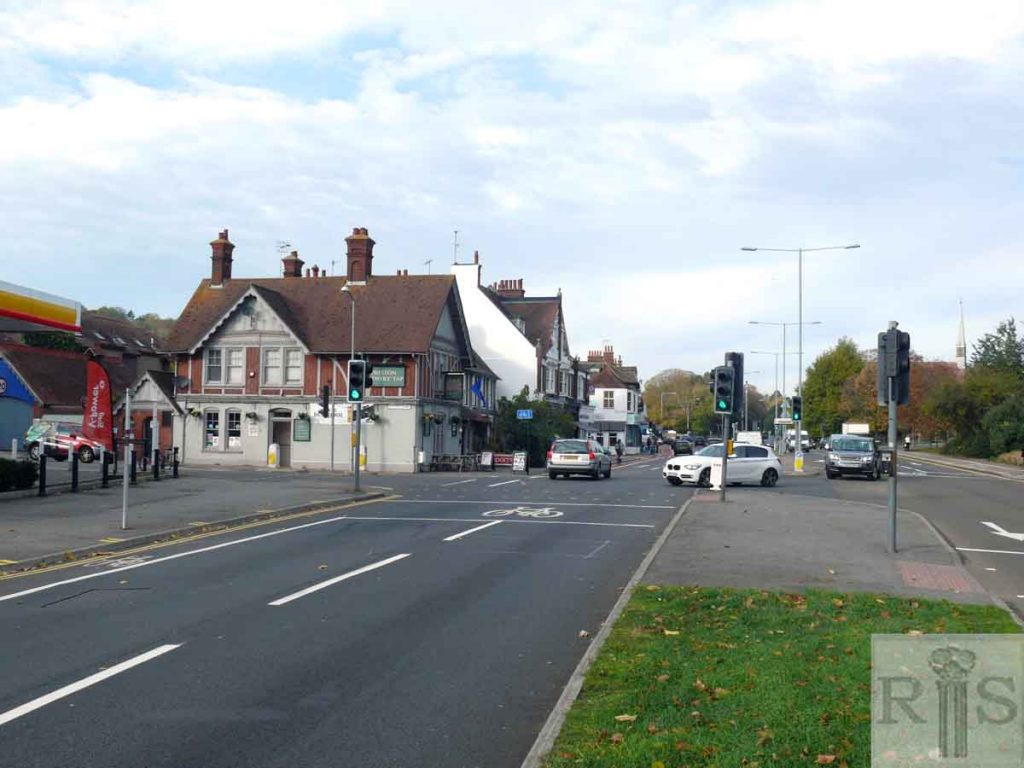
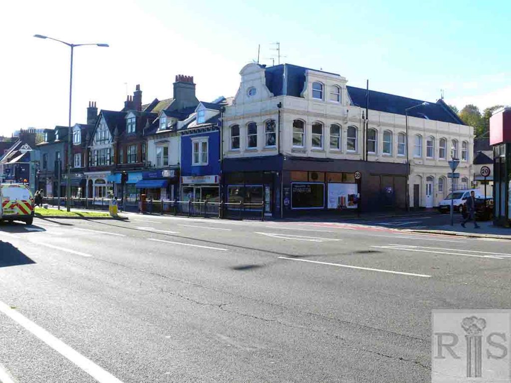
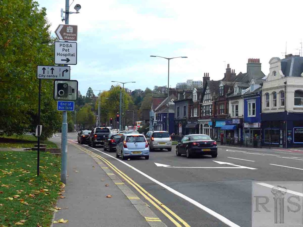
2019: Looking north at the junction of Preston Road and South Road. In the original image, the corner building on the far left next to the wall was the Black Lion, a three-storey building built in the 1850s and demolished in the 1970s to make way for the Shell Garage site.
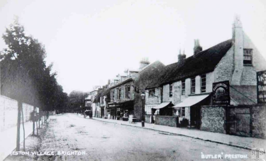
James Gray: View looking south in the village main street. jgc_18_146
2019: In 1936, Preston Road was widened opposite its junction with South Road, pushing the boundary of Preston Manor further east, so the left-hand sides of the 1900-10 and 2019 images are very different.
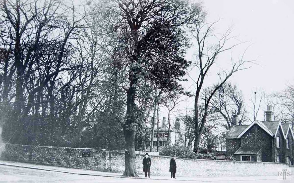
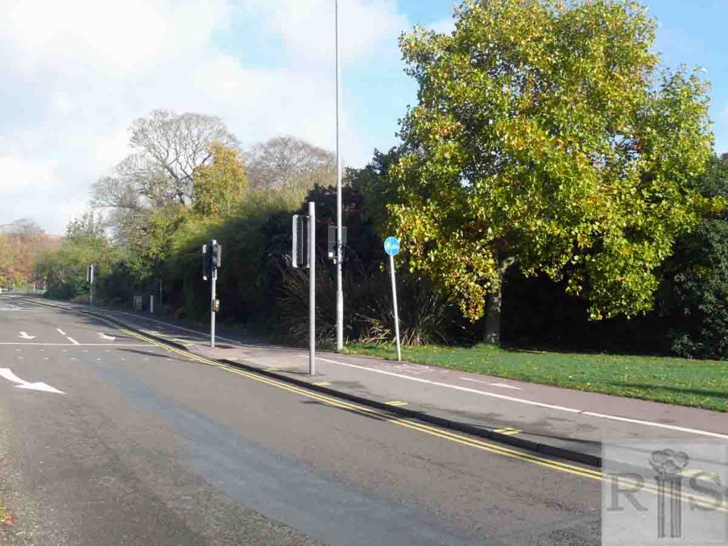
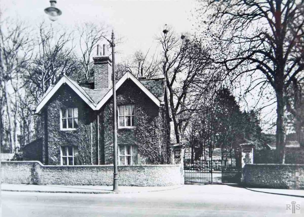
James Gray: Photograph taken on 13 April 1935. The stables and the two cottages, seen here, were removed in the following year when the roadway was widened opposite South Road. When the Stanford family occupied Preston Manor, their butler lived in one of these cottages. Lodge of the Manor, occupied by some of the staff. jgc_18_166
James Gray: Compare these photographs with those on previous pages, particularly the large one, circa 1914. From these it is evident that there had been an earlier widening of Preston Road in this vicinity, probably in 1928, when the Preston Park railings were removed. jgc_18_168
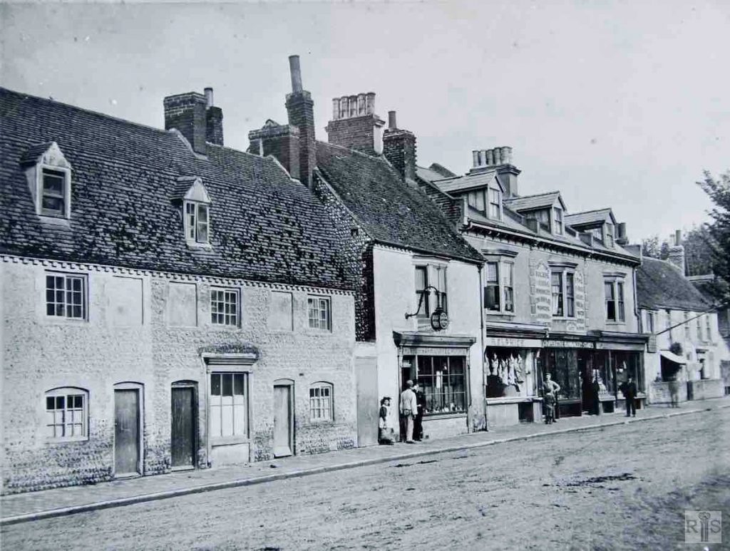
James Gray: Three photographs of rural Preston Road. In this same year the old cottages in this photograph were demolished to make way for the present large shops. Additional Information: H. Elphick – butcher, Preston Park Coffee Rooms. jgc_18_184
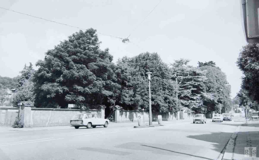
James Gray: By the time this photograph was taken on 25 June 1978, the massive trees had all but obscured the individual houses from the roadway though some entrances are visible. The view is from the corner of Cumberland Road looking north. One wonders what will be the fate of these ten houses, two of which, Nos 235/237, in 1961 were used to house the first students at Sussex University.
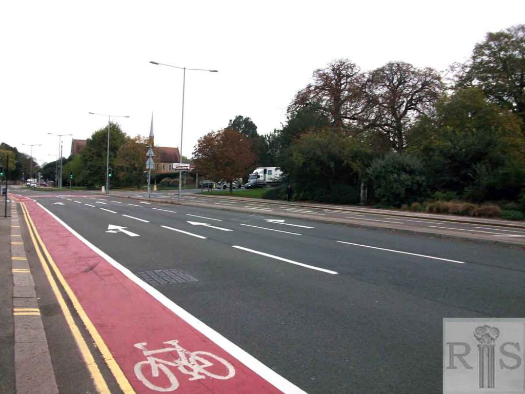
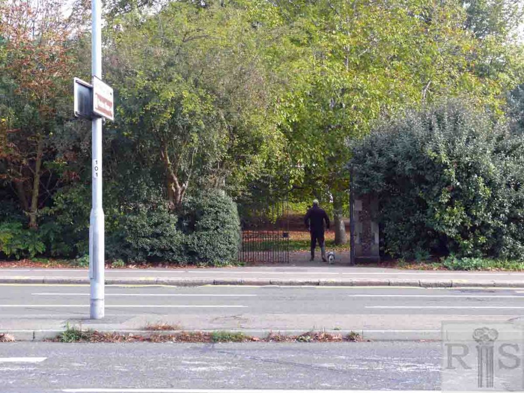
James Gray: View from South Road, looking towards Preston Drove. Note the entrance gates to Preston Manor, and beyond, through the trees, the windows of Preston Vicarage. The fountain went early in the 1920s. jgc_18_164
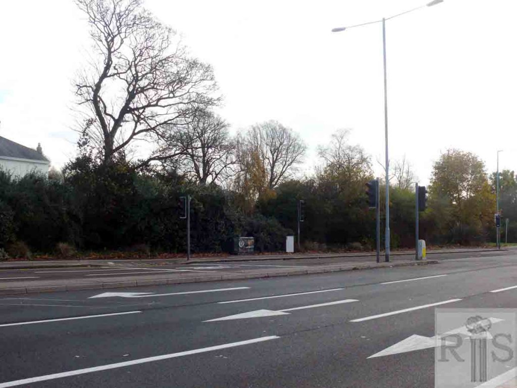
2018: One pillar of the former gates to the Manor can just be seen in the bushes toward the right. Traffic lights mark the junction of Preston Drove. The tall steeple of St John’s Church on the corner of Knoyle Road is visible in the distance. (Photographer: Jane Jordan)
James Gray: Photograph taken on 13 April 1935. The stables and the two cottages, seen here, were removed in the following year when the roadway was widened opposite South Road. When the Stanford family occupied the Manor their butler lived in one of these cottages. jgc_18_165
2018: The buildings and the original wall have gone. The perimeter is now surrounded by shrubbery. The fountain stood just level with the pedestrian crossing. (Photographer: Jane Jordan)
James Gray: Another photograph taken on 13 April 1935. The stables and the two cottages, seen here, were removed in the following year when the roadway was widened opposite South Road. When the Stanford family occupied the Manor, their butler lived in one of these cottages. Compare these photographs with those on previous pages, particularly the large one, circa 1914. From these it is evident that there had been an earlier widening of Preston Road in this vicinity, probably in 1928, when the Preston Park railings were removed. jgc_18_167
2018: The entry gates to the stables and cottages seen in the 1935 image remain with the land occupied by the former buildings now filled by trees and shrubbery. See jgc_18_165 for the other 1935 photograph referred to by James Gray and jgc_18_164 for that taken circa 1914. (Photographer: Jane Jordan)
James Gray: Preston Road, from South Road to Cumberland Road. On the left can be seen the low wall and railings shown in the earlier drawing, as well as the ancient tree. jgc_18_175
2018: Looking north along Preston Road from South Road. No 199 is currently occupied by the Guerrand-Hermes Foundation for Peace and remains relatively unchanged including the low wall. The building was protected and assigned Grade II listing in 1952. The ancient tree (see jgc_18_141 below) has gone. (Photographer: Jane Jordan)
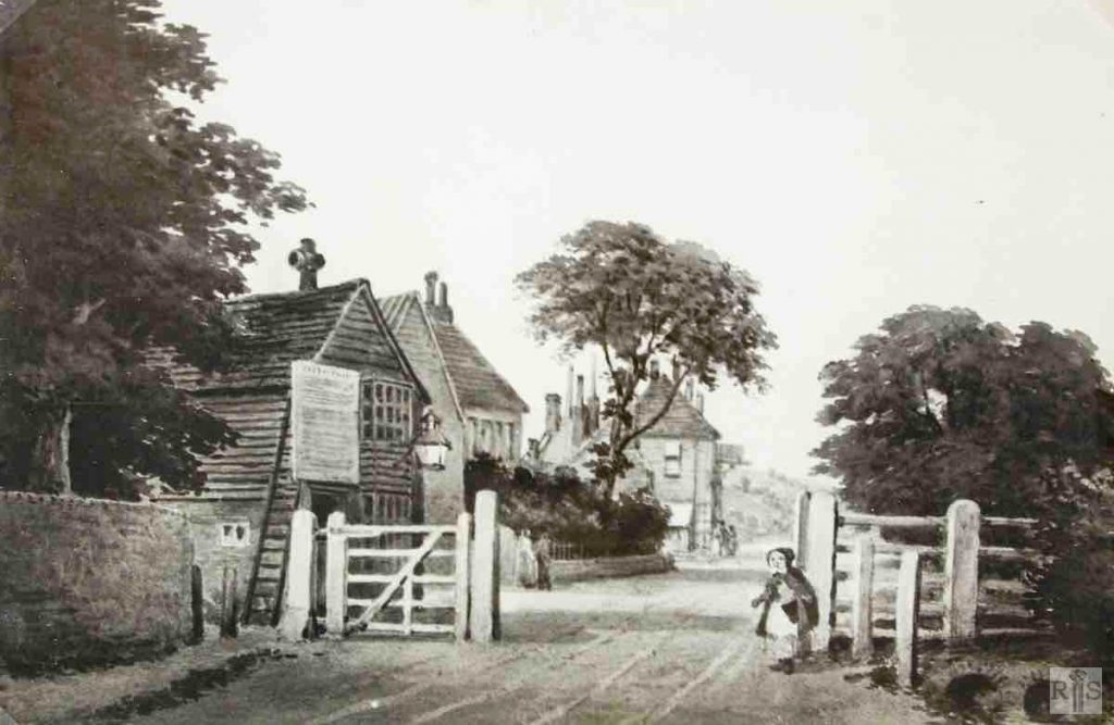
James Gray: Preston Tollgate was erected in 1810. It stood about 20 yards south of the present South Road and was removed in November 1854. On the left beyond the gate can be seen the entrance to the Tea Gardens. The tree in the front garden was removed only a few years ago, whilst the low retaining wall is there to this day.
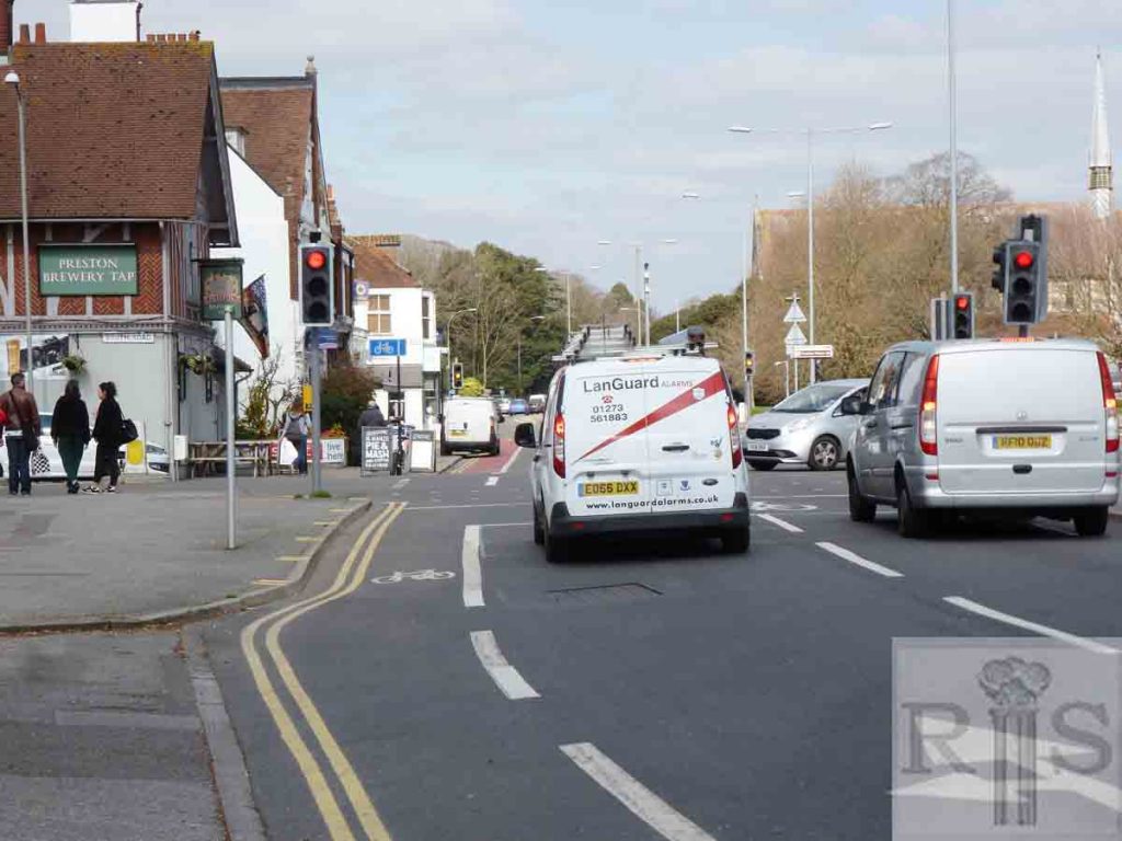
James Gray: Scene at about the corner of South Road. Looking north through the village, from just south of South Road, in the early years of this century. Note particularly the wall on the right of Preston Manor. Additional Information: Brewer’s dray, horses. jgc_18_178
2018: The wall has now been replaced by shrubbery and a petrol service station stands in place of the pub on the left. The Preston Brewery Tap still remains. (Photographer: Jane Jordan)
James Gray: Scene at about the corner of South Road. The view south on 4 July 1971 showing the remainder of this wall which was removed in a further widening and the installation of traffic control lights. Additional Information: Bus. jgc_18_180
2018: The bus stop has been moved further south, no doubt to ease traffic flow at this now very busy junction. The wall has been replaced by shrubbery and a petrol service station stands in place of the pub on the far left. The Preston Brewery Tap still remains. See also jgc_18_178 above. (Photographer: Jane Jordan)
James Gray: In 1896 Lauriston Road was driven through the site of the other cottages shown on the right of this photograph. jgc_18_186
2018: The junction of Lauriston Road where the old cottages used to stand in 1896. The Crown and Anchor Inn at 213 Preston Road still stands and is just visible in the distance of both the old and new images. (Photographer: Jane Jordan)
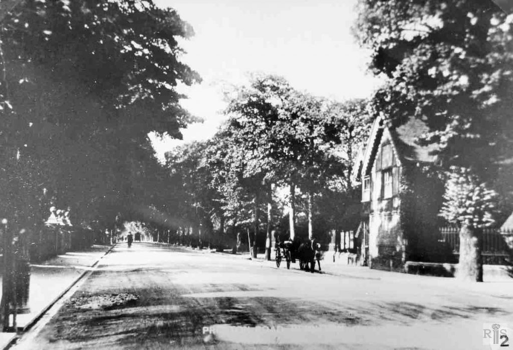
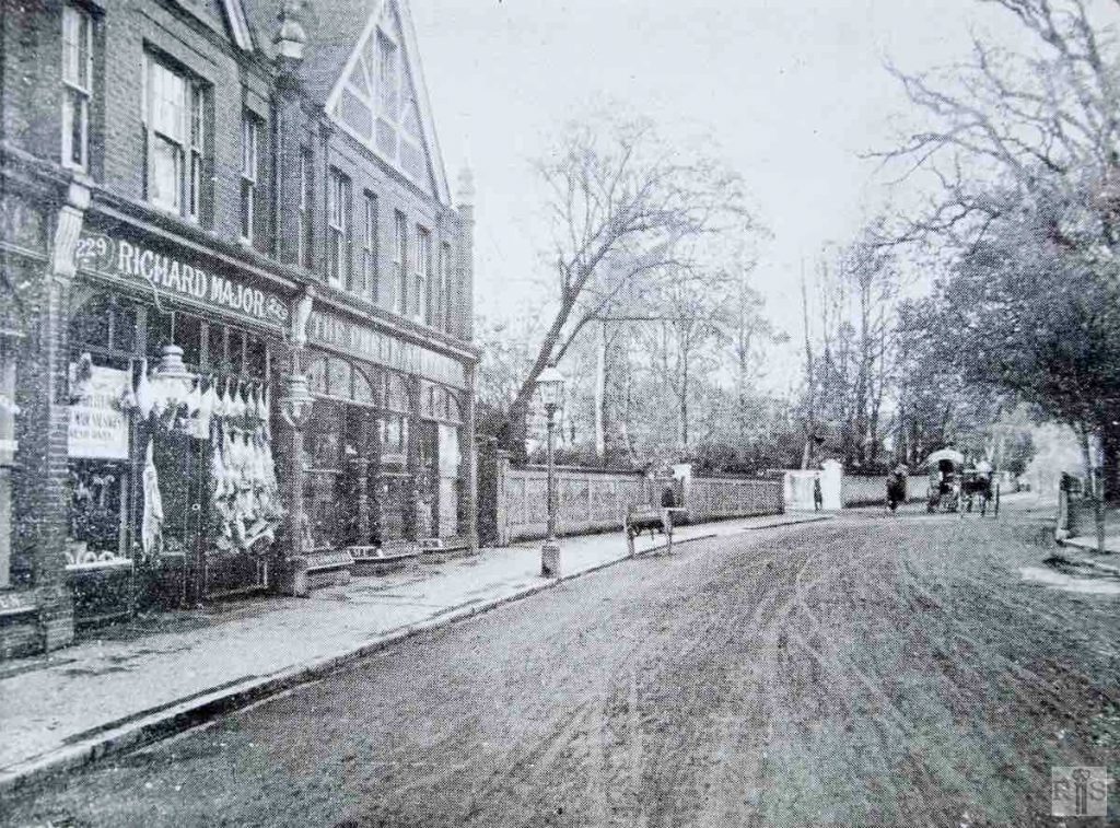
James Gray: By way of contrast here is the view from north to south. This photograph dates from 1890 and emphasises the peaceful aspect of the old village at that period. The view is from approximately Cumberland Road to North Road. Facing the houses was the old Preston Vicarage garden behind the high wall. Contrast the young trees with those shown in later photographs. jgc_18_187
James Gray: The same area in 1955 – 65 years later. The old houses next to the Crown and Anchor were rebuilt in 1894. Later the old cottages by the lamppost were removed for the formation of Lauriston Road, which was laid out in 1896. It will be seen that the two houses with the attic windows are almost unchanged. jgc_18_188
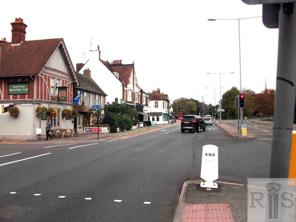
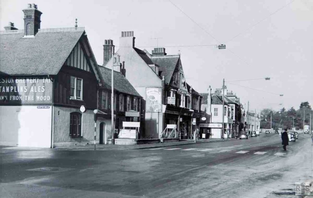
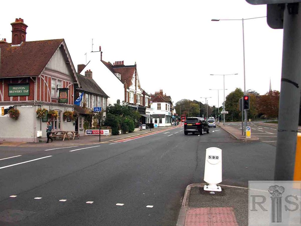
James Gray: Looking north from the corner of South Road. Incidentally the street nameplate is one of the few things remaining unaltered. jgc_18_189
2018: Looking north from the corner of South Road. The previously unaltered street nameplate on the Preston Brewery Tap pub has now been changed. (Photographer: Jane Jordan)
James Gray: View from the same corner as jgc_18_189. The road was widened in 1936 and the trees outside the old tea rooms were removed a few years later. jgc_18_190
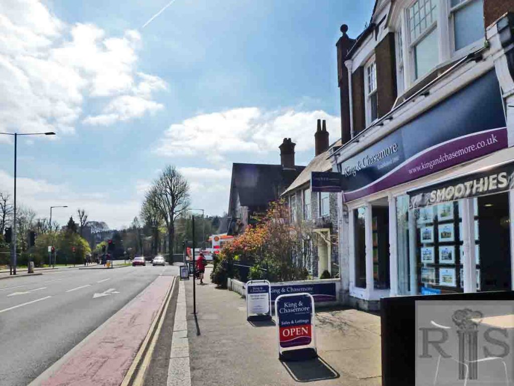
2018: Next to the Preston Brewery Tap pub on the corner, the old tea rooms –now a Grade II listed building – is now occupied by offices of the Guerrand-Hermès Foundation for Peace. The rest of the block leading along to Middle Street contains two estate agents and a delicatessen. (Photographer: Jane Jordan)
James Gray: Preston Road running through the village, showing the corner of Cumberland Road. Beyond the two shops was the long flint garden wall of the large house Clermont that lay well back from the road with its gardens extending along the south side of Cumberland Road.
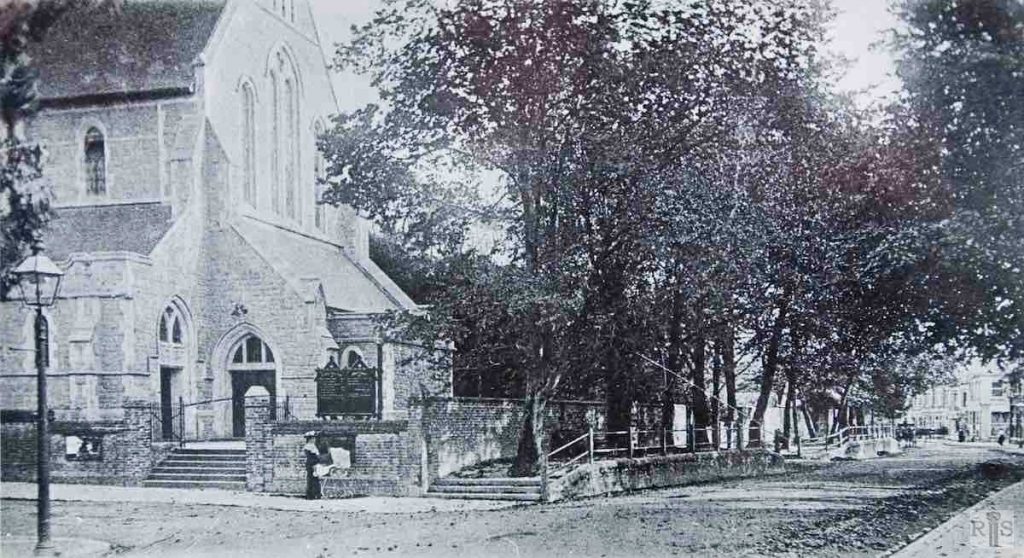
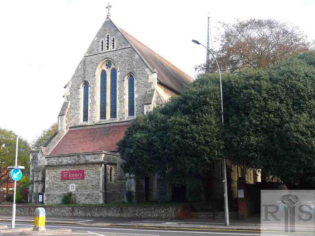
James Gray: View of Preston Road and St John the Evangelist’s Church from the corner of Knoyle Road, showing the raised, tree-lined pavement of that period. jgc_18_199
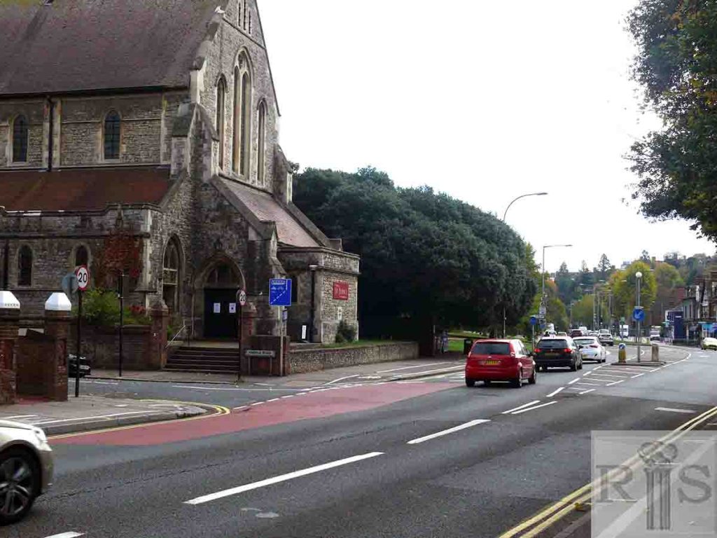
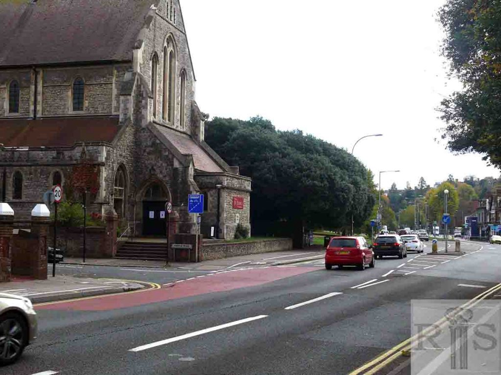
2018: View of the church looking south along the now widened Preston Road.
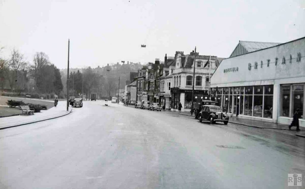
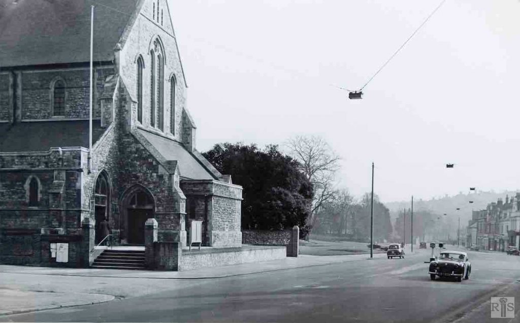
James Gray: View of the same corner as jgc_18_199. The area underwent a complete transformation in 1931, when as part of a larger scheme for widening the main road to London, the roadway was nearly doubled in width from the church to beyond Preston Drove. To achieve this Preston Vicarage was demolished and the cleared area laid out as a bowling green. jgc_18_200
James Gray: This photograph was taken probably soon after the church had been constituted the Parish Church in 1908. Note the original built-up pavement, which was such a feature of this neighbourhood until 1931. jgc_18_203
2018: St John’s Church. The road has been widened and the pavements levelled. (Photographer: Jane Jordan)
James Gray: Left is Aberdeen House – Number 247 –and right is Loxborough House – Number 249. jgc_18_242
2018: Despite many changes along this stretch of Preston Road, these two adjoining large buildings have remained relatively unchanged. Dense foliage in the forecourt of these flats now limits the original view. (Photographer: Jane Jordan)
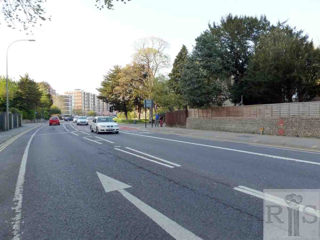
James Gray: A view along Preston Road. jgc_18_145
2019: Peacock Lane emerges onto London Road, Withdean, just beyond the wall on the right of the 2019 image. Until the 1930s this road was known as Withdean Drove Road and there were houses to the north of it as well as the farmhouse to the south.
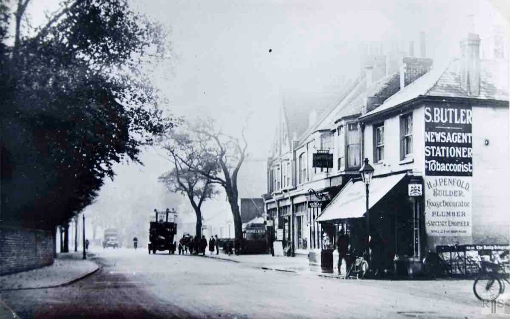
James Gray: The view, looking in the opposite direction, a few years later. The roadway here was widened in 1936. Additional Information: S Butler, newsagent and H Penfold, builder. jgc_18_176
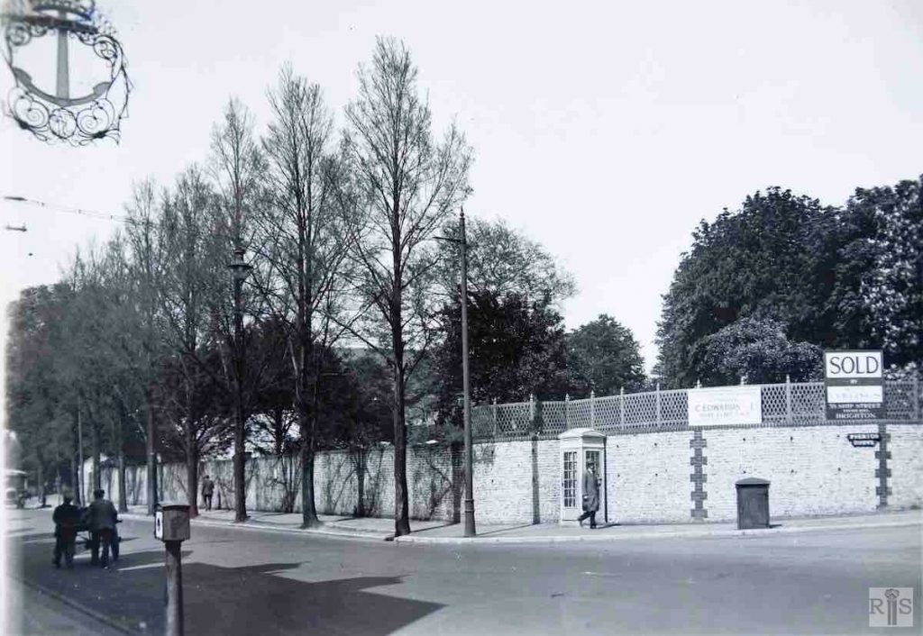
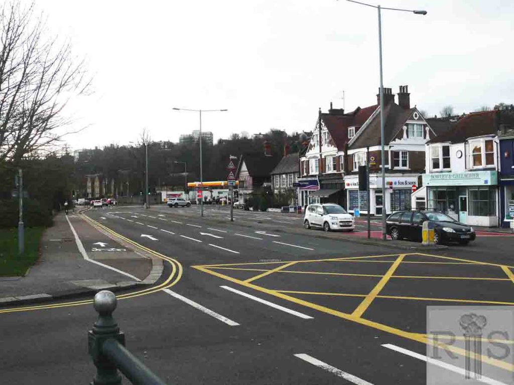
James Gray: These three photographs [jgc_18_181, 182 and 183] provide an interesting contrast. This photograph [top right] shows the high wall of Preston Vicarage, at the corner of Preston Drove, as it was in 1931. Additional Information: C Edwards Ltd, Nine Elms, SW8, Collings Estate Agents. jgc_18_181
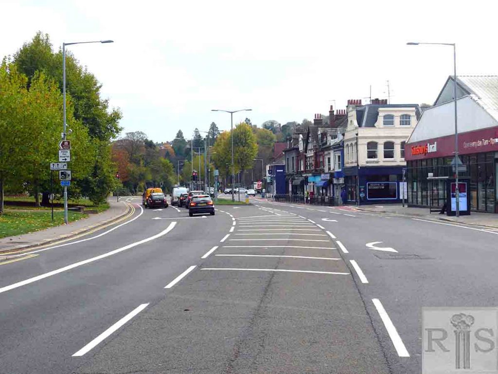
2018: Looking south along Preston Road at the corner of Preston Drove. The road has been widened again following the first extension in 1936 to accommodate the ever-increasing flow of traffic. At the traffic lights in the distance is the turning into South Road with a Shell petrol station sited on the corner. (Photographer: Jane Jordan)
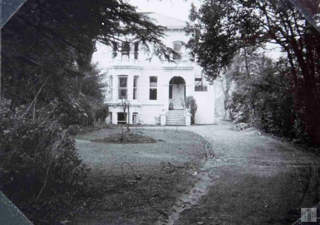
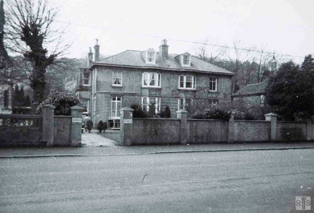
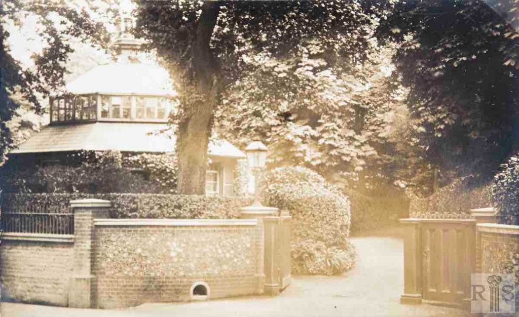
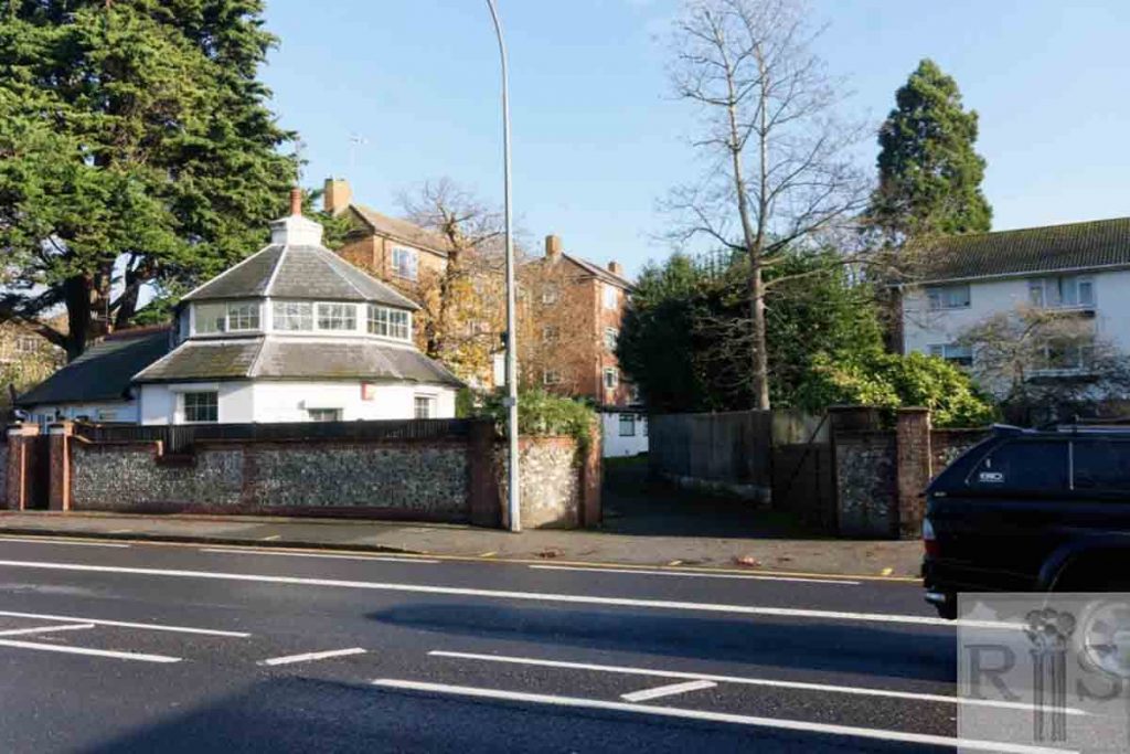
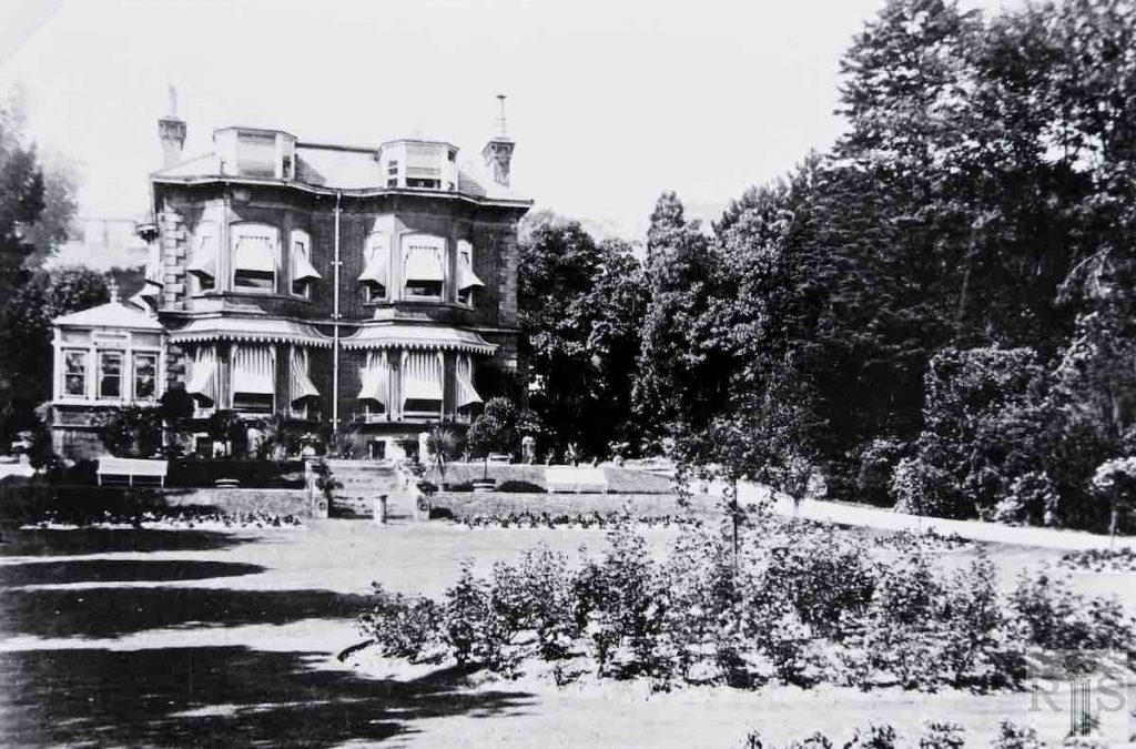
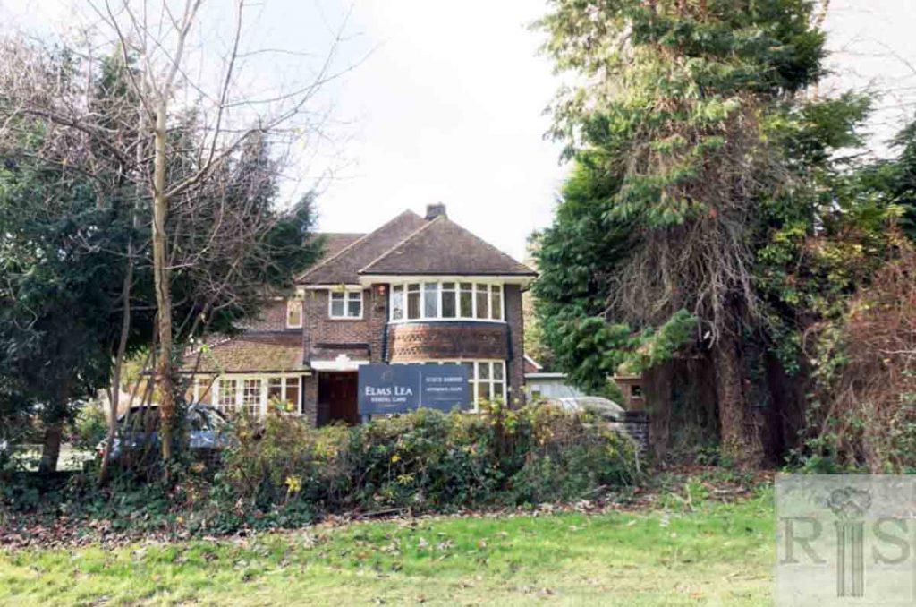
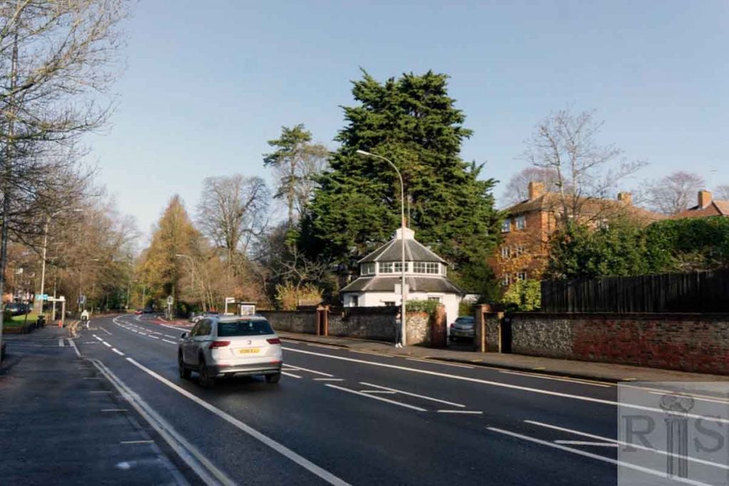
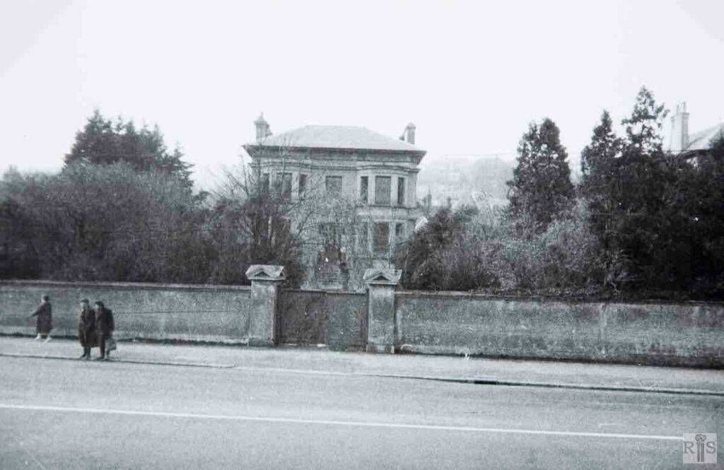
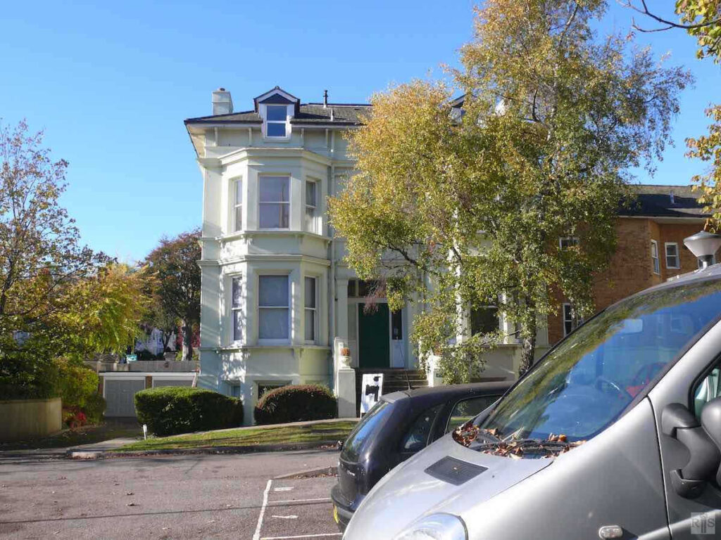
James Gray: A Victorian house, facing west and set back a considerable distance from London Road, Withdean. It was built in the 1860s and stood in large grounds extending northwards as far as Varndean Road. The small house by the entrance gate, shown here, is still there though the unusual greenhouse in the roof – left, above – has been removed. jgc_34_008
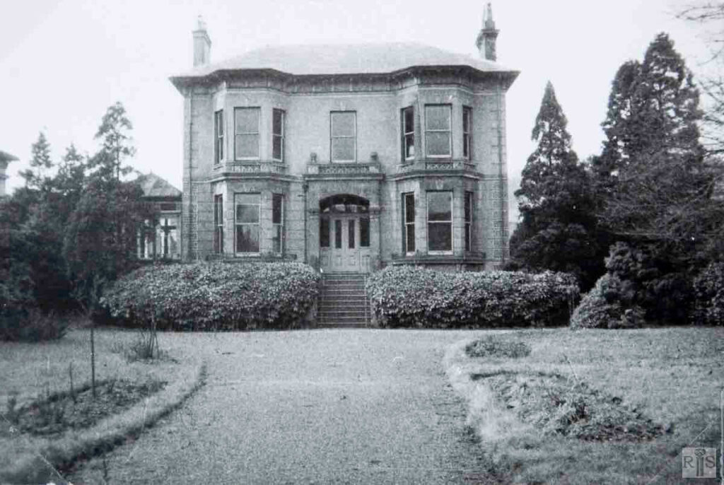
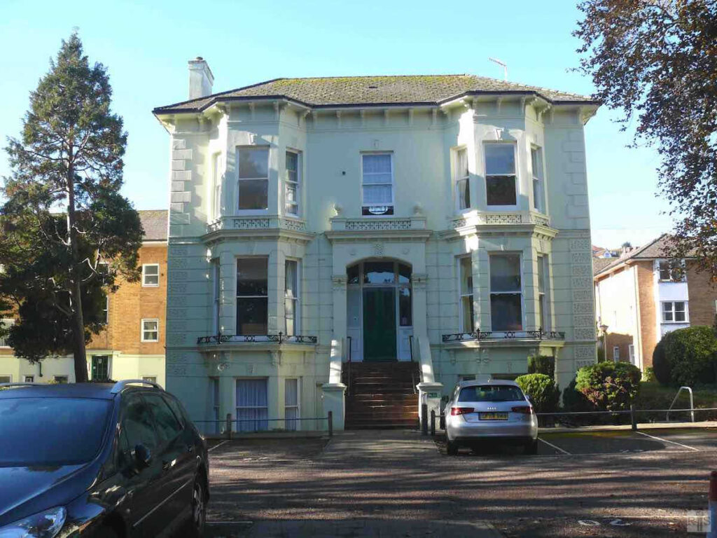
James Gray: This splendid house was built in the early 1880s for Mr Robert C. Gazeley who bought the Tivoli Gardens when they closed in 1888. It was the next house to the south of Beechwood and had a short life, being demolished in 1935. The houses in Elms Lea Avenue now cover this site. jgc_34_012
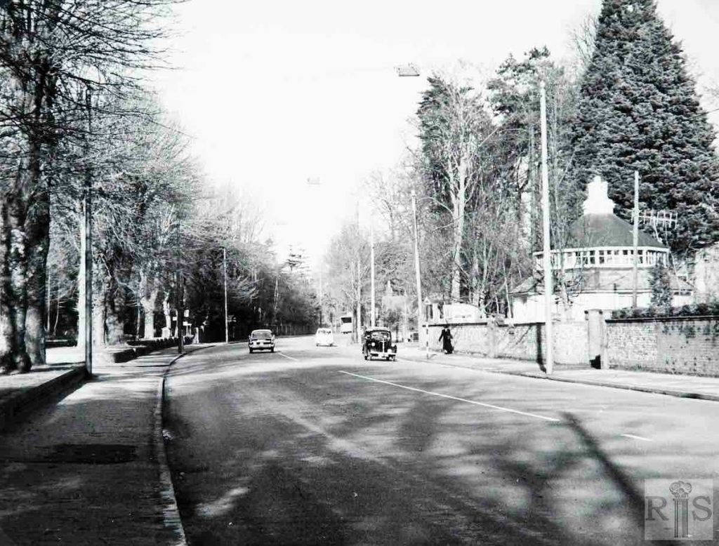
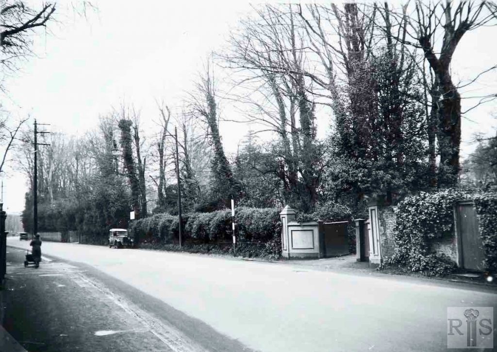
James Gray: This photograph shows quite clearly the effect of the widening of the roadway in this area. jgc_34_030
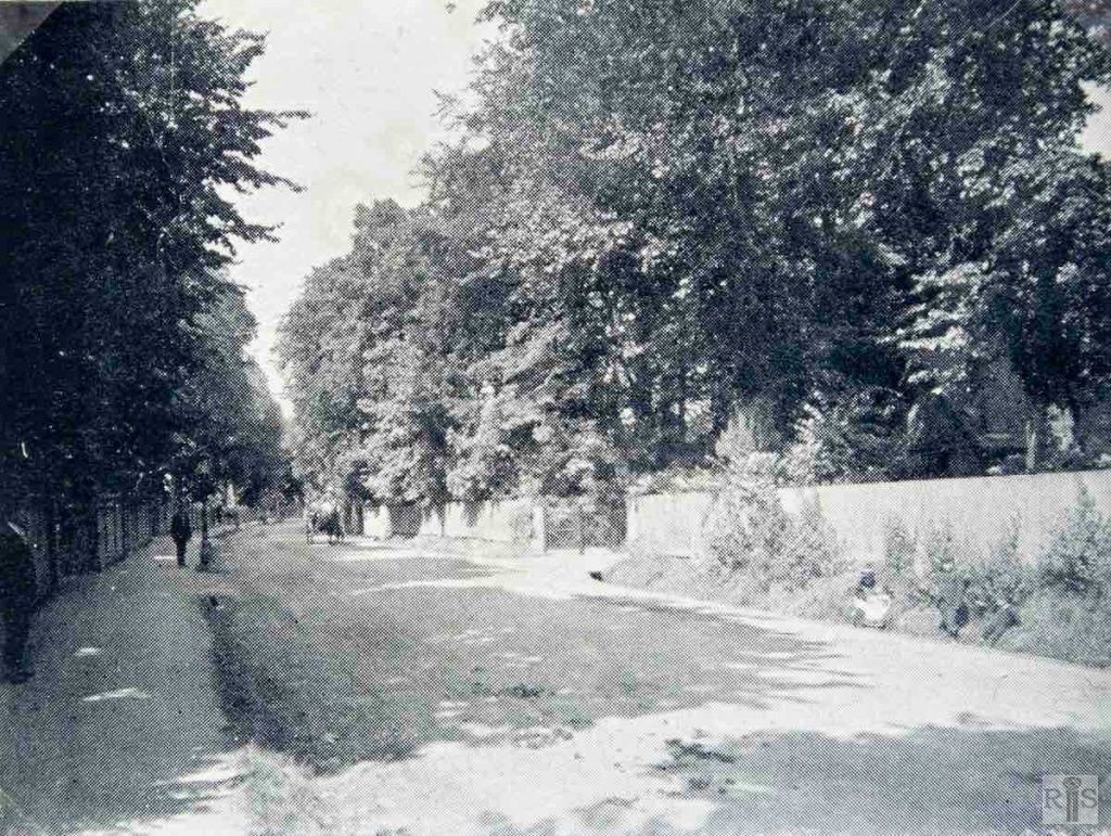
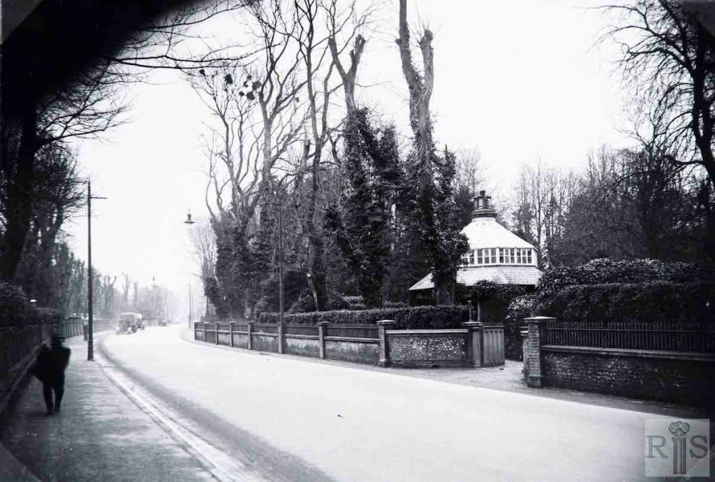
James Gray: Photographs [see also jgc_34_014 below] of the length of this road between Varndean Road and Harrington Road, before the widening. In the view above [see jgc_34_030, right] can be seen the widened road beyond Varndean Road, and this had been completed in June 1933. jgc_34_013
2018: The one obvious landmark is the Round House, gate lodge for Withdean Lodge. Even the large tree behind it is still there. The traffic flow seems to have lessened just as the new picture was taken, as if it wanted to match the few cars that appear in the original, despite it being a Thursday afternoon! See also jgc_34_008 and 013. (Photographer: Bill Kocher)
James Gray: Photographs [see also jgc_34_013 above] of the length of this road between Varndean Road and Harrington Road, before the widening. Another view. jgc_34_014
2020: The 2020 photograph shows Varndean Road on the left. Preston Road is still tree-lined almost a century later. (Photographer: Bill Kocher)
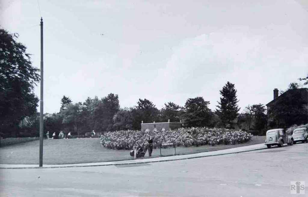
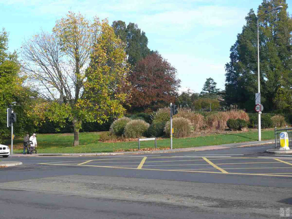
James Gray: The scene in 1956. [See also jgc_18_181 & 182.] The road was widened in 1936 and at the same time the bowling greens were laid out. jgc_18_183
2018: Vicarage Bowling Club is now well established. Two bowling greens sit behind the ornamental shrubbery and trees have been planted around the perimeter, no doubt to provide some protection from the traffic noise on this now very busy junction. (Photographer: Jane Jordan)
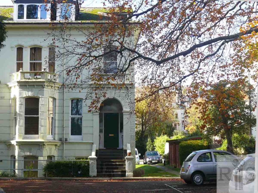
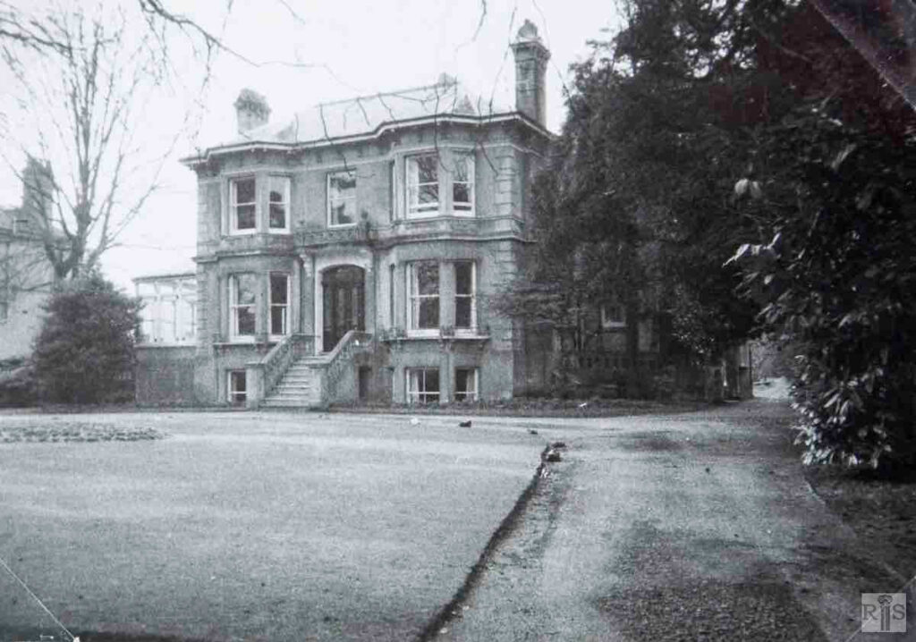
James Gray: Cromer Lodge – Number 237. jgc_18_238
2018: The exterior of Cromer Lodge is relatively unchanged save for the extension blocks added to the rear and extending towards Cumberland Road. This forms part of the Shawcross & Carlton House complex which encompasses Nos 235 to 241 Preston Road. See also caption for jgc_18_237 above. (Photographer: Jane Jordan)
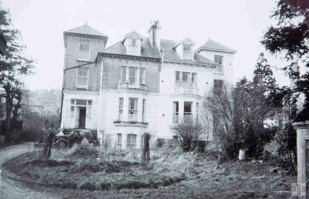
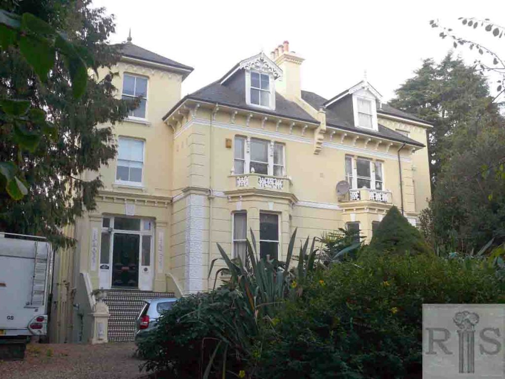
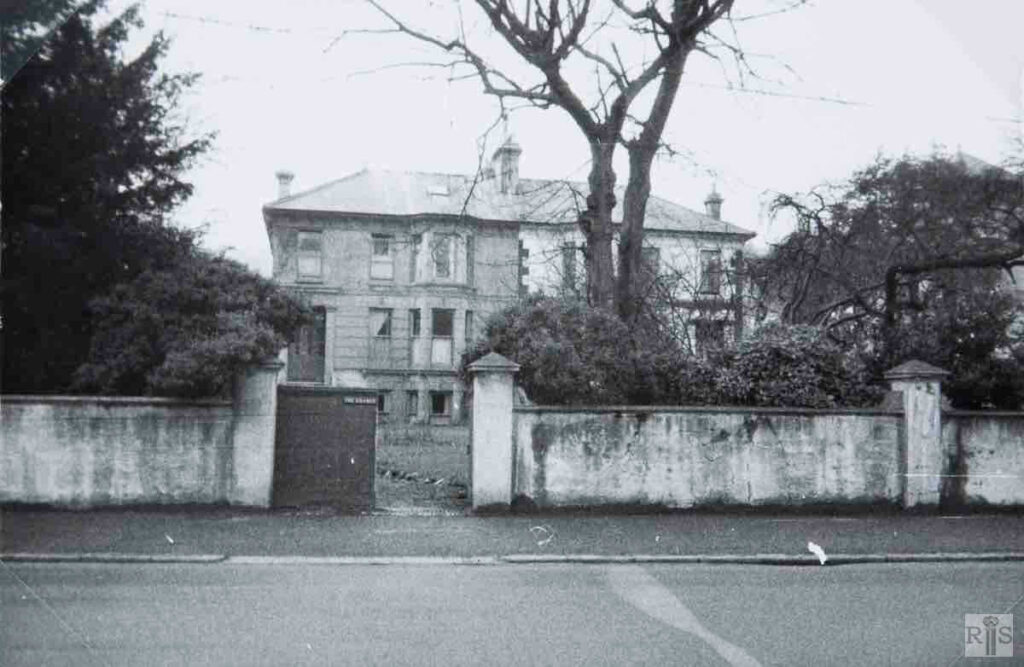
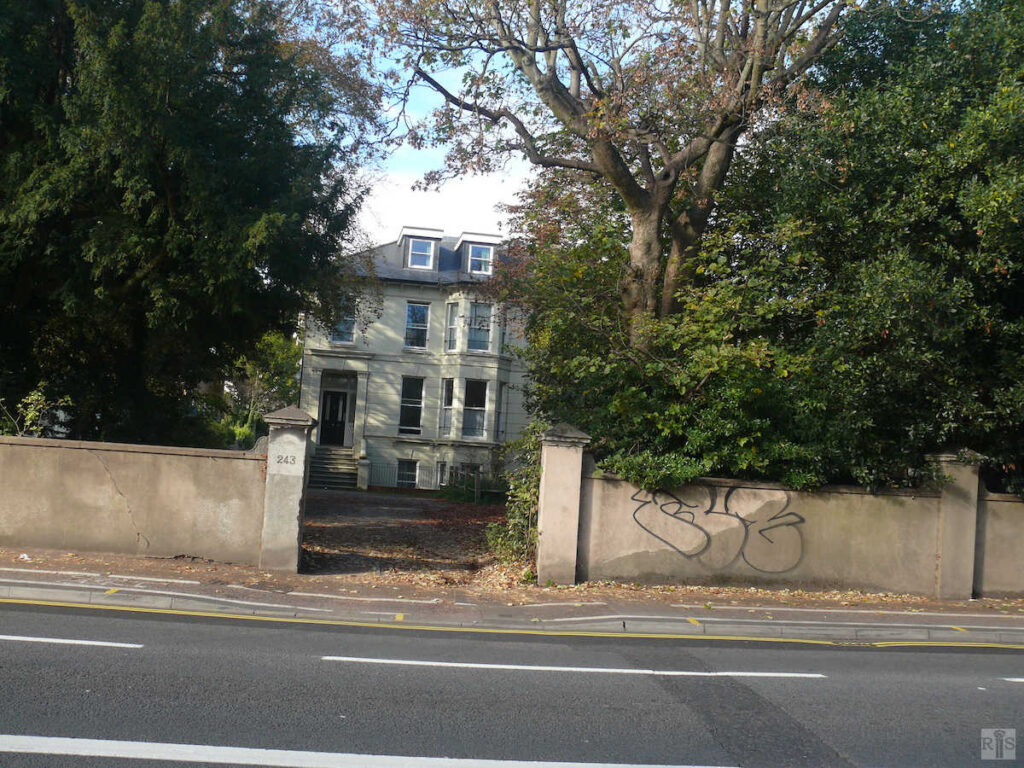
James Gray: Left house is the The Grange – Number 243 – and right is Engadine – Number 245. jgc_18_241
2018: Both 243 and 245 Preston Road remain standing although in a slightly dilapidated condition. Dormer windows have been added extending the flat occupancy. Already slightly obscured in the James Gray image, No 245 is now hidden by dense foliage and overgrown shrubbery. The same tree, however, still stands to the right of the entrance gate having escaped the hurricane of October 1987. (Photographer: Jane Jordan)
