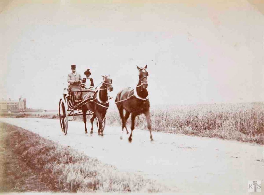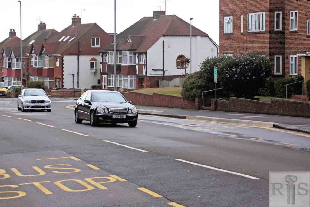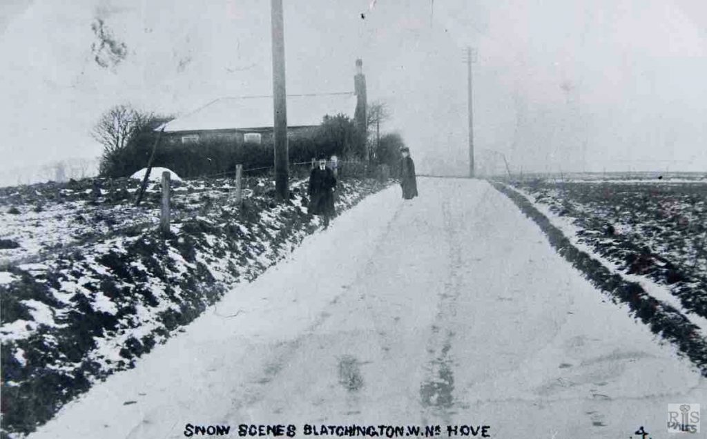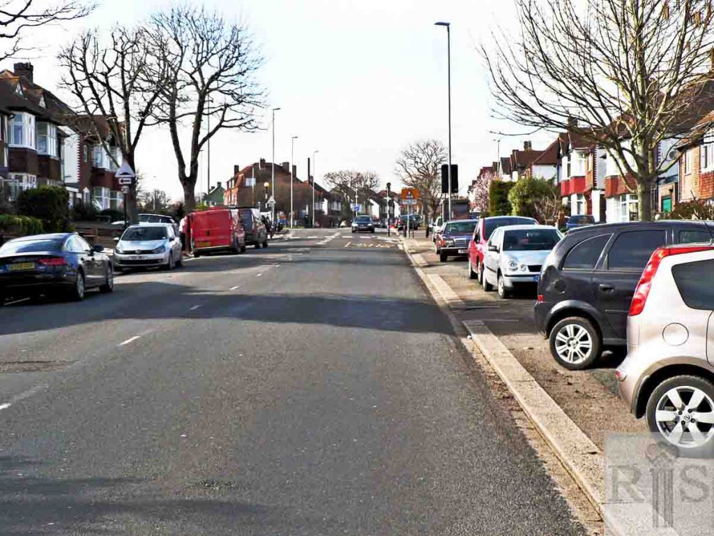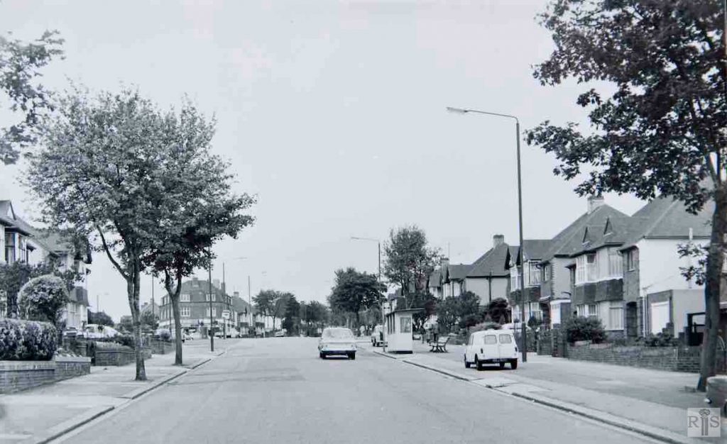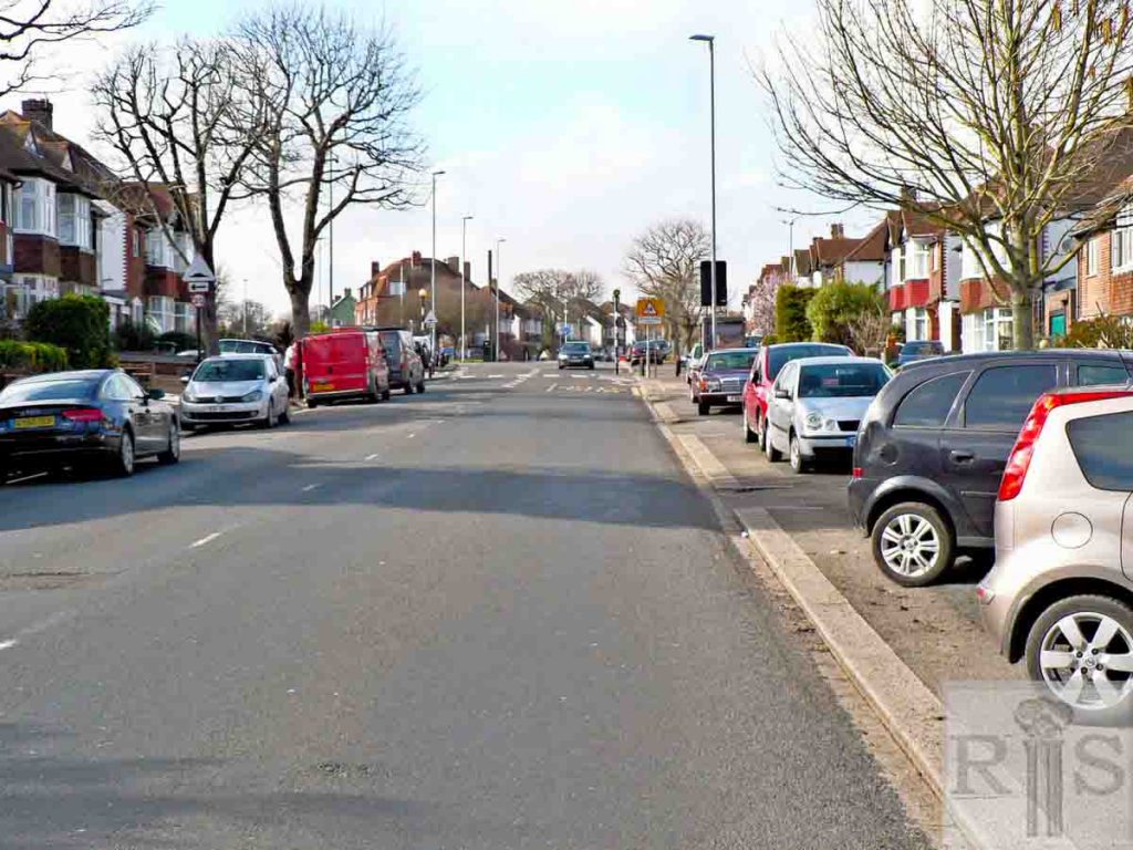
James Gray: It is hard to realise that these two photographs [jgc_36_001 and 002] were taken on what is now Nevill Road. They show the old narrow lane, which ran from the top of Sackville Road to the hamlet of West Blatchington and thence by Toads Hole Road, to the Dyke Road. In this photograph the trap is travelling north and is in the position roughly opposite Nevill Court, just above Nevill Avenue. The distant building is St Joseph’s Home in Old Shoreham Road that looks as if it were in course of being extended.
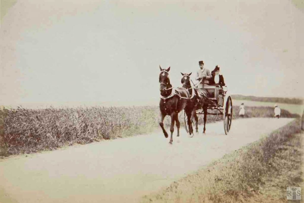
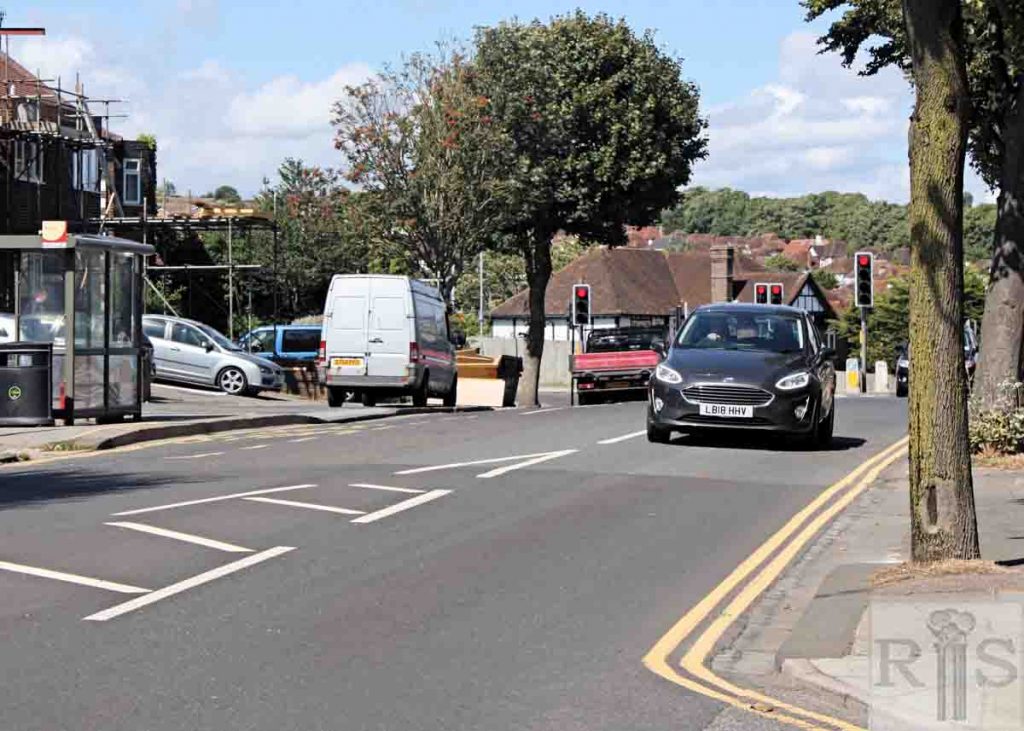
James Gray: It is hard to realise that this and the previous photograph was taken on what is now Nevill Road. They show the old narrow lane, which ran from the top of Sackville Road to the hamlet of West Blatchington and thence by Toads Hole Road, to the Dyke Road.
In this photograph the trap is travelling south but the view is northwards towards the Three Cornered Copse which is plainly seen on the hill beyond. The position of the trap is about opposite the top entrance to the Greyhound Stadium Car Park.
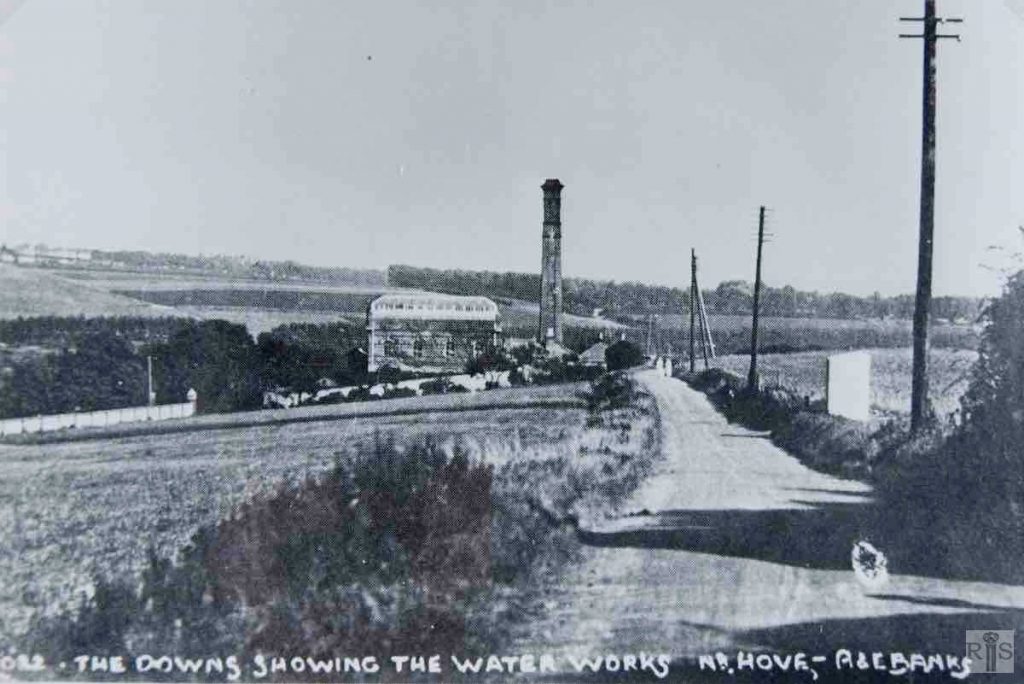
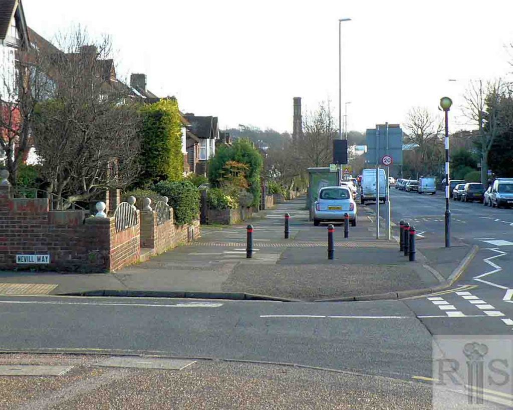
James Gray: This and the following photograph [jgc_36_011], taken probably in the years between 1900 and the First World War, shows the old, narrow, country road which wended its way from the top of Sackville Road to the distant hamlet of West Blatchington. This photograph is easily recognisable as Goldstone Waterworks, with its still existent chimney; also to the right the open area of Hove Park, opened in 1906 and distant houses in the area of Dyke Road. The photographer was probably standing near the spot where the present Nevill Road divides from Court Farm Road. The wall to the extreme left is there to this day. jgc_36_010
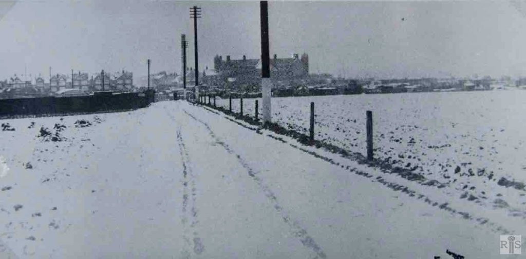
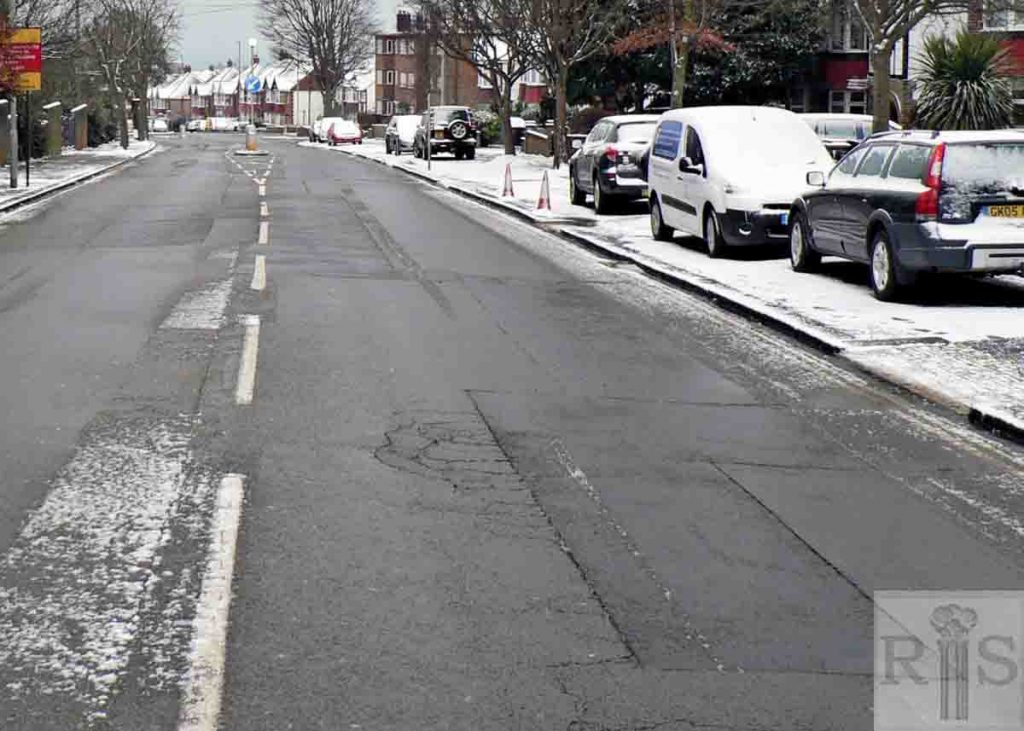
James Gray: This photograph and the previous one, taken probably in the years between 1900 and the First World War, shows the old, narrow, country road which wended its way from the top of Sackville Road to the distant hamlet of West Blatchington. This photograph dates from January 1910 and is one of several taken by Tom Wiles of Hove. The lane then led through Clark’s Farm on the left and Holmes Farm at the right. Note St. Joseph’s Home and houses in Old Shoreham Road. jgc_36_011
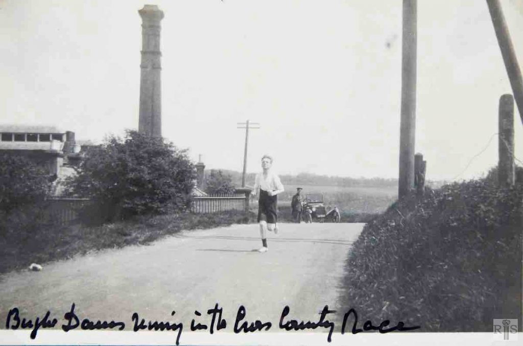
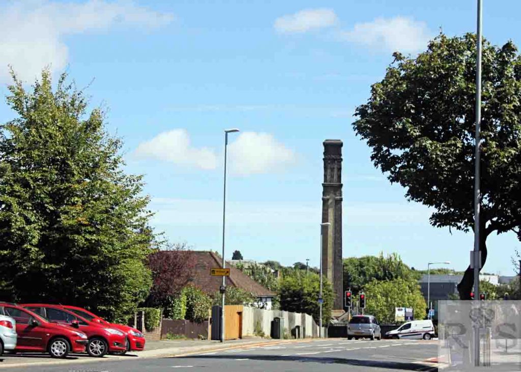
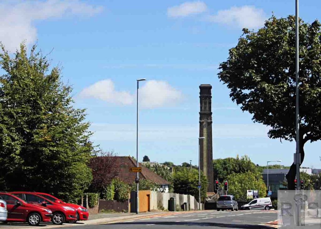
James Gray: 55 years separate these photos (this and following) of the same spot. When this one was taken in 1915 the soldier was running on the narrow country lane which led from Hove to West Blatchington and Hangleton with the Goldstone Pumping Station behind him. Beyond the small car was Goldstone Farm, Hove Park and open ground now the site of Shirley Drive and adjoining roads. The country road was to remain like this for another 17 years. jgc_36_012
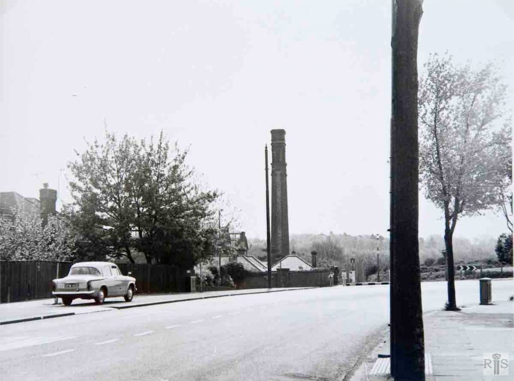
James Gray: 55 years separate this and the previous photograph [jgc_36_012] of the same spot. In 1932 came transformation. The narrow road was replaced by the wide present Nevill Road and the first houses were built at the lower end between Old Shoreham Road and Orchard Road, though it was not until 1934-5 that the houses came round the bend. The growth of trees prevents a comparison of the backgrounds. Date of photograph 17 May 1970. jgc_36_013
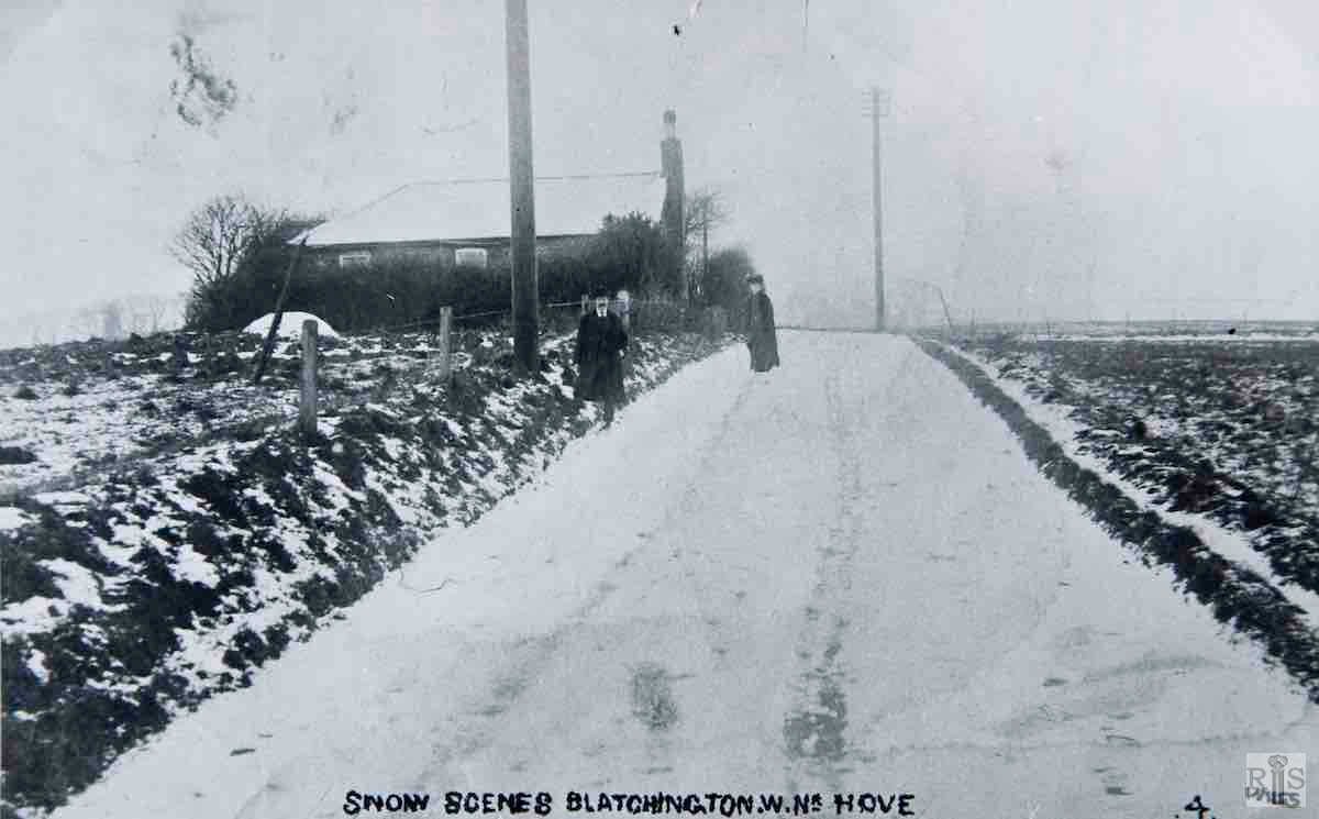
James Gray: This photograph and the following [jgc_36_015 and 016] have been placed consecutively because incredible as it may seem they both show the same spot. This photograph of January 1910, shows the old farm road which meandered from the top of Sackville Road, towards the distant hamlet of West Blatchington. Just past the low house, the road took a sharp turning left leading to West Blatchington Windmill, seen at the extreme left.
James Gray: The altered appearance of this area, 64 years later, on 31 July 1974. Nevill Road, commenced at the Sackville Road end in 1932, was extended along this stretch in 1934-35, and to avoid taking the anticipated traffic round the bend and through West Blatchington, Nevill Road was carried straight on to join Toads Hole Road down in the valley. However, the road to the windmill was widened, built up and named Court Farm Road. This can be clearly seen in this photograph, and the third house from the left is roughly on the site of the cottage in the other view.
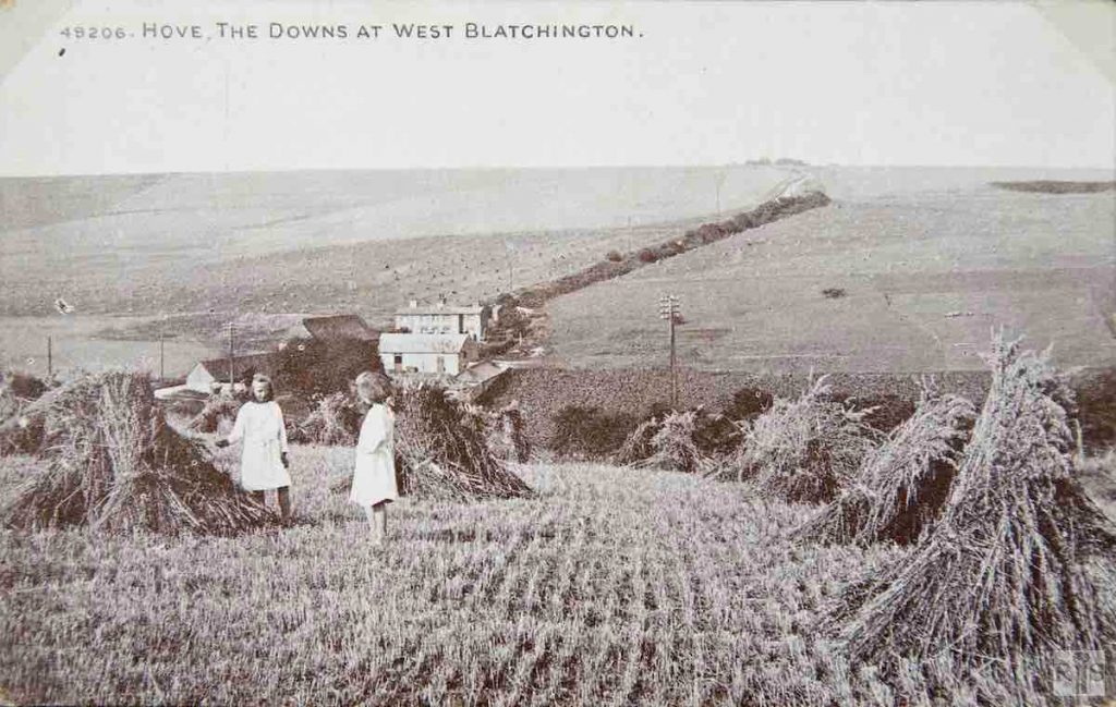
James Gray: These wheatfields on Court Farm were where the present Nevill Road now stands. Toad’s Hole Cottages and the farm buildings are in the background and the old farm road linking West Blatchington with Patcham can be seen struggling up towards Dyke Road. jgc_36_059
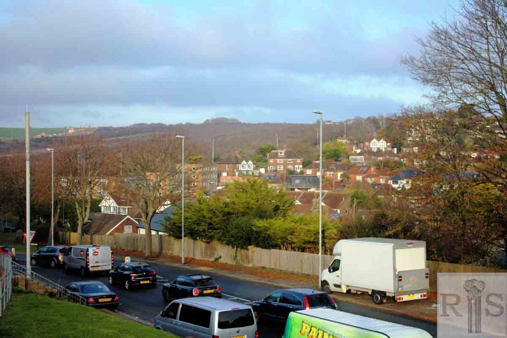
2018: Nevill Road is in the foreground of this view.
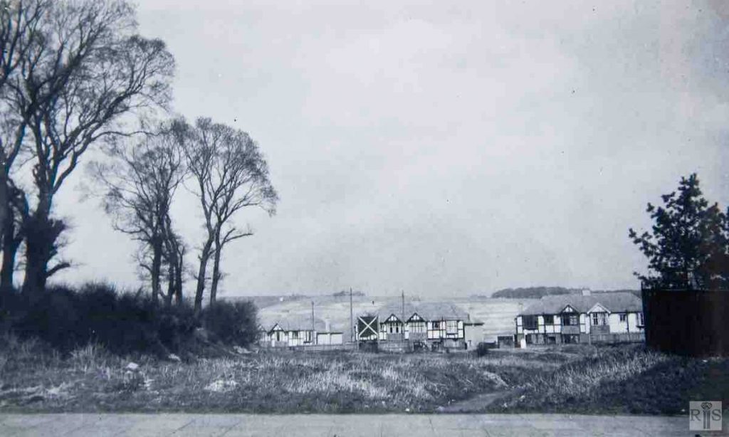
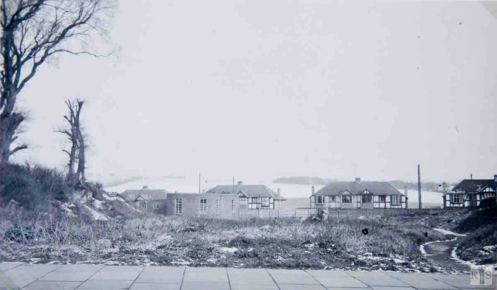
James Gray: Nevill Road from Court Farm Road, before building of the Nevill Hotel, November 1950. jgc_36_062
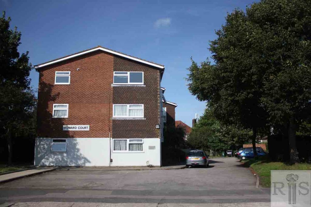
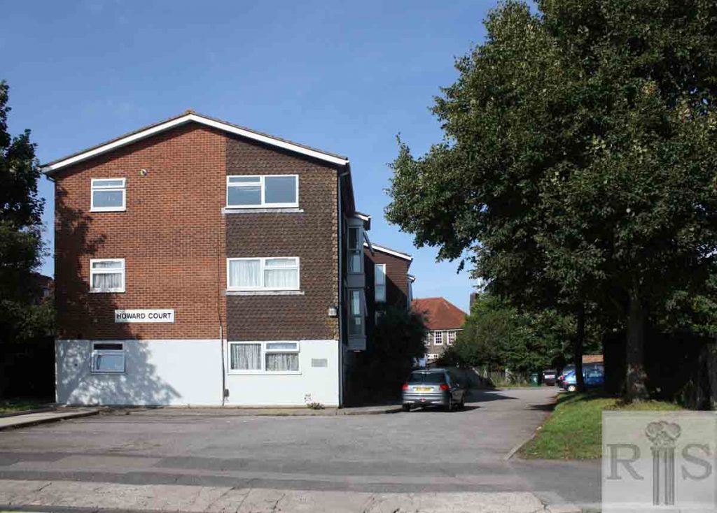
2018: The two houses, 219 and 221 Nevill Road, on the extreme right in the 1950 photo, are no longer visible in the 2018 scene, where Howard Court now occupies the former waste ground. The red-tiled roof of the Nevill Hotel can be seen in the background, to the right of these flats. (Photographer: Alan Hobden)
James Gray: February 1953; same scene as the previous photo [jgc_36_062], but showing the single storey, two-roomed Nevill Hotel, forerunner of a larger hotel to be built at some future date. jgc_36_063
2018: The 2018 photo shows the red-roofed, larger Nevill Hotel in the background, behind the flats of Howard Court. This photo was taken from the south side of Court Farm Road, in front of the St George’s Catholic Church, looking north east towards Nevill Road. (Photographer: Alan Hobden)
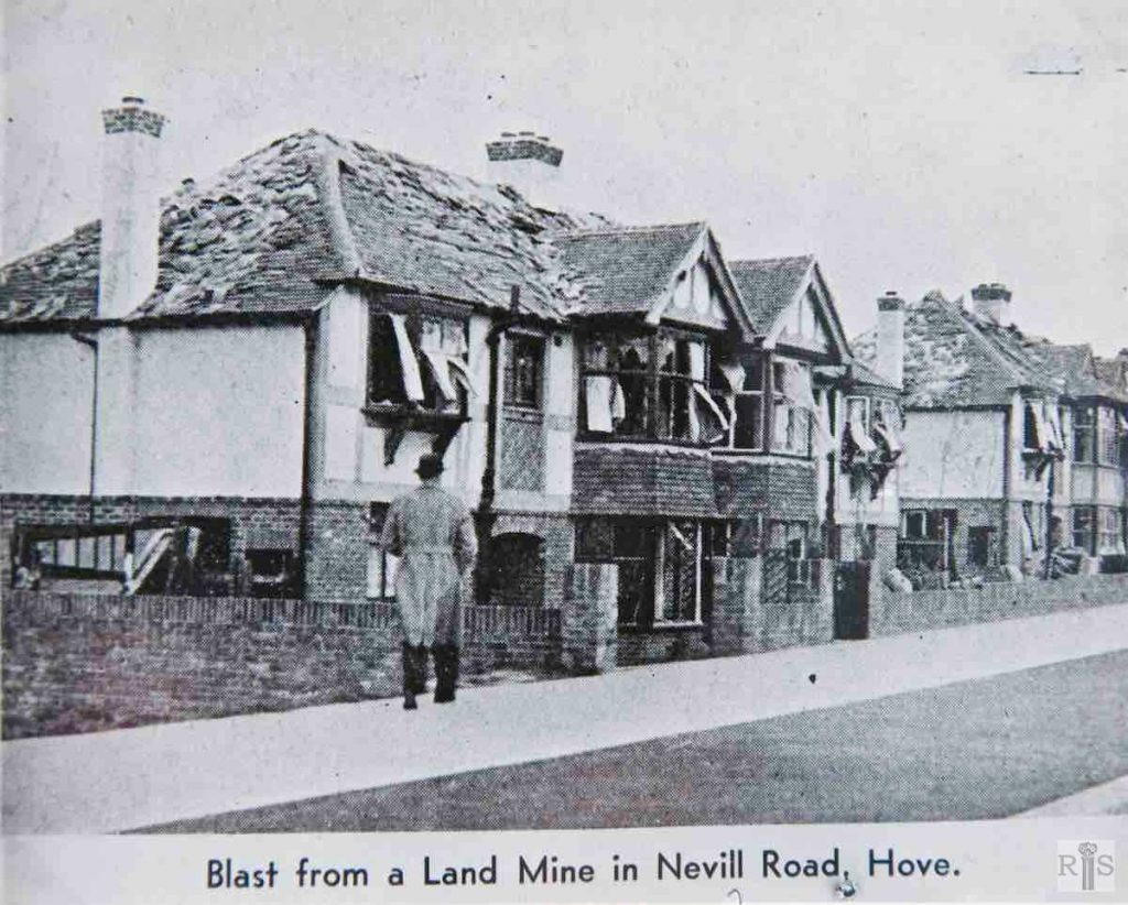
James Gray: In April 1941, a land mine fell in waste ground adjoining Nevill Road and Goldstone Way. The blast severely damaged the end eight houses in Nevill Road, Nos 215-229. After the war they had to be completely rebuilt. Newspaper report: ‘Several houses in a residential area of a South Coast town were badly damaged on Monday night when a heavy bomb fell on some allotments near by. Although some of the houses were rendered uninhabitable and others will require first-aid attention before they can be lived in, there were only ten casualties, all of them slight.’ jgc_36_078
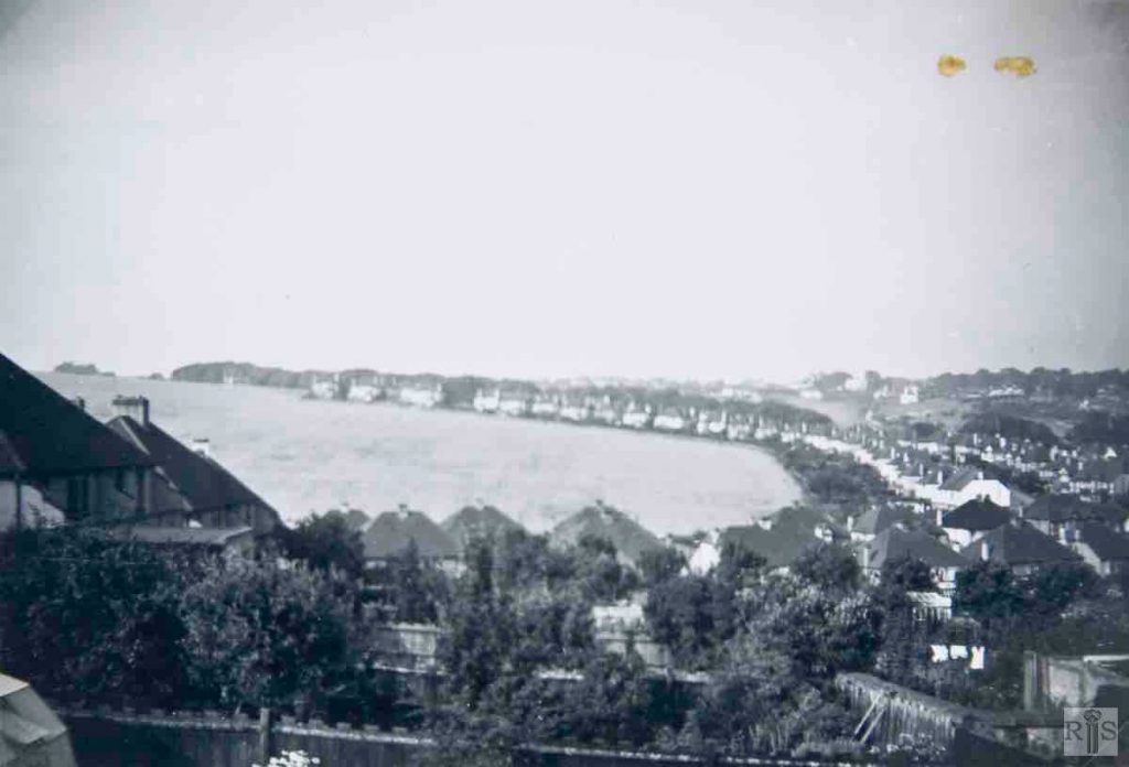
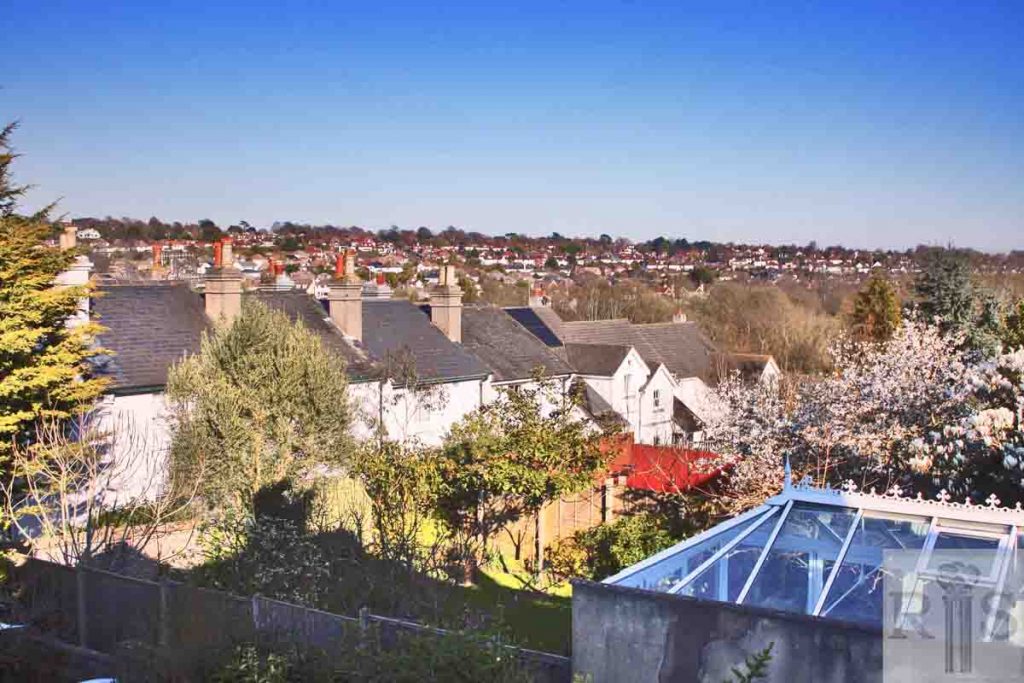
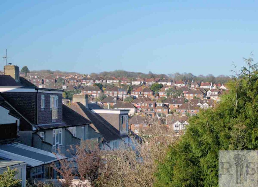
James Gray: View of Woodland Avenue and the Three-Cornered Copse, from the balcony of 167 Nevill Road. At the time of the photograph, August 1951, the building of Goldstone Avenue had not commenced. jgc_36_135
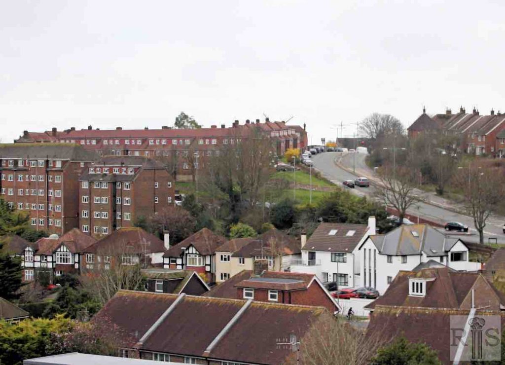
2019: The growth of trees since 1951 prevents an identical view from the rear balcony of 167 Nevill Road today, with the houses of Nevill Way to the immediate left. The second photograph looks further eastwards, towards the row of four old, white-painted Mews Cottages and the later Waterworks Cottages to their right. Gray’s text refers to ‘Goldstone Avenue’ but this should read ‘Elizabeth Avenue’. (Photographer: Alan Hobden)
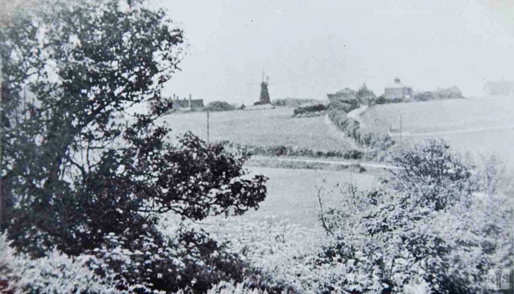
James Gray: View westwards across the fields of Court Farm about 1907. The road descending the hill is Toads Hole Road, while the lateral road is the present Nevill Road. The land between was known as Parson’s Field, being glebe land. On the skyline are several buildings. From left to right these are – Court Farm House, the Windmill, West Blatchington Church, Hillside Cottages, and (far right) New Cottages. Now just the windmill and the Church remain. jgc_36_137
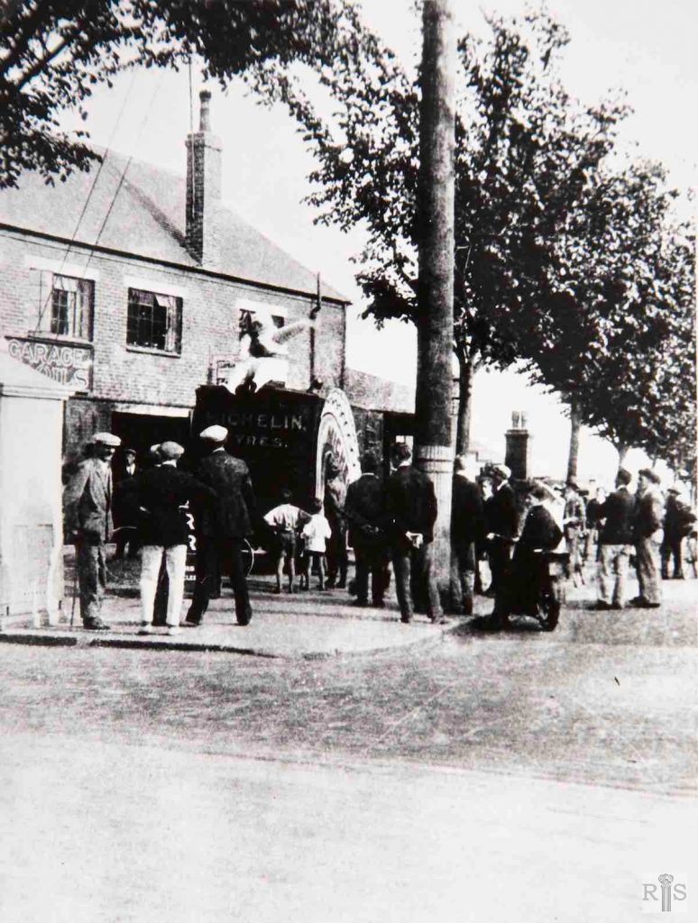
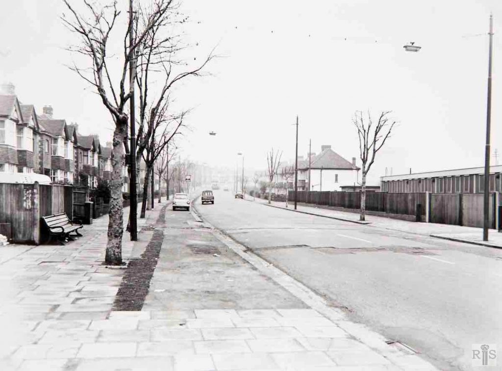
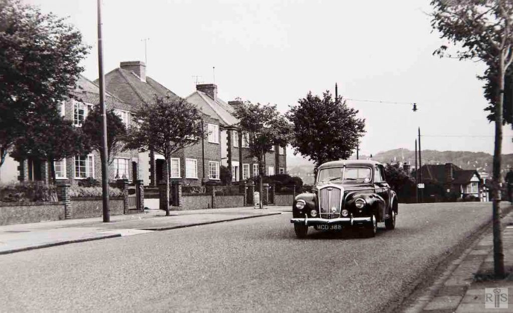
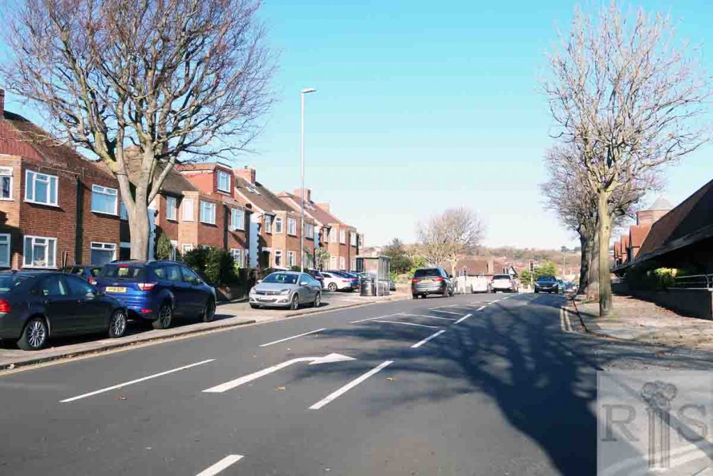
James Gray: In this photograph, also of 1933, can be seen the recently constructed Nevill Road, in which a few houses, built by Brooksbank, had been erected on the east side below the Greyhound Stadium. jgc_17_073
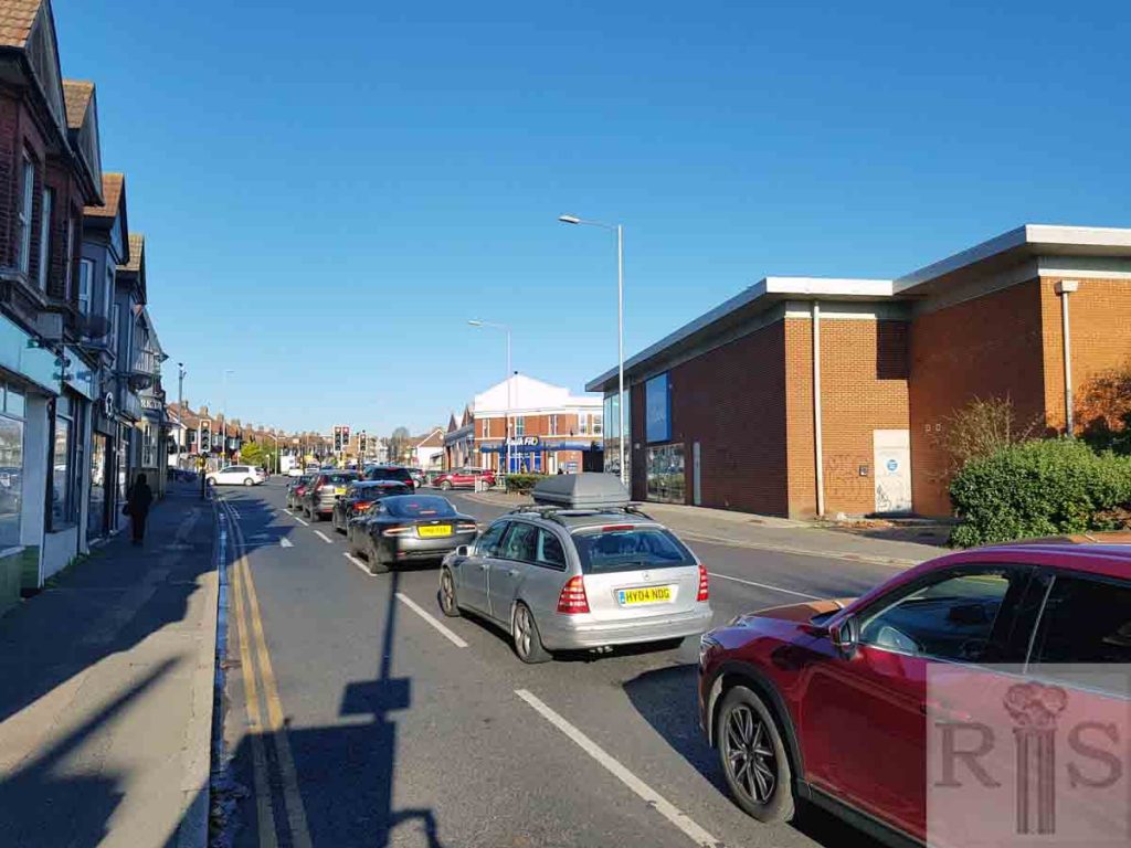
2018: The building on the far side of Old Shoreham Road is now Kwikfit. Houses occupy the west (left) side of Nevill Road. (Photographer: Helen Glass)
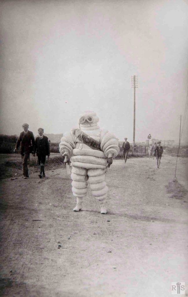
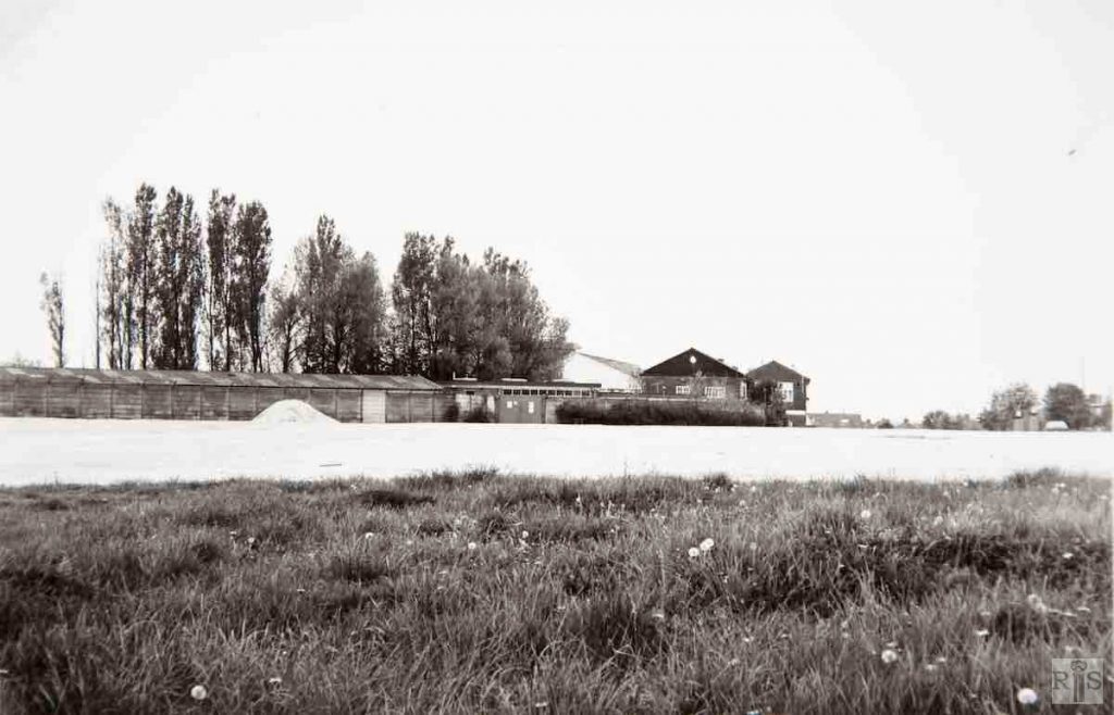
James Gray: Site of the present Nevill Road at the junction with Old Shoreham Road, in 1929. Central figure is the Michelin man. He is standing on the newly formed rough road leading to the Greyhound Stadium opened in the previous year. The original narrow bridle road that led from Sackville Road to West Blatchington is to the left of the two boys. Trees in the distance are those which are still standing in Court Farm Road. Additional Information: Michelin man – Bibendum – for many years advertised tyres. jgc_17_074
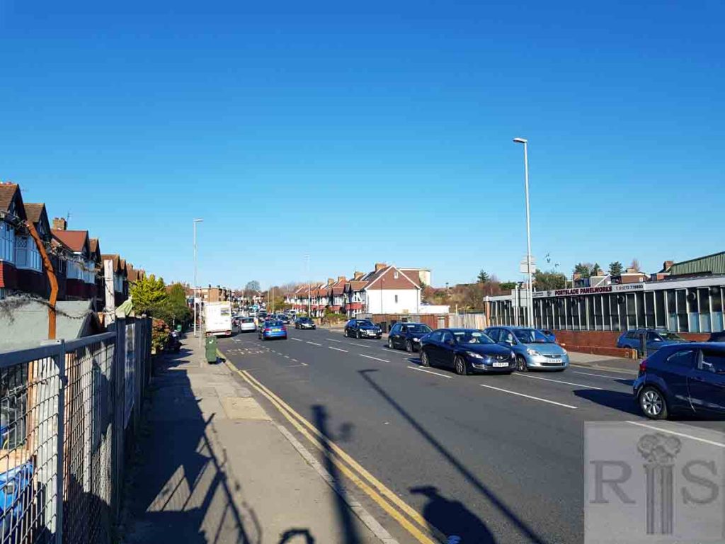
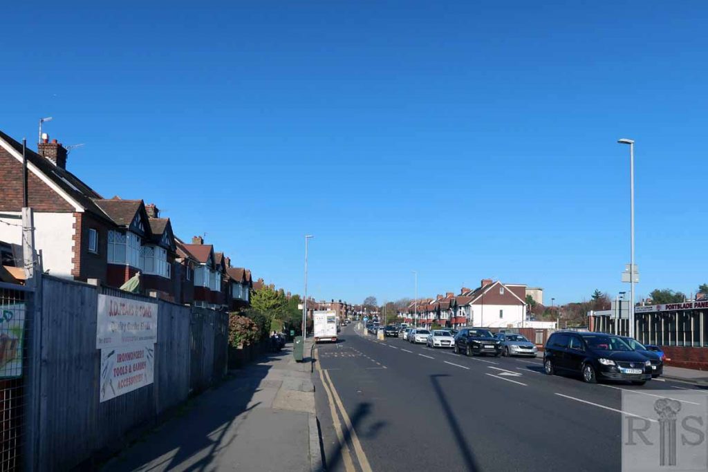
2018: This image was taken from the southern end of Nevill Road, looking north. The west (left-hand side) is now completely built up with houses. (Photographer: Helen Glass)
James Gray: Old Shoreham Road, between Holmes Avenue and Sackville Road, was laid out for building in 1930, and allowance for later widening was provided on the north pavement which was twice the width of the south pavement. Similarly, when Nevill Road was projected in 1932 this provision was made on the west pavement and, higher up, on the north side of the road. In 1967 and the succeeding year the widening of these very busy roads was put in hand and these photographs taken in December 1967, show the roads as they were before the work started. One wonders why Nevill Road was not built to its maximum width right from the start. jgc_17_078
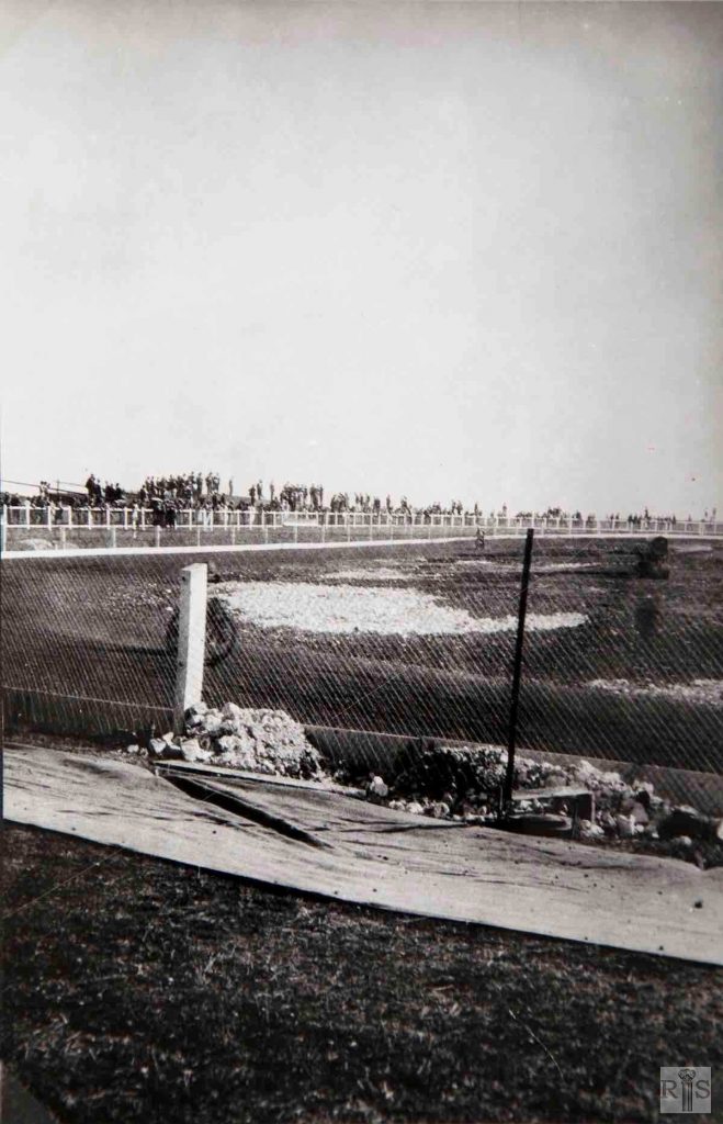
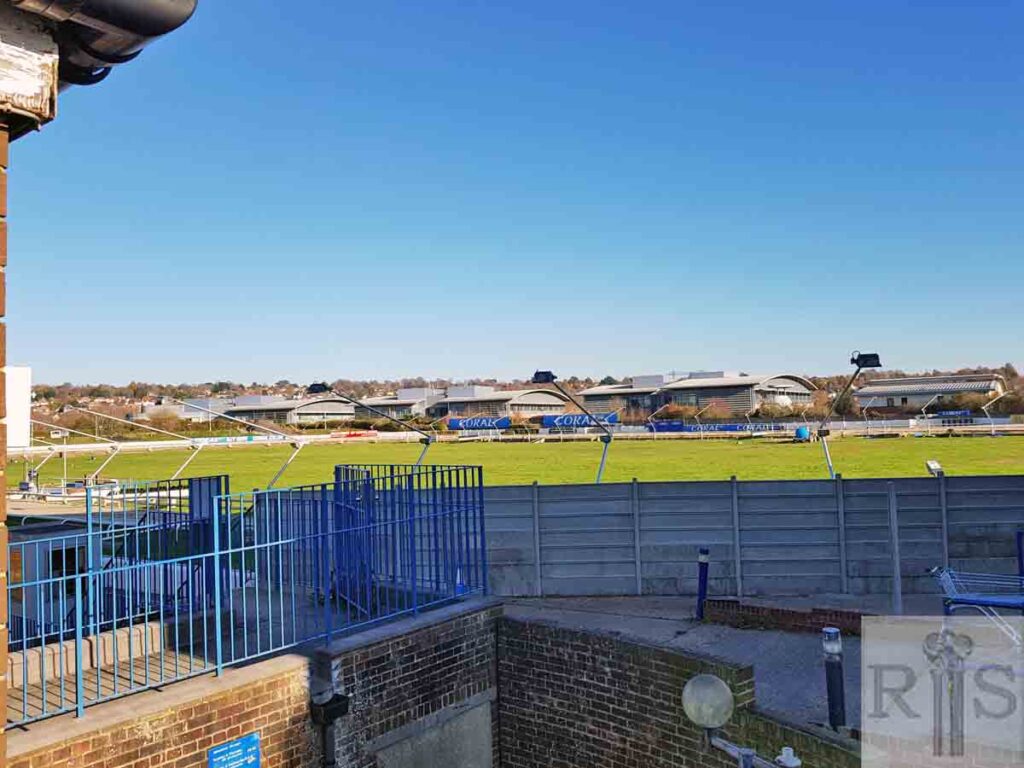
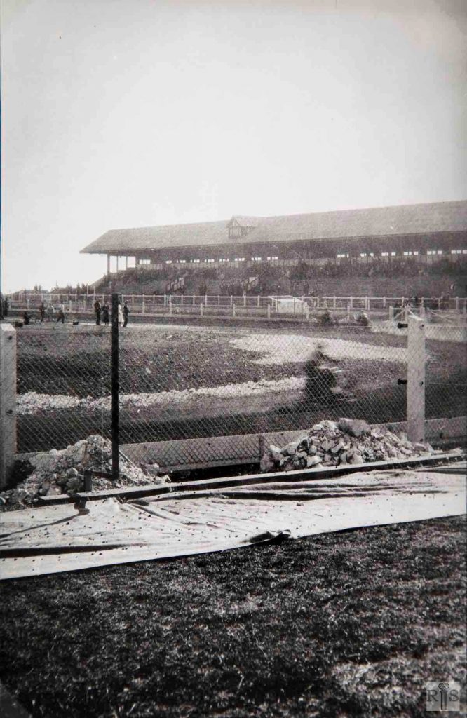
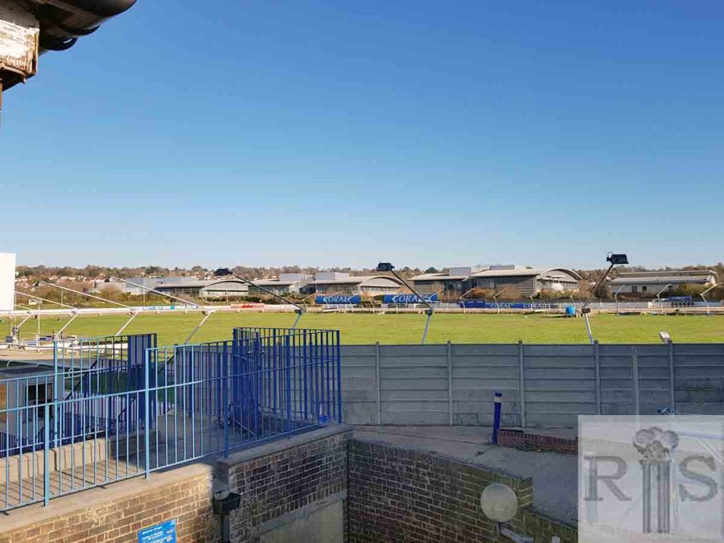
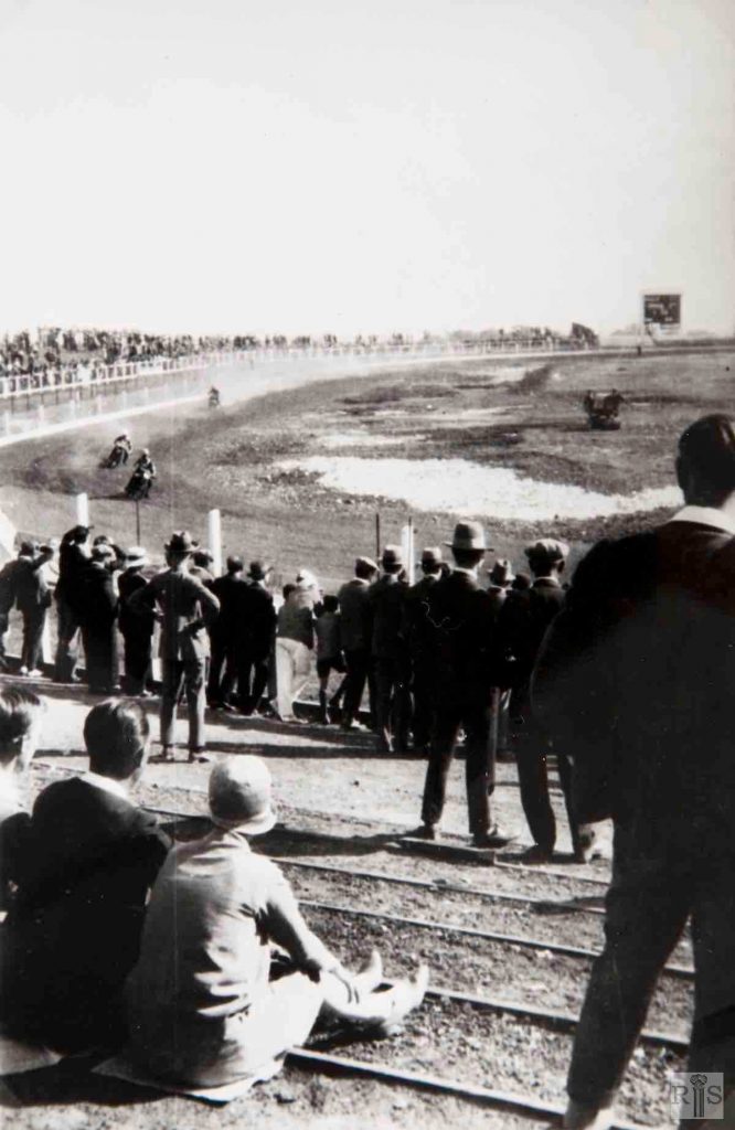
James Gray: When the first meeting was held here on 2 June 1928, the Stadium stood in open country, the nearest houses being a few in Old Shoreham Road, near Leighton Road. In that summer the centre was left in a rough condition and was not laid out as a field for rugby football until 1929. Speedway, or dirt track racing as it was called, was tried out in 1929-1930, but was not a success. Note the primitive original stand and the uncovered east side. jgc_17_083
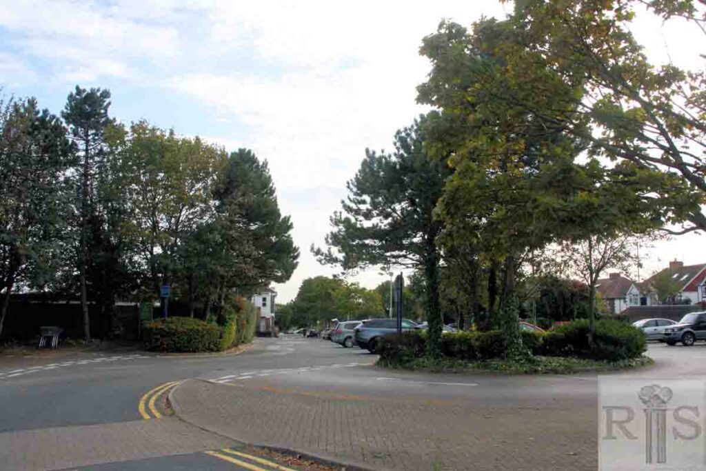
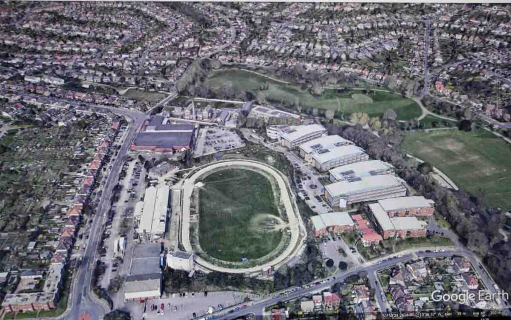
2019: Since the James Gray picture was taken, only a year after the greyhound track was opened, the Hove Greyhound Stadium has been redeveloped and enlarged and is now the Coral Brighton & Hove Greyhound Stadium. Offices occupied by the Legal and General financial services company now stand between the stadium and Hove Park. (Photographer: Helen Glass)
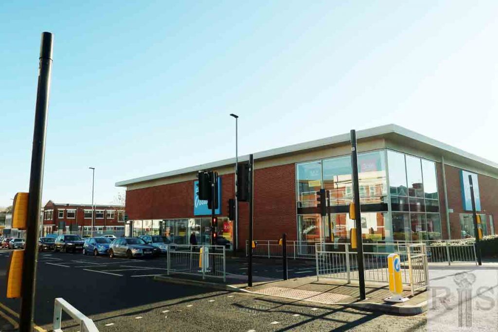
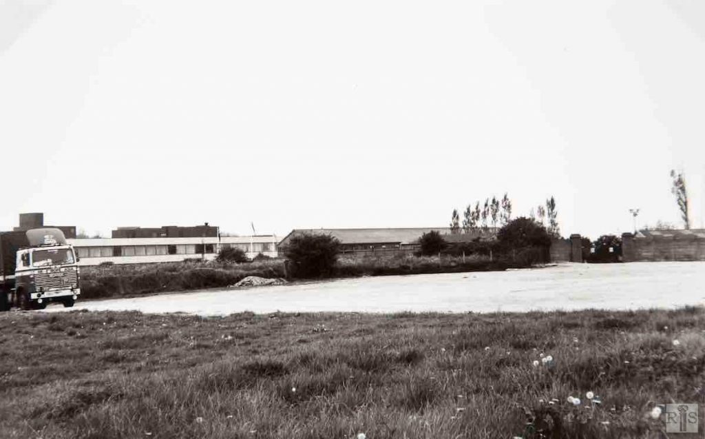
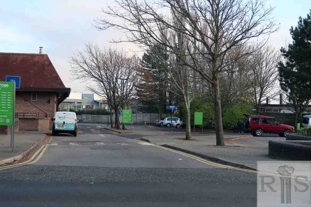
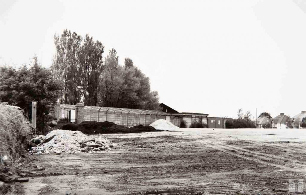
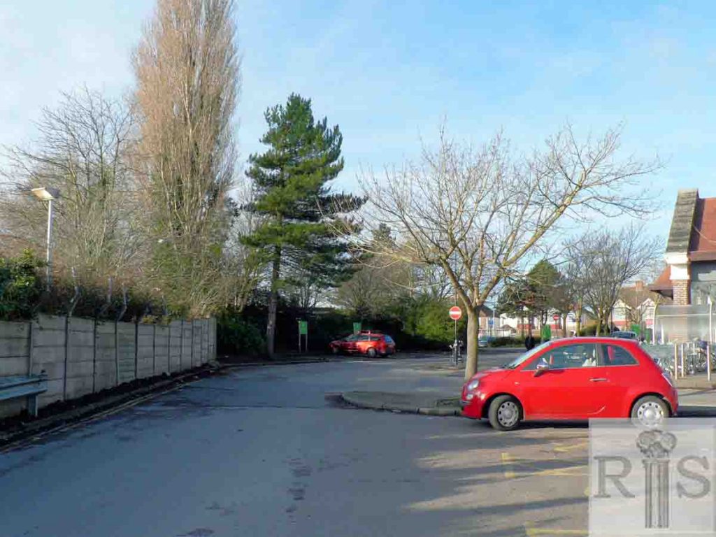
James Gray: On land, which had been successively farm land, spare grassland, wartime allotments, and finally the Greyhound Stadium car park, was erected in 1985-86 a large super store occupied by the local Co-operative Society. This photograph shows the view west across the deserted car park. jgc_17_086
James Gray: Knowing that the development was imminent I had this and the previous photograph taken on 19 May 1985, and work started three days later. The completed store opened to the public on 11 June 1986. View to the south to the East Stand of the Greyhound Stadium, and beyond, offices of the Alliance Building Society. Additional Information: Alliance Building Society offices demolished, 2001. Now City Park. jgc_17_087
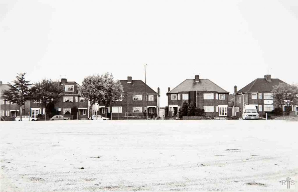
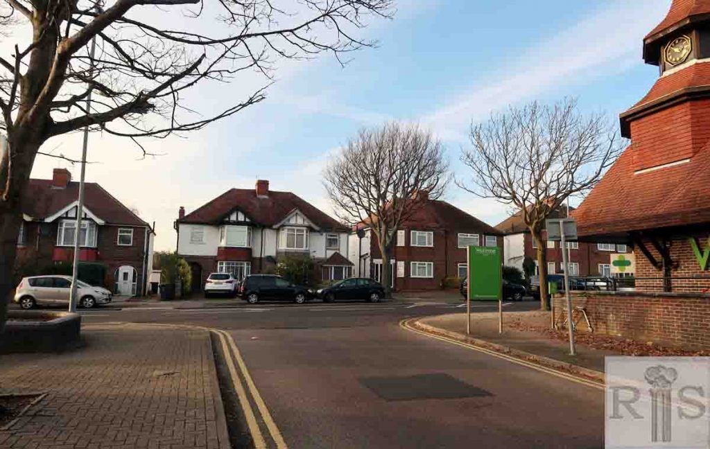
James Gray: This photograph of 1958 sets the scene, as the [Co-operative Society] store is on land level with the car in Nevill Road, but just off the photograph on the right-hand side. jgc_17_088
2018: The houses on the left side (west) of Nevill Road, facing what was the Co-operative Society Store, now Waitrose, are relatively intact in the 2018 image. (Photographer: Helen Glass)
James Gray: Two more photographs of 19 May 1985 [see also jgc_17_090 below]. They look down to the Main Stand at the Greyhound Stadium, and just a glimpse of houses in lower Nevill Road. These emphasise the size of this large car park, some of which still remains to serve both the Stadium and the new super store. jgc_17_089
James Gray: Two more photographs [jgc_17_089 and 090] of 19 May 1985. They look down to the main stand at the Greyhound Stadium, and just a glimpse of houses in lower Nevill Road. These emphasise the size of this large car park, some of which still remains to serve both the Stadium and the new super store. jgc_17_090
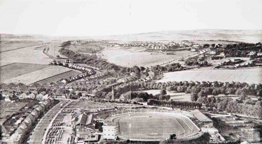
James Gray: This aerial photograph, taken in 1939, gives an excellent panoramic view of the area, and shows the extension of the original race stand and the erection of that east side of the Stadium. Note also, Hove Park, Goldstone Pumping Station, Tredcroft Road and Hill Drive completely without houses, Shirley Drive and Woodruff Avenue with just a few houses and the open area now covered by the houses of Benett Drive and Shirley Avenue. jgc_17_097
James Gray: This fine aerial photograph of this area was taken in 1947. There had then been no building after the end of the 1939-1945 war, so all the houses seen were pre-war built. Note the vast area to the west of Woodland Avenue, later developed by Cooks, the central area of Hill Drive and Hill Brow, and beyond Hove Park the market garden land behind Goldstone Crescent. The Greyhound Stadium was opened in June 1928.
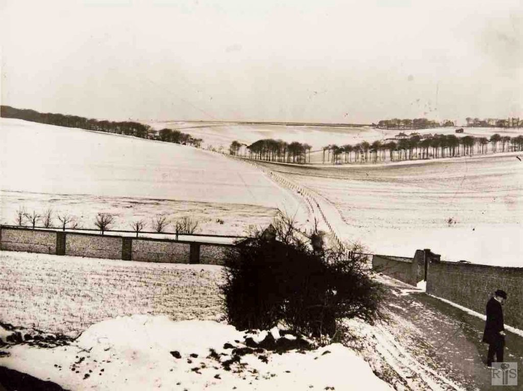
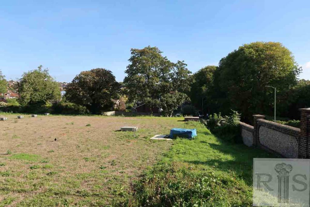
James Gray: This photograph was taken in January 1904 from a spot near the junction of the present Woodland Drive and Nevill Road. On the right can be seen the wall surrounding Goldstone Waterworks, unchanged to this day, and the right of way footpath leading to the Three-Cornered Copse. Beyond the trees are the buildings of Lower Tongdean Farm with the farmhouse screened by the semi-circular clump beyond. The iron railings on each side of the path, traces of which can still be seen at the west edge of the copse, acted as a dividing line between Tongdean Farm and Court Farm, West Blatchington. The double line of trees (not shown here) which now flank Woodland Drive by Hove Park were planted in 1906. The wall running away to the left can still be seen behind the houses on the north side of Nevill Road. jgc_17_134
