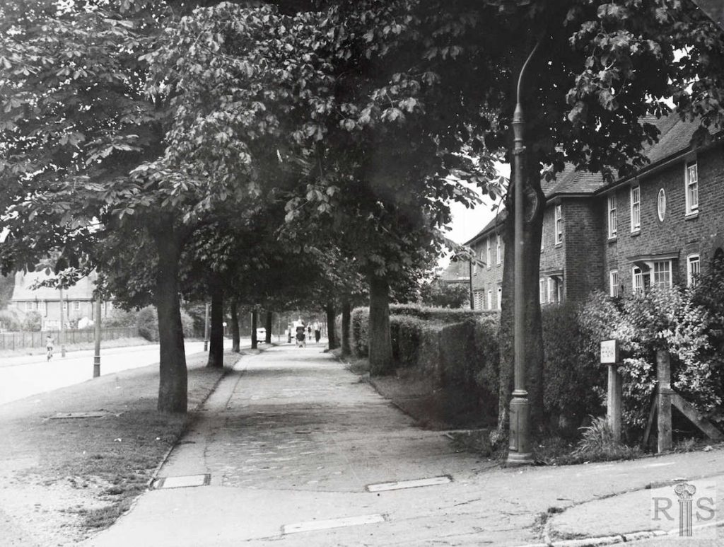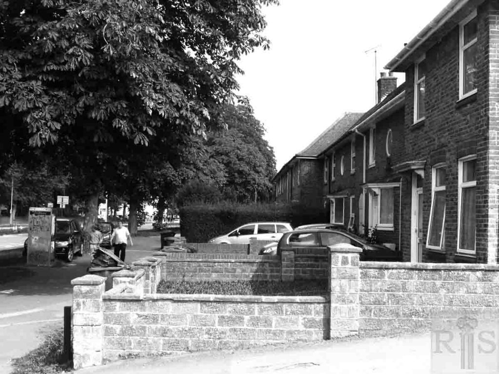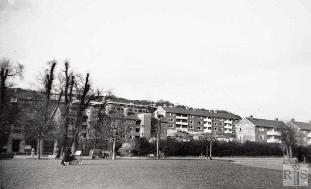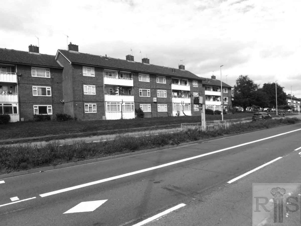
between Saunders Park View and Wild Park
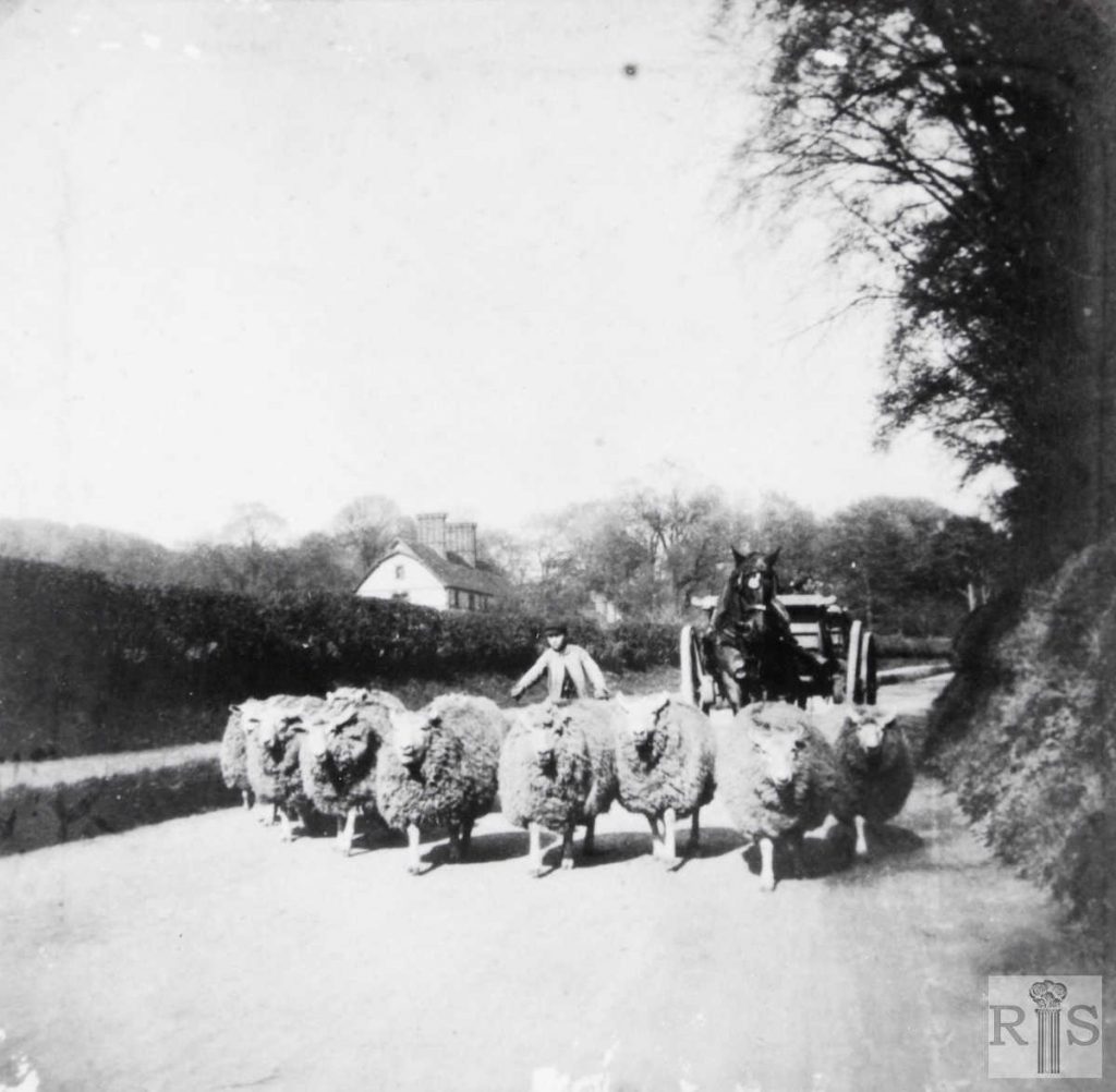
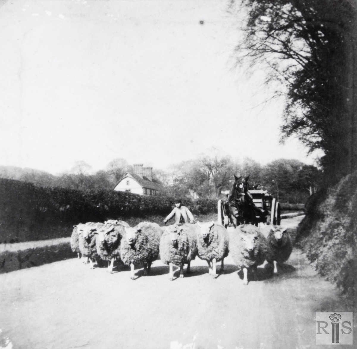
James Gray: At the time of this photograph, the early 1900s, just a country scene on a narrow road, which might have been miles away from anywhere. Today, some 70 years later, the sheep would have little chance of survival, for this is the extremely busy Lewes Road, looking north between the skew bridge and Coldean Lane. On the right would now be found the houses of the North Moulsecoomb Council Estate. In the distance are Coldean Cottages, removed in 1960. This is the subject of a separate photograph [jgc_28_202 on the Woburn Place page] further on in this album. jgc_28_053
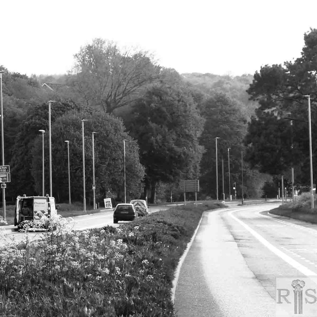
2018: Clearly the sheep would stand even less of a chance on the modern dual carriageway. (This photograph was taken at first light.) Any view of Coldean has been obscured by the mature trees growing on the western side of the road. The creation of Moulsecoomb Wild Park has left part of the image still fairly rural, although the area is now mostly covered by trees and scrub rather than the sheep-grazed pastures of the early 1900s. (Photographer: Ron Fitton)
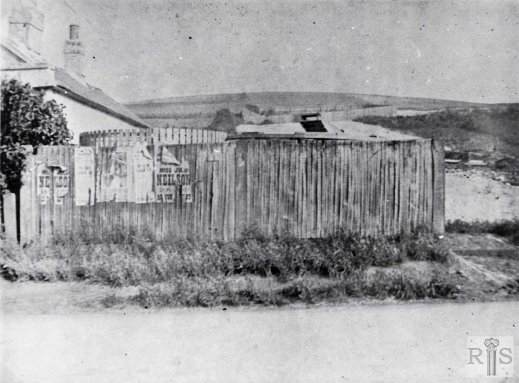
James Gray: This cottage, formerly the toll-keepers cottage, stood in the Lewes Road, approximately where the corner of Natal Road is. In the garden was the pound, a circular enclosure, in which were kept stray sheep and cattle from the area of Steyning Rural Council, the cottage being then outside the boundaries of Brighton Borough. The house was demolished in 1921 when the building of the South Moulsecoomb council estate commenced. On the hill in the background can be seen the wooden fence surrounding the site of Woodbine Cottage. jgc_28_108
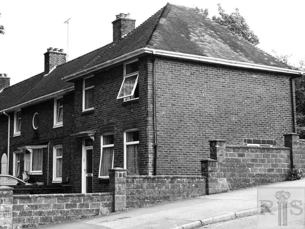
2018: The site is now occupied by No 1 The Highway – part of the Bevendean housing estate (Photographer: Ron Fitton)
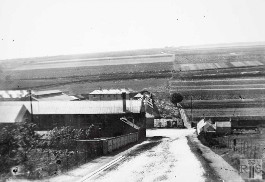
James Gray: The rural scene from Woodbine Cottage, about 1904. At the foot of the newly made Natal Road were the toll-keeper’s and policeman’s cottages, also seen on other pages. Until 1923 the Brighton – Preston boundary ran down by the fence on the right, across the Lewes Road and continued over the hill as can be seen in this photograph. The land in the left distance then formed part of Harrington Farm and later became the North Brighton allotments. The houses of Hollingdean Estate now cover it. Note the forerunner of Allen West’s premises and beyond, part of the old [Preston] Cavalry Barracks. jgc_28_117
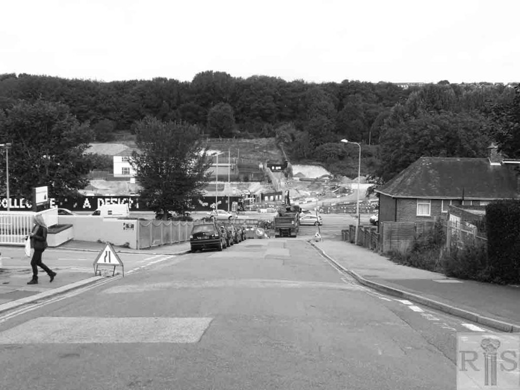
2018: All of the buildings mentioned have been demolished as have the Allen West buildings (at the time of the 1904 photograph they would have been the Reason Engineering Company premises). The embankment on the western side is now completely hidden by trees and the long derelict Preston Barracks have been demolished. Brighton University’s Mithras House entrance and car park below can be glimpsed south of Natal Street. Land on both sides of the Lewes Road, including the barracks site and Mithras House car park, is currently being developed by the local council and the University of Brighton to provide new homes, student halls of residence, a new academic building, shops, cafés and so on. (Photographer: Ron Fitton)
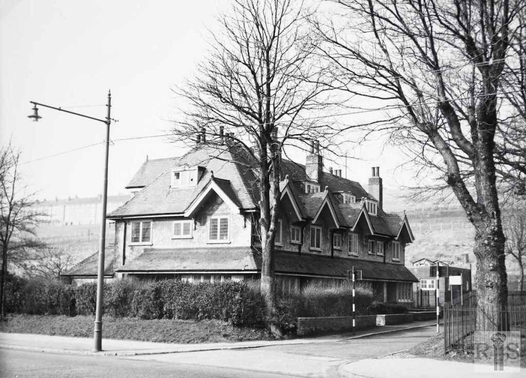
James Gray: These four houses were of quite a different era. They were built early in the present century and occupied by workers on neighbouring farms. Internally, they were quite large, containing several rooms. They were removed in 1963 as part of the Polytechnic development. Date of photograph 21 February 1960. jgc_28_136
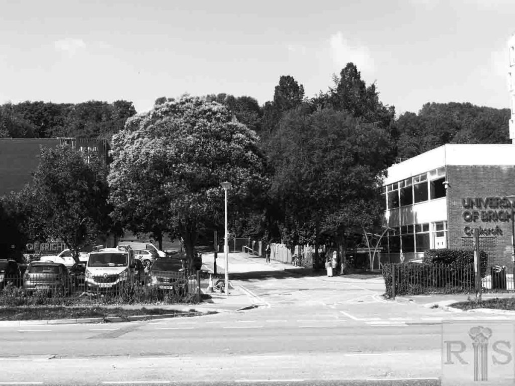
2018: The building was demolished in 1963 to make way for the Polytechnic (now University) although the ugly car park that stands on the site now hardly seems like compensation for the loss of the grand looking villa. (Photographer: Ron Fitton)
James Grey: Almost a country scene, but it is at the junction of Natal Road and the Highway, Moulsecoomb, in the spring of 1958. There was no thought of widening Lewes Road or of a dual carriageway. Compare this photograph with the 1904 and 1919 views [see also jgc_28_118 and 119 on the Lewes Road (6) page] of the same area, on previous pages; the four cottages known as Moulsecoomb Villas is the common factor in all three. A photograph taken now (1985) would show more remarkable changes. jgc_28_142
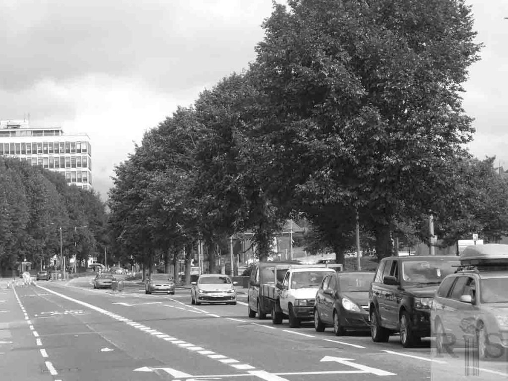
2018: The Lewes Road was widened to a dual carriageway in 1962 and then reduced down to a single lane again in 2003 and finally this busy arterial road was reduced even further with the introduction of cycle lanes in 2013. (Photographer: Ron Fitton)
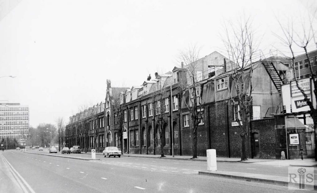
James Gray: This photograph of 8 April 1973, shows the long Allen West building empty and its future uncertain. By now Lewes Road had been widened and made dual carriageway, while the huge Polytechnic building had been erected on the cleared site of Moulsecoomb Villas. Compare this photograph with the one [jgc_28_101] showing the building of the premises in 1900, seen on the previous page. jgc_28_143
2018: The factory was demolished not long after the photograph was taken, while the administrative building behind it was taken over by Brighton Polytechnic in 1977 and renamed Mithras House. The original factory site became a car park and remained undeveloped until very recently. (Photographer: Ron Fitton)
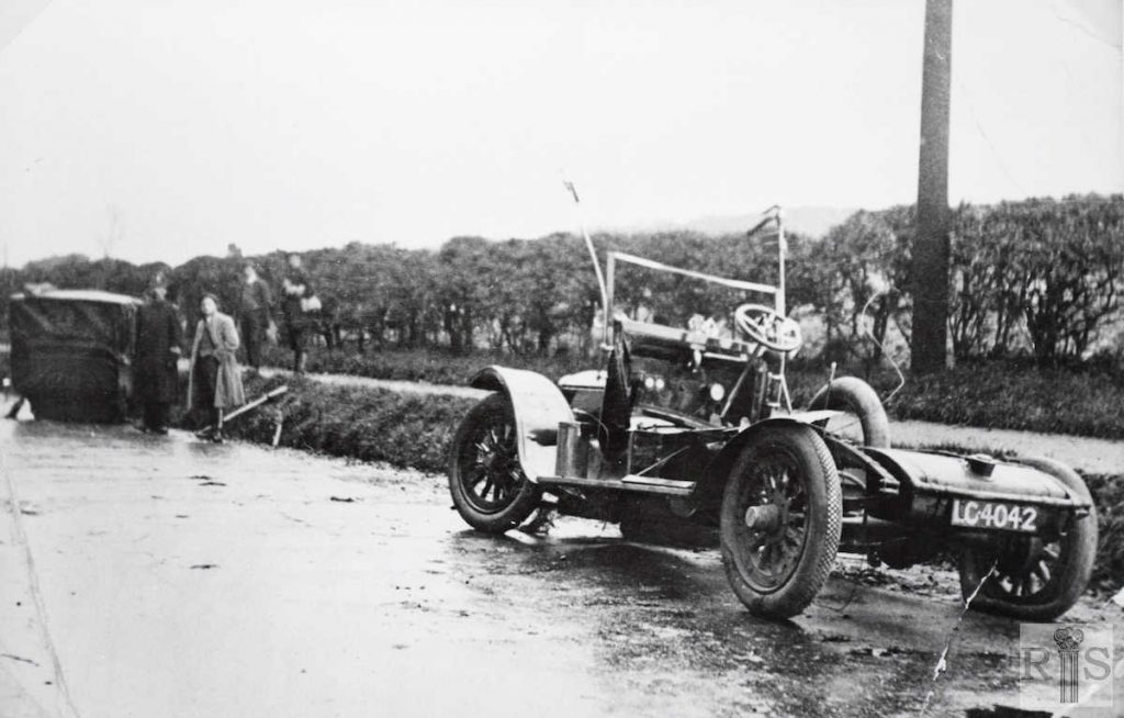
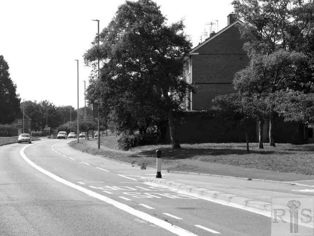
James Gray: Chassis and body divided in a mishap on the country area of the Lewes Road, just north of Bates’ Nurseries. Period not known, but thought to be about 1920. The vehicle is on the wrong side of the road, facing towards Brighton. Then, there was only one footpath – on the west side of Lewes Road. jgc_28_146
2018: This photograph was taken near to where the original incident occurred. Bates Nurseries was demolished in the 1950s to make way for the Bates Estate. (Photographer: Ron Fitton)
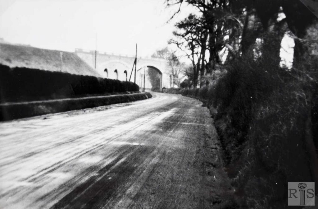
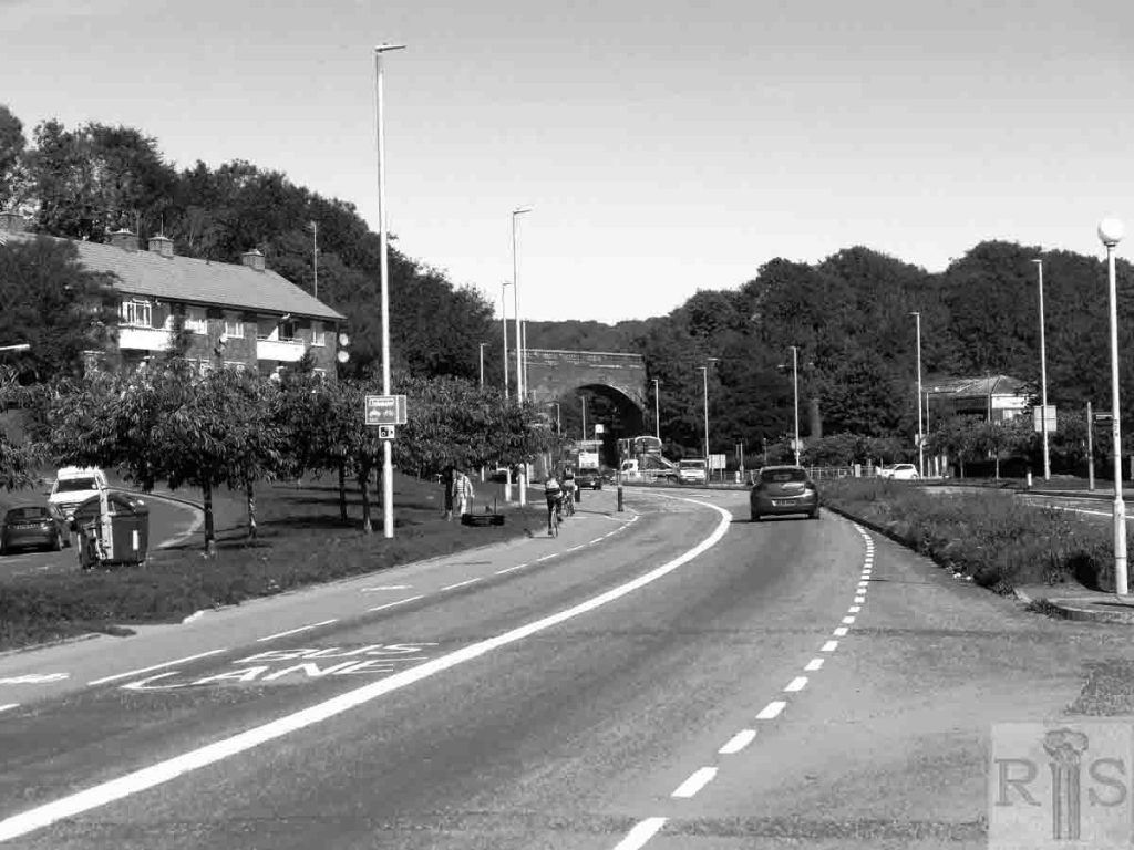
James Gray: In 1919 the year of this photograph, Lewes Road near the viaduct was still a country road with a raised footpath. It did not change until the building of the South Moulsecoomb council estate started in 1921. jgc_28_171
2018: It is interesting to note that the embankments either side of the Skew Bridge (as the viaduct was once affectionately called) are both completely covered in vegetation. Lewes Road nowadays is a very busy arterial road with separate bus and cycle lanes. (Photographer: Ron Fitton)
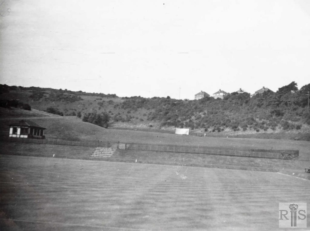
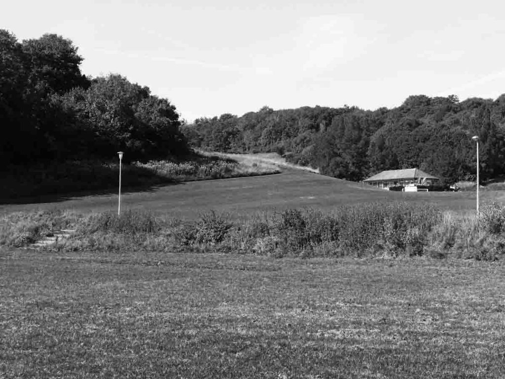
James Gray: Two photographs of the Wild Park, at some time in the 1930s. jgc_ 28_172
2018: Despite some controversial tree felling, the Wild Park remains substantially unaltered since the time the original photograph was taken. (Photographer: Ron Fitton)
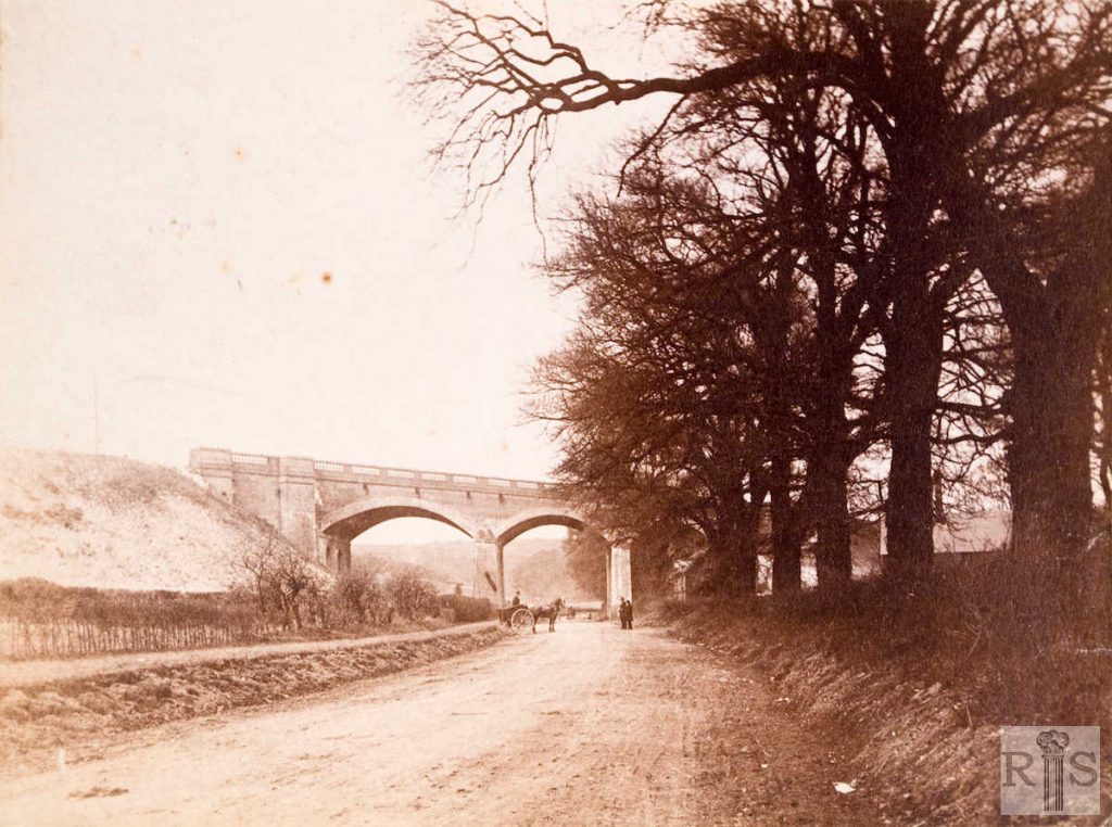
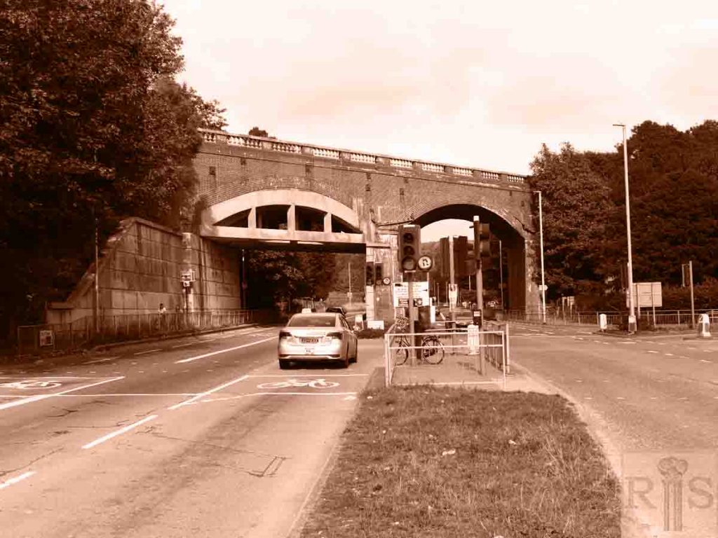
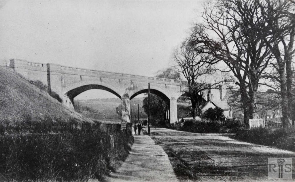
James Gray: These old photographs show a rural Lewes Road, very different from what it is today – 1954. This view dates from about 1885, Compare these photographs with the modern view [see jgc_28_177] overleaf. jgc_28_175
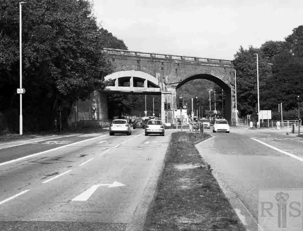
2018: The Skew Bridge has survived the ravages of time, although Lewes Road itself has undergone various transformations. After widening in the 1960s, it is now a very busy arterial road with separate bus and cycle lanes. There is still only one line for traffic in each direction. (Photographer: Ron Fitton)
James Gray: This one is of a somewhat later period, as witness the appearance of the telegraph poles. Note the two Railway Cottages and the lane leading to Hodshrove Farm. jgc_28_176
2018: See caption for jgc_28_175 above. (Photographer: Ron Fitton)
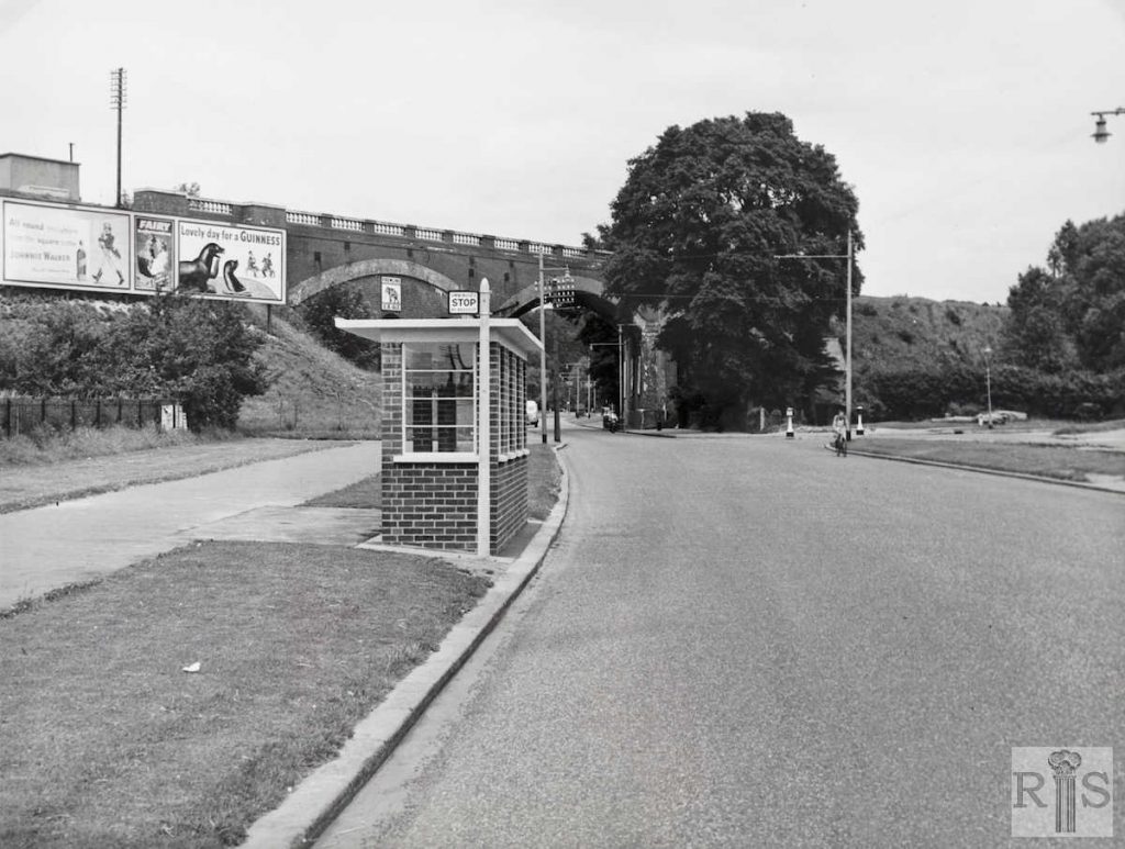
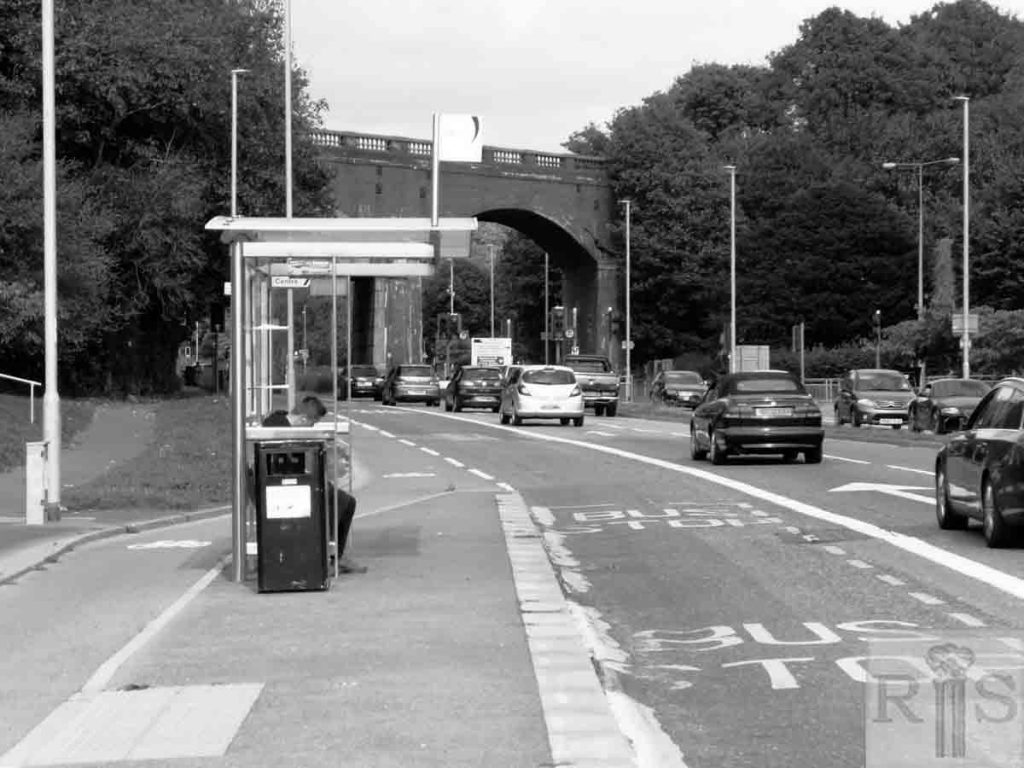
James Gray: The viaduct was constructed in 1844/1845 and two of the arches were bricked up for future support early in the present century. Change first came to rural Lewes Road with the building of the South Moulsecoomb Housing Estate in 1921. North Moulsecoomb beyond the viaduct was built in 1927 and Moulsecoomb School in 1929. All this necessitated the removal of the long line of trees shown in earlier photographs and the widening of the roadway. Later the east Moulsecoomb Estate was laid out and finally blocks of flats were constructed on the site of Bates Nursery. In this photograph (taken in July 1954) can still be seen Railway Cottages almost hidden behind the trees and the old lane leading to Hodshrove. jgc_28_177
2018: It is interesting to note how much the vegetation has grown up since the original photograph was taken, almost completely obscuring the embankments. 1950s bus stops clearly offered more protection from the elements than their modern counterparts. (Photographer: Ron Fitton)
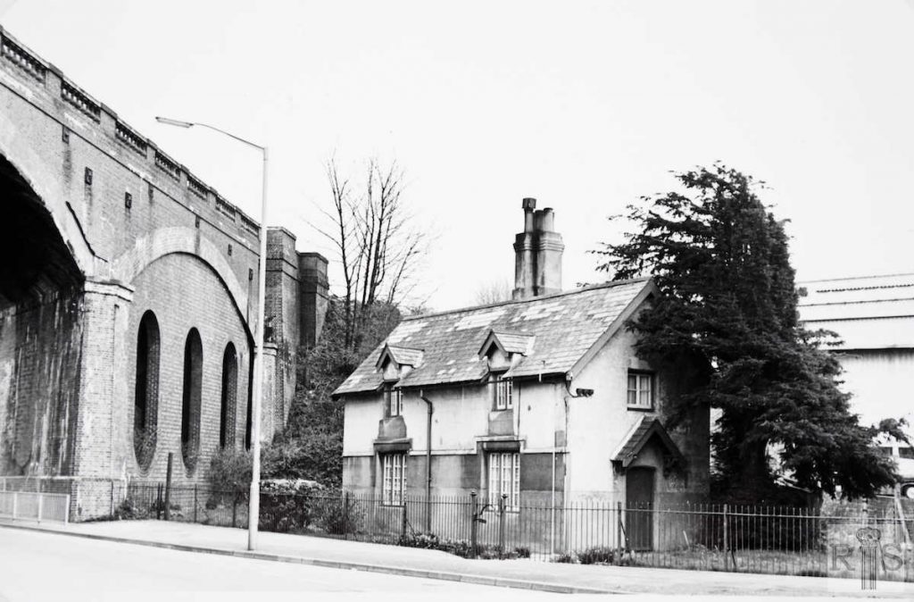
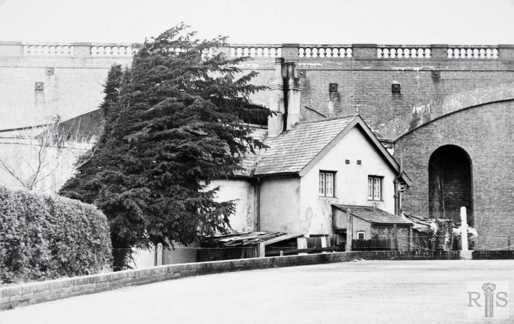
James Gray: These two small cottages, probably built when the Lewes Railway was constructed in the mid-1840s, had seen remarkable changes during their long life. As seen from earlier photographs they first adjoined this bridge across what was little more than the country road from Brighton to Lewes. Their peace was disturbed first by the building of the South Moulsecoomb Council Estate in 1921/1923, and more so when North Moulsecoomb followed a few years later. The London to Brighton and South Coast Railway built many of these dual cottages for their Gangers etc. Local examples can be found at Mill Lane, Patcham and to the rear of the Brangwyn Estate. jgc_28_178
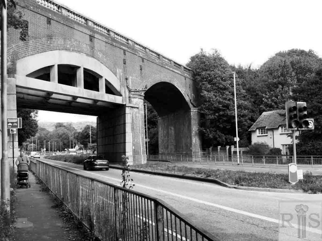
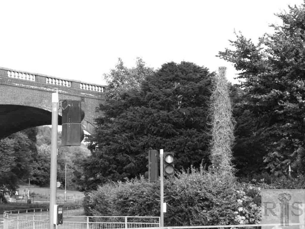
2018: In this photograph [jgc_28_178] the railway cottages are only just visible from the front but are now completely obscured from the rear and side [jgc_28_179] by a mixture of vegetation and the walls of a waste collection service. (Photographer: Ron Fitton)
James Gray: [See caption for jgc_28_178 above.] jgc_ 28_179
2018: See caption for jgc_28_178 above. (Photographer: Ron Fitton)
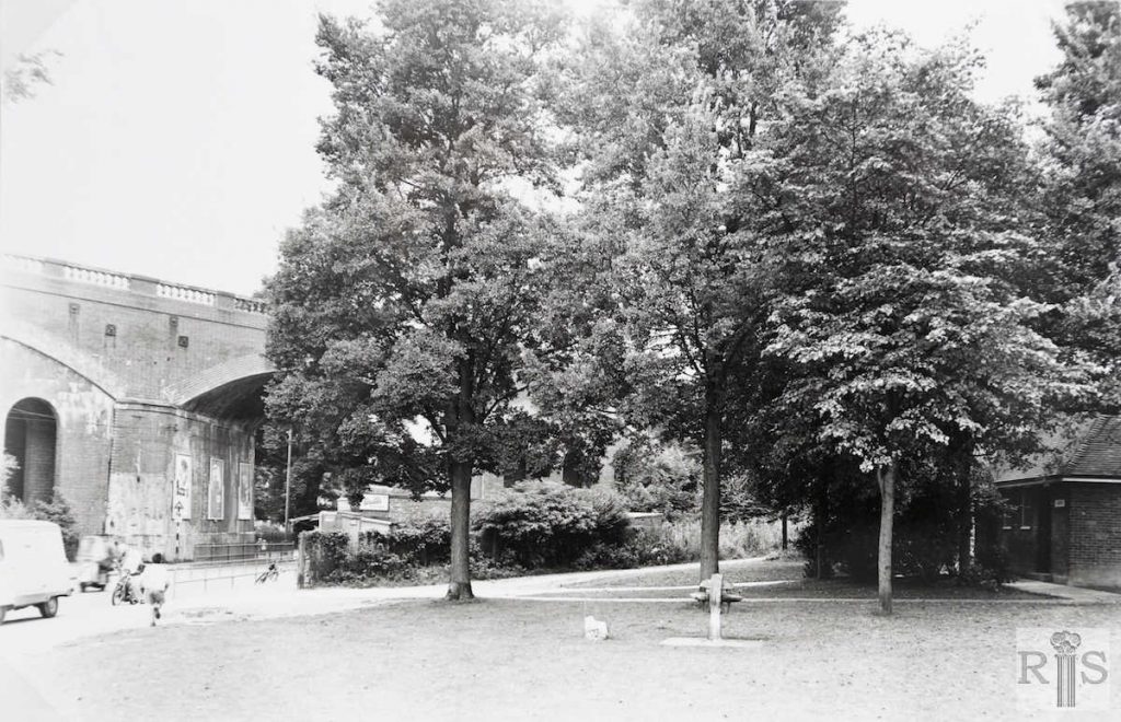
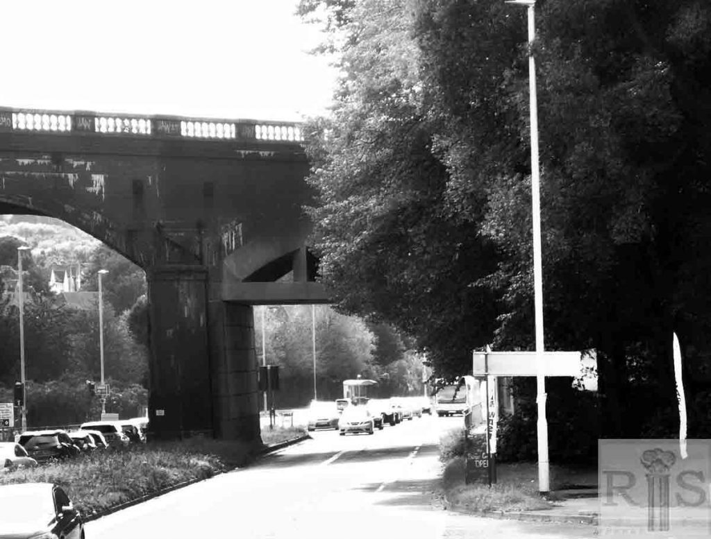
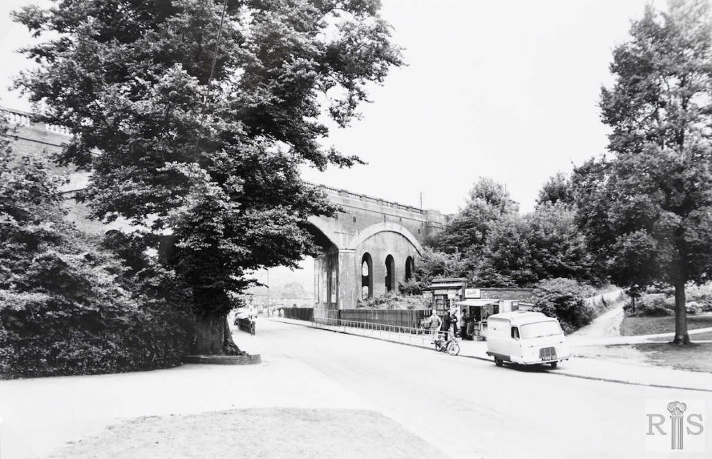
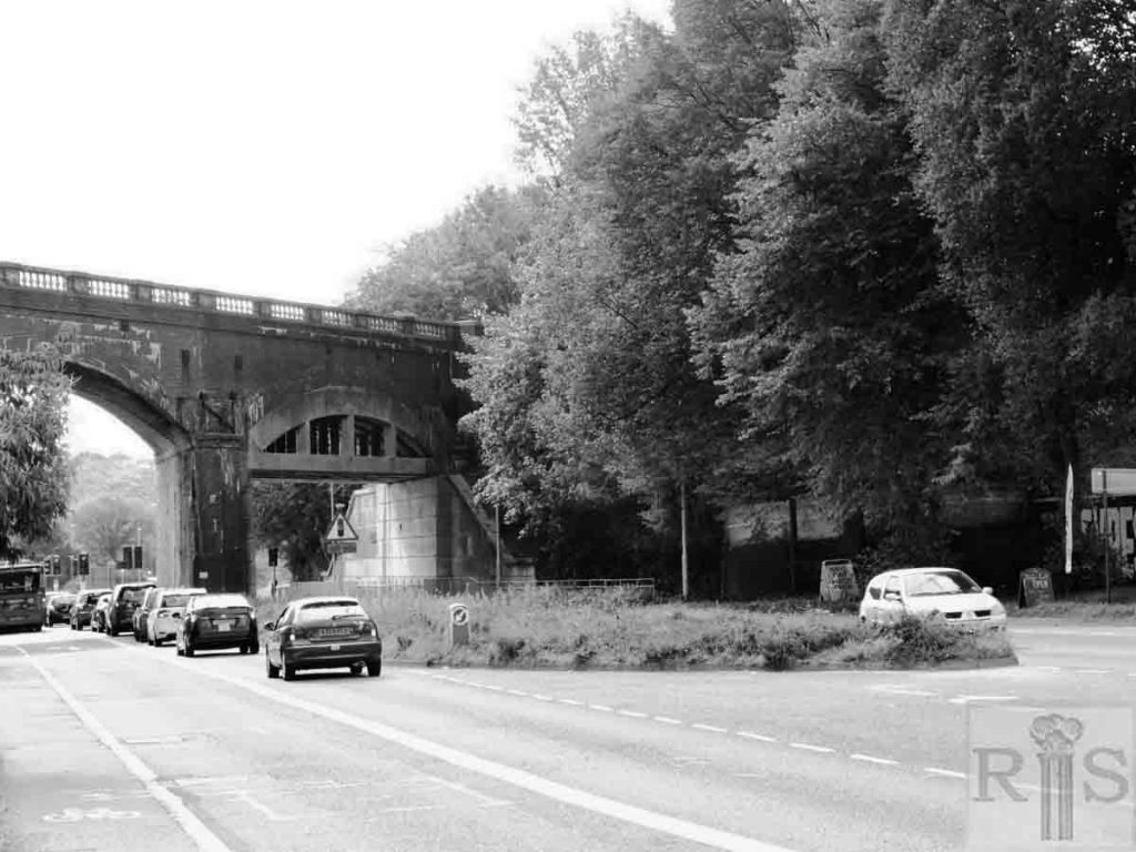
James Gray: The widening of this important north-south road, from Hollingdean Road to Falmer, commenced in 1962 and is still continuing in 1968. The work was carried in stages commencing with the stretch from Preston Barracks to Moulsecoomb Place, and the final obstacle to be dealt with was to carry one lane of the dual carriageway through the railway arches. This will pass through the west arch that was buttressed many years ago. These photographs of 8 September 1963 show the arches from both directions and nearly five years later the work has yet to be started. jgc_28_180
2018: See caption for jgc_28_175 above. (Photographer: Ron Fitton)
James Gray: [See caption for jgc_28_180 above.] jgc_28_181
2018: See caption for jgc_28_175 above. (Photographer: Ron Fitton)
James Gray: This postcard, which appears on another page, is included for the purpose of comparison. jgc_28_182
2018: See caption for jgc_28_175 above. (Photographer: Ron Fitton)
James Gray: Two photographs of the building of Bates Nursery flats, for Brighton Corporation, in 1952. The road in the foreground is Ryelands Drive and the clump of trees on the right are those seen behind Moulsecoomb School in the previous photograph. [See also jgc_28_188 below] jgc_28_189
2018: The Estate is fully developed now running along the West side of the Lewes road from the University of Brighton northwards to finish opposite Moulsecoomb Way. Westwards it
stretches as far back as the railway line. (Photographer: Ron Fitton)
James Gray: See caption for jgc_28_189 above. jgc_28_188
2018: Although the Lewes Road itself is a lot busier nowadays the scene does not look that much different after over 60 years. (Photographer: Ron Fitton)
James Gray: At the time of this photograph, the early 1900s, just a country scene on a narrow road, which might have been miles away from anywhere. Today, some 70 years later, the sheep would have little chance of survival, for this is the extremely busy Lewes Road, looking north between the skew bridge and Coldean Lane. On the right would now be found the houses of the North Moulsecoomb Council Estate. In the distance are Coldean Cottages, removed in 1960. This is the subject of a separate photograph [jgc_28_202 on the Woburn Place page] further on in this album. jgc_28_053
James Gray: This cottage, formerly the toll-keepers cottage, stood in the Lewes Road, approximately where the corner of Natal Road is. In the garden was the pound, a circular enclosure, in which were kept stray sheep and cattle from the area of Steyning Rural Council, the cottage being then outside the boundaries of Brighton Borough. The house was demolished in 1921 when the building of the South Moulsecoomb council estate commenced. On the hill in the background can be seen the wooden fence surrounding the site of Woodbine Cottage. jgc_28_108
James Gray: The rural scene from Woodbine Cottage, about 1904. At the foot of the newly made Natal Road were the toll-keeper’s and policeman’s cottages, also seen on other pages. Until 1923 the Brighton – Preston boundary ran down by the fence on the right, across the Lewes Road and continued over the hill as can be seen in this photograph. The land in the left distance then formed part of Harrington Farm and later became the North Brighton allotments. The houses of Hollingdean Estate now cover it. Note the forerunner of Allen West’s premises and beyond, part of the old [Preston] Cavalry Barracks. jgc_28_117
James Gray: These four houses were of quite a different era. They were built early in the present century and occupied by workers on neighbouring farms. Internally, they were quite large, containing several rooms. They were removed in 1963 as part of the Polytechnic development. Date of photograph 21 February 1960. jgc_28_136
2018: The building was demolished in 1963 to make way for the Polytechnic (now University) although the ugly car park that stands on the site now hardly seems like compensation for the loss of the grand looking villa. (Photographer: Ron Fitton)
James Grey: Almost a country scene, but it is at the junction of Natal Road and the Highway, Moulsecoomb, in the spring of 1958. There was no thought of widening Lewes Road or of a dual carriageway. Compare this photograph with the 1904 and 1919 views [see also jgc_28_118 and 119 on the Lewes Road (6) page] of the same area, on previous pages; the four cottages known as Moulsecoomb Villas is the common factor in all three. A photograph taken now (1985) would show more remarkable changes. jgc_28_142
James Gray: This photograph of 8 April 1973, shows the long Allen West building empty and its future uncertain. By now Lewes Road had been widened and made dual carriageway, while the huge Polytechnic building had been erected on the cleared site of Moulsecoomb Villas. Compare this photograph with the one [jgc_28_101] showing the building of the premises in 1900, seen on the previous page. jgc_28_143
James Gray: Chassis and body divided in a mishap on the country area of the Lewes Road, just north of Bates’ Nurseries. Period not known, but thought to be about 1920. The vehicle is on the wrong side of the road, facing towards Brighton. Then, there was only one footpath – on the west side of Lewes Road. jgc_28_146
2018: This photograph was taken near to where the original incident occurred. Bates Nurseries was demolished in the 1950s to make way for the Bates Estate. (Photographer: Ron Fitton)
James Gray: In 1919 the year of this photograph, Lewes Road near the viaduct was still a country road with a raised footpath. It did not change until the building of the South Moulsecoomb council estate started in 1921. jgc_28_171
2018: It is interesting to note that the embankments either side of the Skew Bridge (as the viaduct was once affectionately called) are both completely covered in vegetation. Lewes Road nowadays is a very busy arterial road with separate bus and cycle lanes. (Photographer: Ron Fitton)
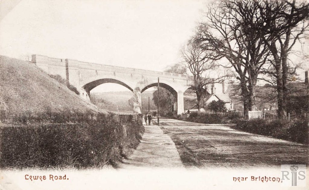
James Gray: These old photographs show a rural Lewes Road, very different from what it is today – 1954. This view dates from about 1885, Compare these photographs with the modern view [see jgc_28_177] overleaf. jgc_28_175
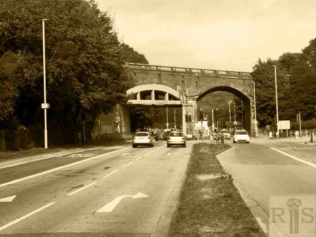
2018: The Skew Bridge has survived the ravages of time, although Lewes Road itself has undergone various transformations. After widening in the 1960s, it is now a very busy arterial road with separate bus and cycle lanes. There is still only one line for traffic in each direction. (Photographer: Ron Fitton)
James Gray: The viaduct was constructed in 1844/1845 and two of the arches were bricked up for future support early in the present century. Change first came to rural Lewes Road with the building of the South Moulsecoomb Housing Estate in 1921. North Moulsecoomb beyond the viaduct was built in 1927 and Moulsecoomb School in 1929. All this necessitated the removal of the long line of trees shown in earlier photographs and the widening of the roadway. Later the east Moulsecoomb Estate was laid out and finally blocks of flats were constructed on the site of Bates Nursery. In this photograph (taken in July 1954) can still be seen Railway Cottages almost hidden behind the trees and the old lane leading to Hodshrove. jgc_28_177
James Gray: These two small cottages, probably built when the Lewes Railway was constructed in the mid-1840s, had seen remarkable changes during their long life. As seen from earlier photographs they first adjoined this bridge across what was little more than the country road from Brighton to Lewes. Their peace was disturbed first by the building of the South Moulsecoomb Council Estate in 1921/1923, and more so when North Moulsecoomb followed a few years later. The London to Brighton and South Coast Railway built many of these dual cottages for their Gangers etc. Local examples can be found at Mill Lane, Patcham and to the rear of the Brangwyn Estate. jgc_28_178
James Gray: The widening of this important north-south road, from Hollingdean Road to Falmer, commenced in 1962 and is still continuing in 1968. The work was carried in stages commencing with the stretch from Preston Barracks to Moulsecoomb Place, and the final obstacle to be dealt with was to carry one lane of the dual carriageway through the railway arches. This will pass through the west arch that was buttressed many years ago. These photographs of 8 September 1963 show the arches from both directions and nearly five years later the work has yet to be started. jgc_28_180
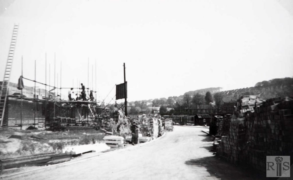
James Gray: Two photographs of the building of Bates Nursery flats, for Brighton Corporation, in 1952. The road in the foreground is Ryelands Drive and the clump of trees on the right are those seen behind Moulsecoomb School in the previous photograph. [See also jgc_28_188 below] jgc_28_189
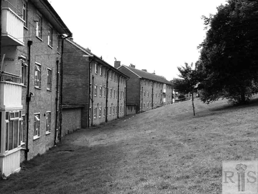
2018: The Estate is fully developed now running along the West side of the Lewes road from the University of Brighton northwards to finish opposite Moulsecoomb Way. Westwards it
stretches as far back as the railway line. (Photographer: Ron Fitton)
