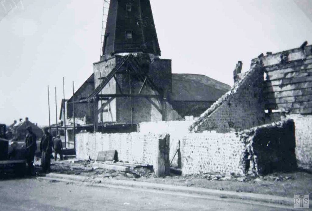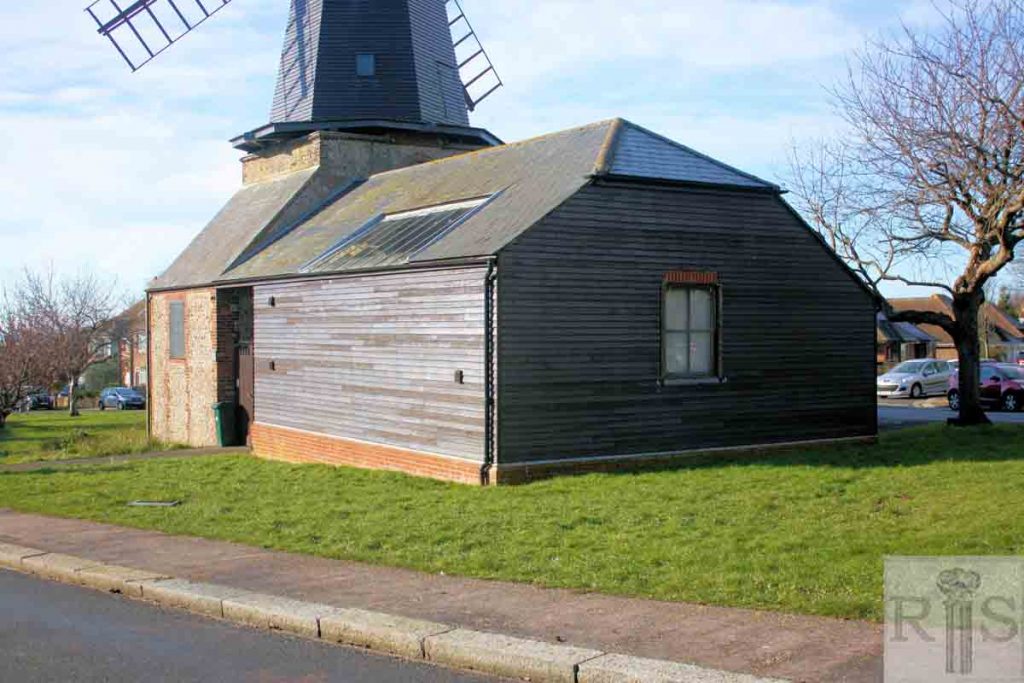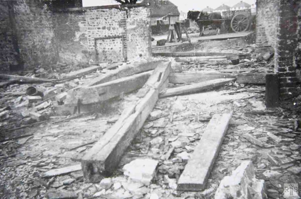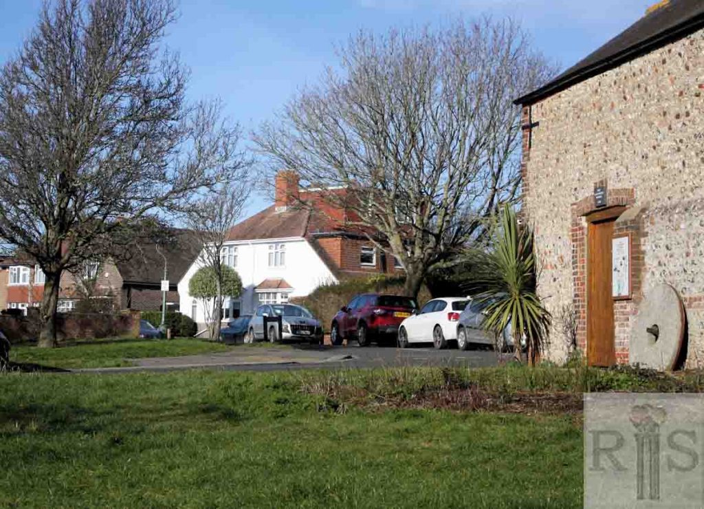
For images of West Blatchington Mill see Holmes Avenue (A)
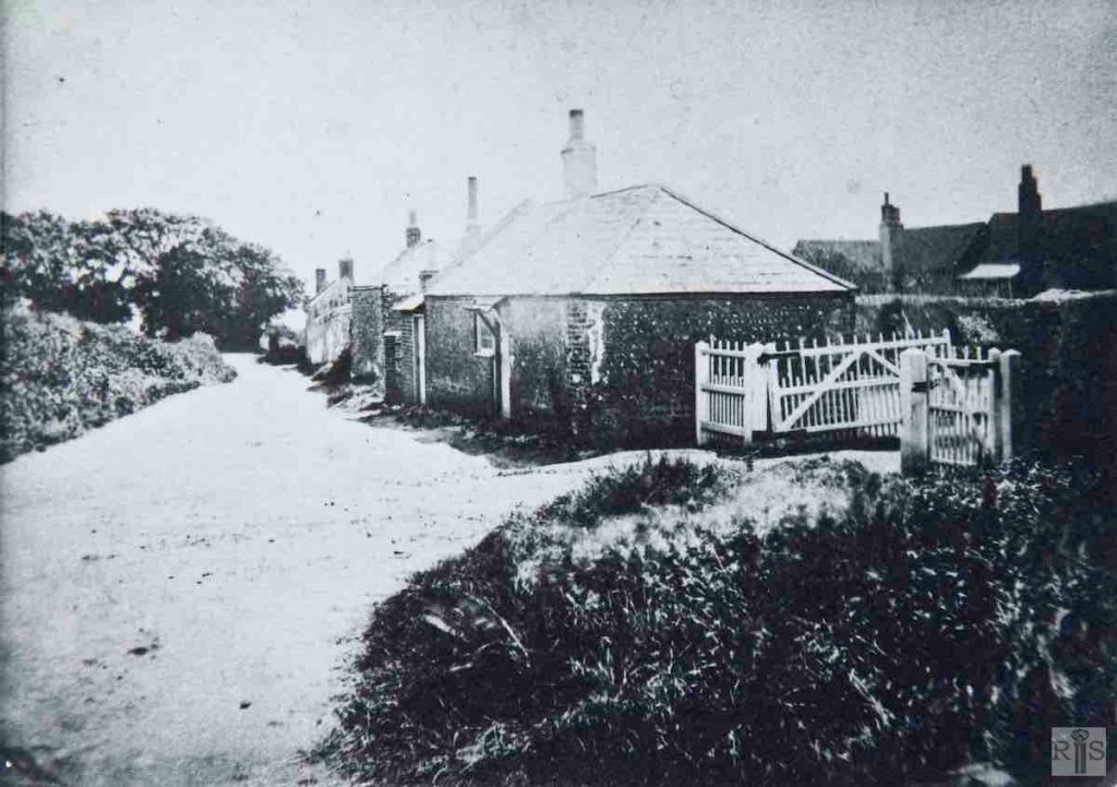
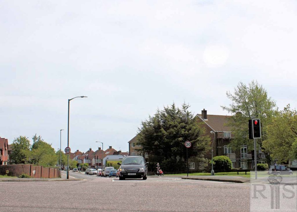
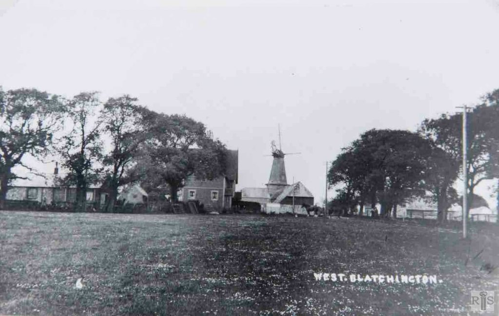
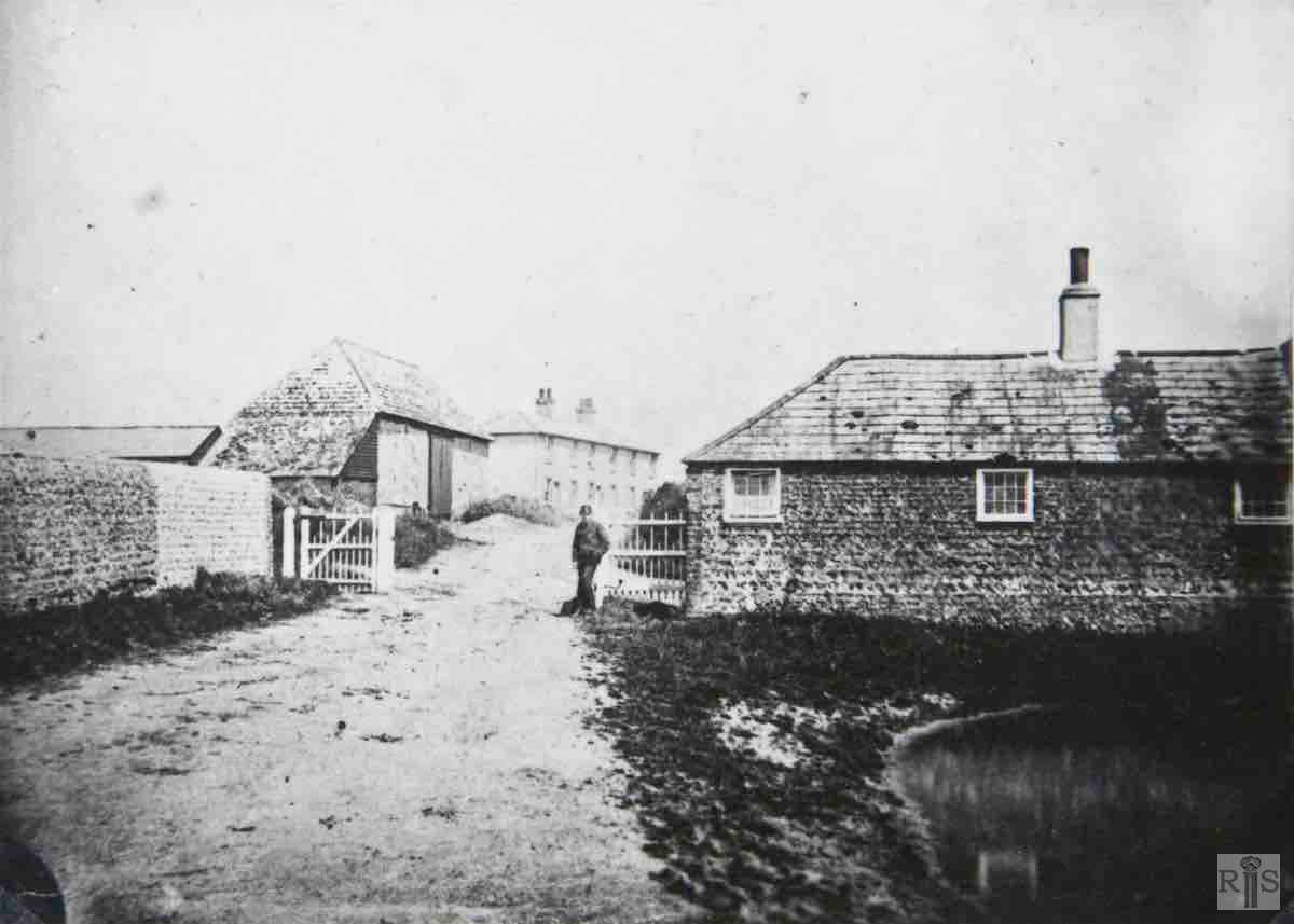
James Gray: Ancient cottages at the north entrance to Court Farm. The site is roughly the junction of the present Holmes Avenue and Court Farm Road. A few of the trees in the distance are still standing – 1954. The old cottages were removed early in 1937. jgc_36_021
2019: The 1937 photo is a close up of the view seen in jgc_36_018 (on Hamgleton Road page), taken in the 1890s. St Peter’s Church northern boundary wall is just out of shot to the right.
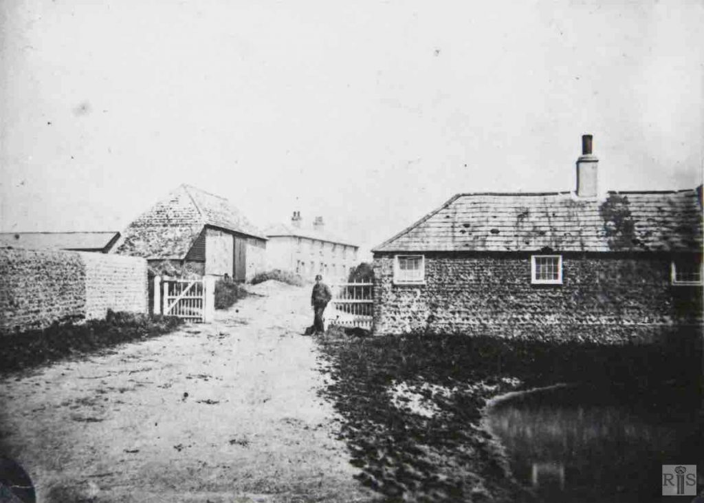
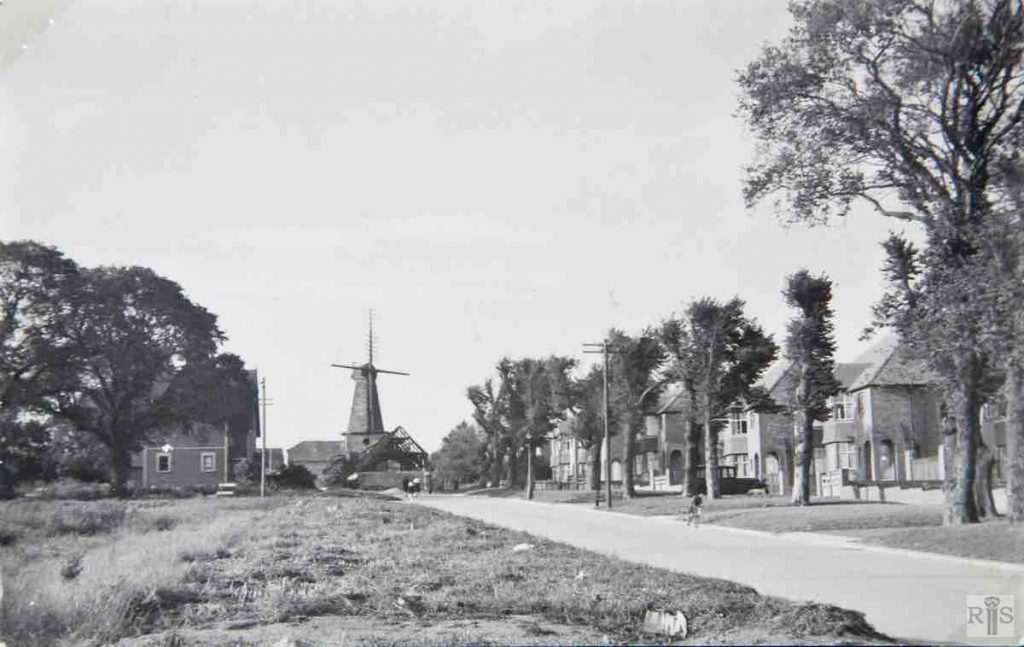
James Gray: View of the same area from within the farm, looking north, showing the rear of the cottages and a glimpse of the duck pond. Hillside Cottages in the background outlived the other buildings and were demolished as recently as 1953. The wall on the left is the present Churchyard wall. jgc_36_022
2018: If the pond had still been here in 2018, the photographer would have been standing in it to take the photo!
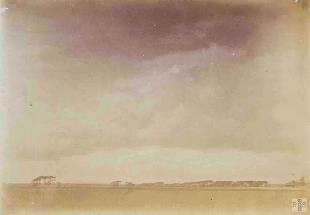
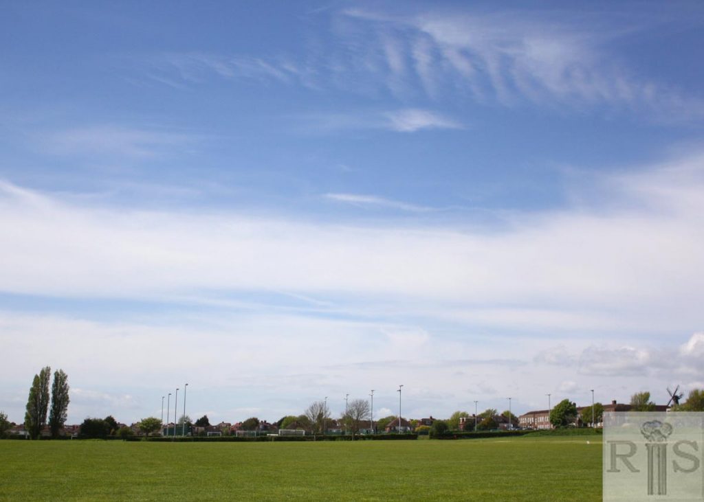
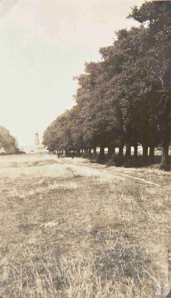
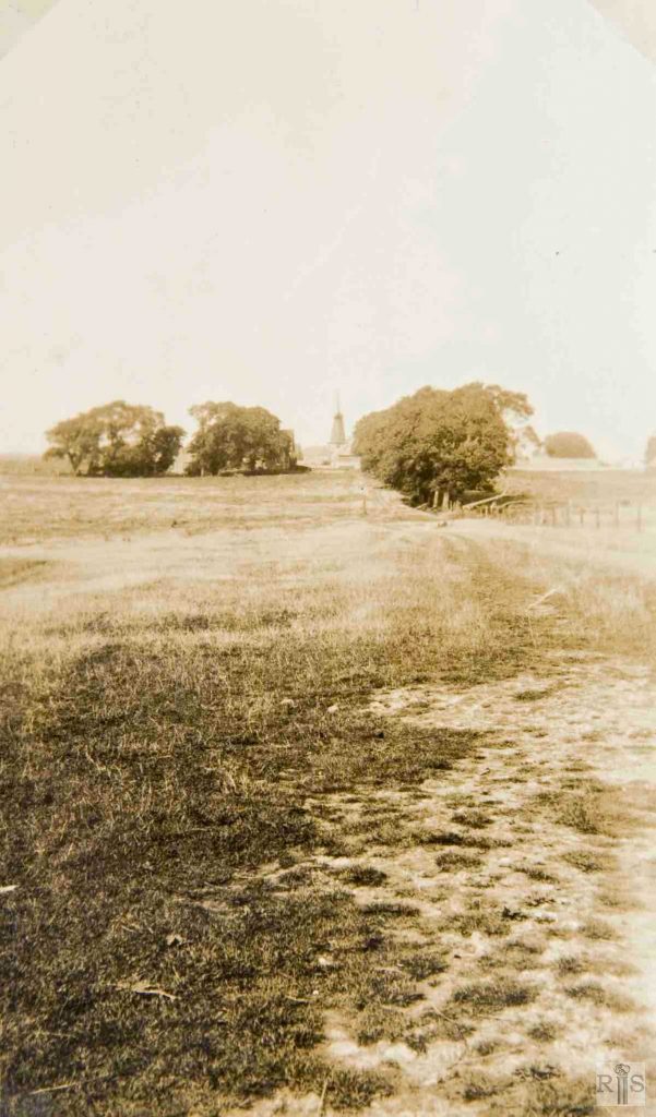
James Gray: Taken 2 September 1892, this view is from the south-east looking towards the line of trees on the site of the present Holmes Avenue. jgc_36_029
2018: In the 1892 view, the West Blatchington Windmill can be seen on the far right. In 2018, the windmill can still be seen, but the land in the foreground is now the Nevill Sports Ground and beyond that are the playing fields for Blatchington Mill School.
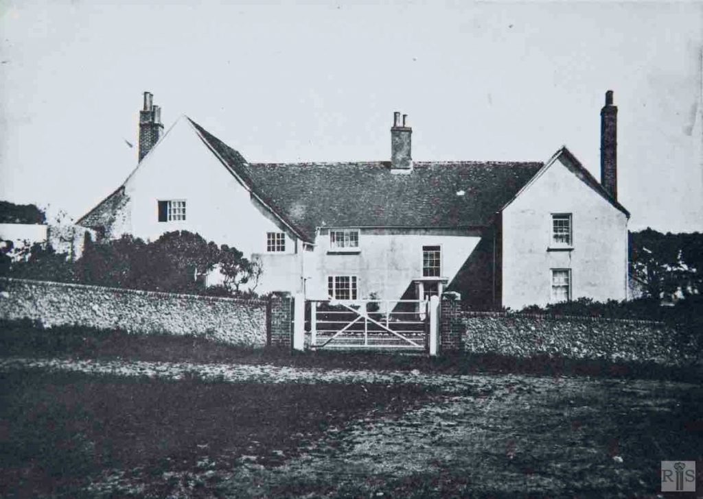
James Gray: Blatchington Court showing the original main entrance which was at the west, almost opposite the Church. When the estate was acquired by Hove Corporation in 1938 Holmes Avenue was extended across the front of the house, and this entrance was bricked up, thus leaving the only entrance the present one in Court Farm Road. jgc_36_038
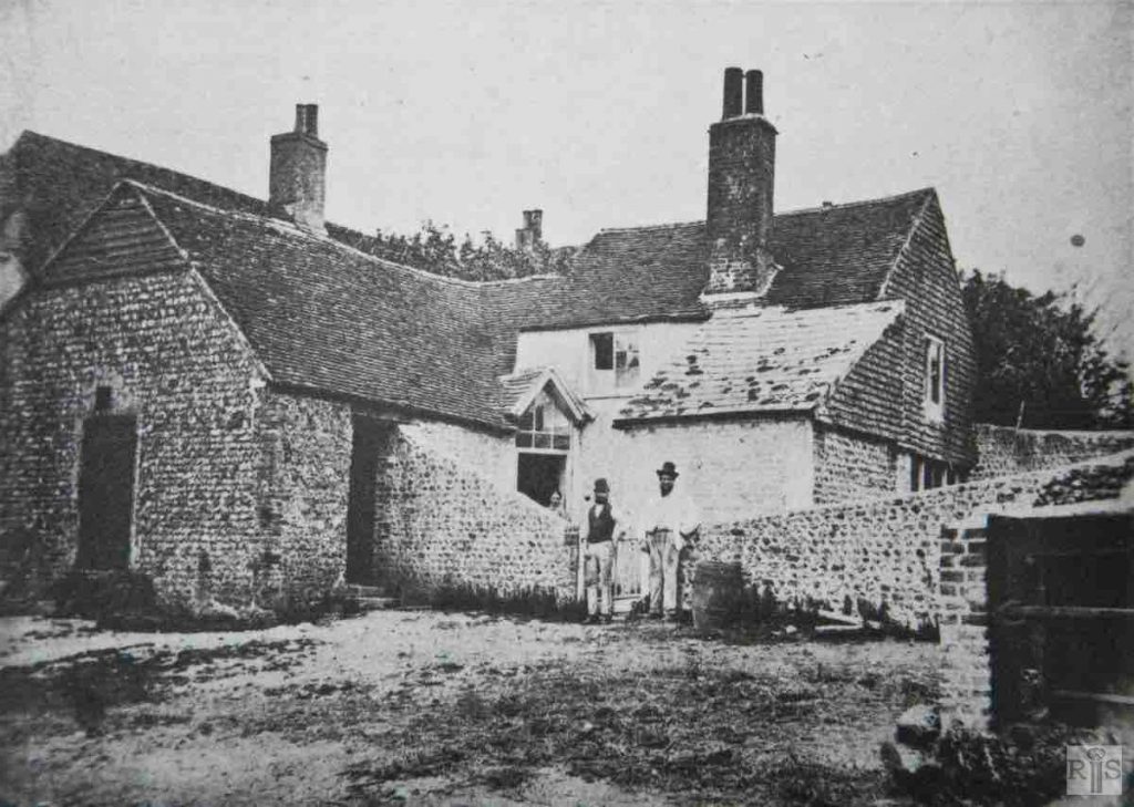
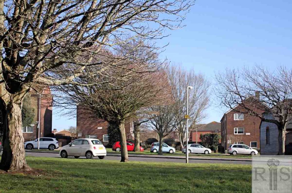
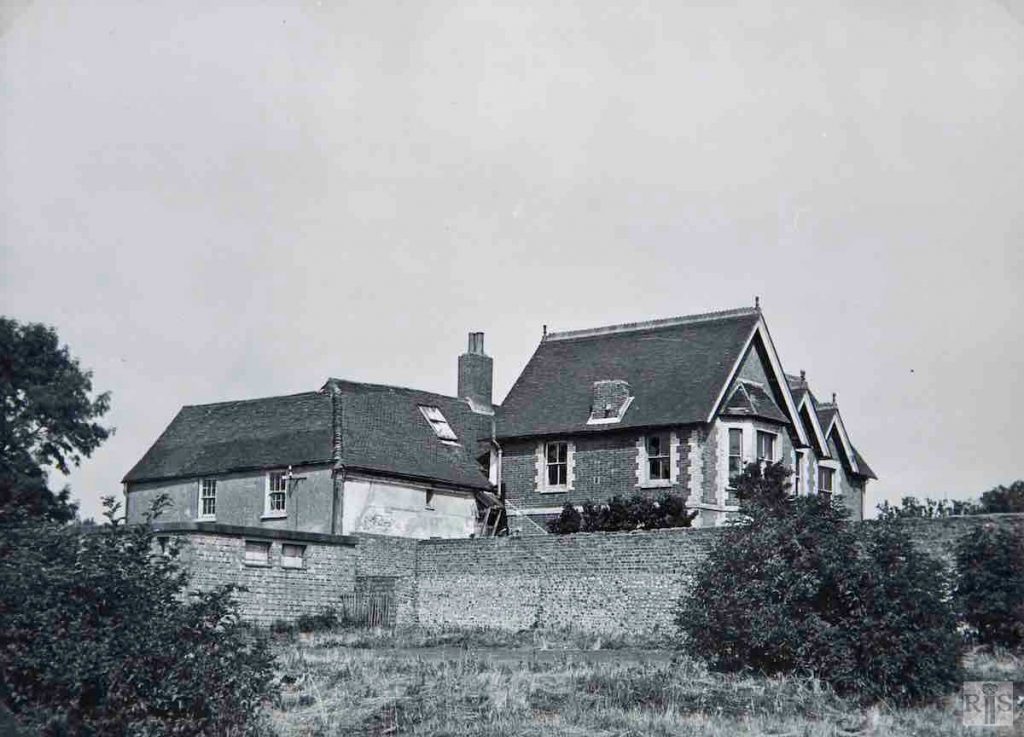
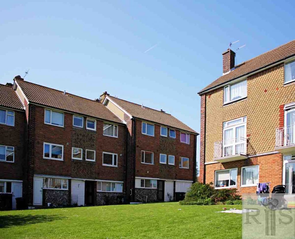
James Gray: The rear of Blatchington Court showing the kitchen and domestic quarters. A path from the north entrance led to the gate shown on the right of the photograph. jgc_36_039
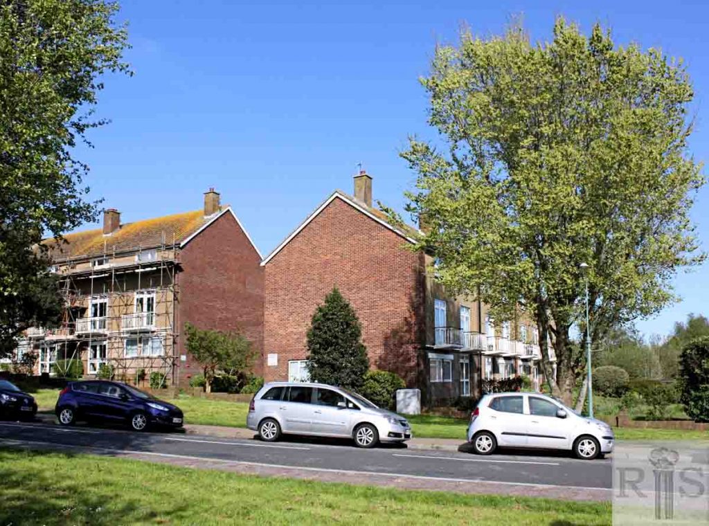
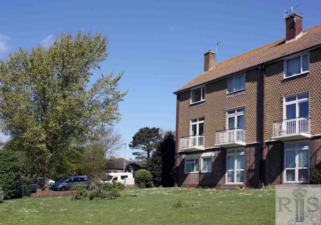
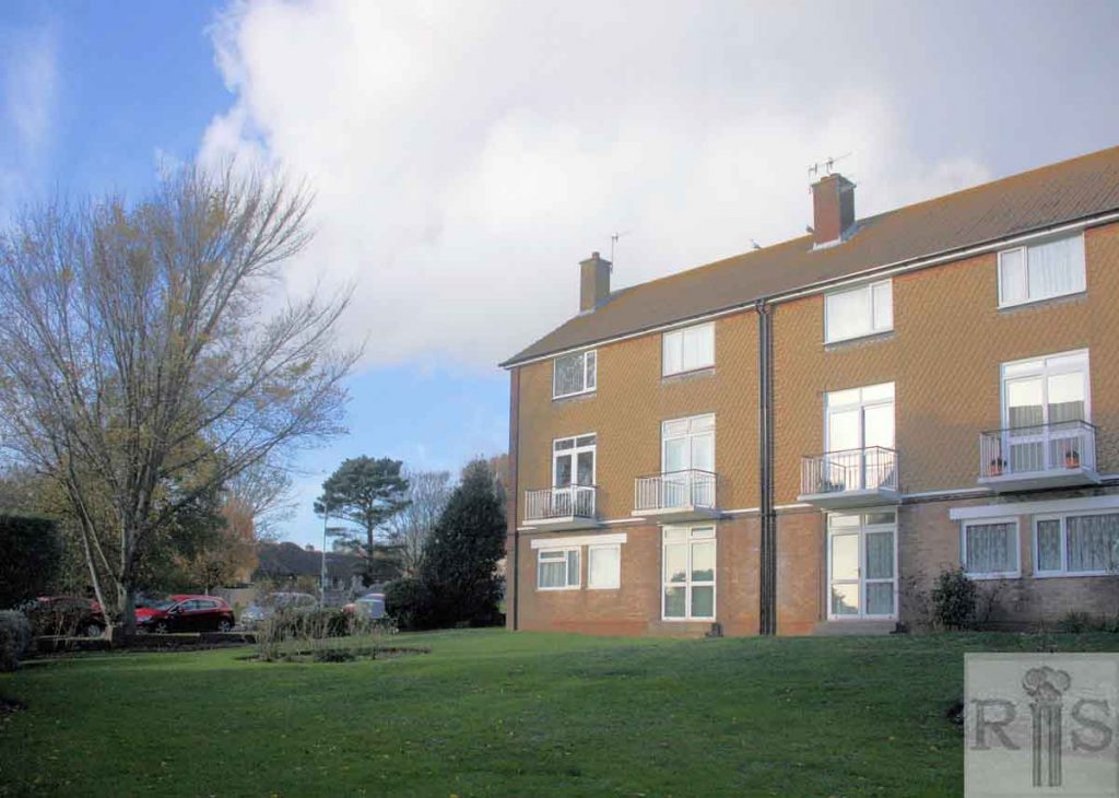
2018: This grassed area, between two blocks of flats comprising part of The Mount in Holmes Avenue, was the site of the back of Blatchington Court and its yard. The view is north-west, towards St Peter’s Church.
James Gray: Three views [jgc_36_047, 048 and 049] of West Blatchington farm, dating from about 1912. They are copies of originals in the possession of Mr A Whittington who is the man seen at the top of the sweep, and who, in 1954, was living at 194 Ellen Street, Hove. For many years he lived in Meadow Cottages which can be seen in the photograph on the left. jgc_36_048
James Gray: The building of Holmes Avenue in progress [in 1937]. The field on the left was known for many years as Jackass Field. Beyond this field can be seen Meadow Cottages, three old farm workers cottages, demolished later in the same year. jgc_36_068
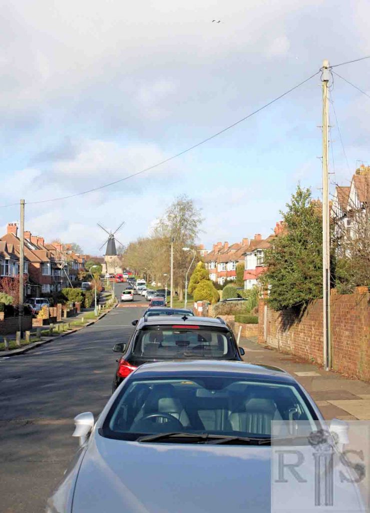
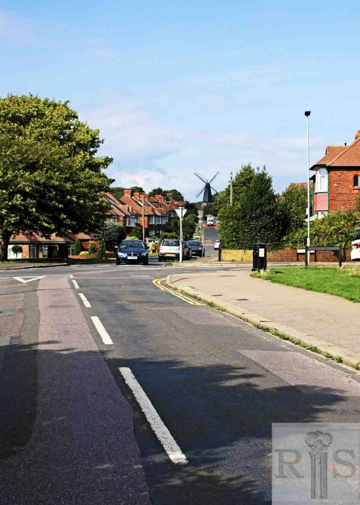
James Gray: Photograph taken in Jackass Field, and looking towards the Windmill, when this was still farmland. This area was filled in with houses in the late 1930s. jgc_36_072
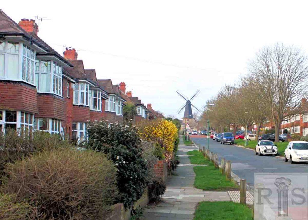
2018: The horse near the people in Gray’s image would now be standing in the middle of Holmes Avenue. This photograph was taken close to the junction with Meadway Crescent, and looks north up the west side of Holmes Avenue towards West Blatchington Windmill. (Photographer: Alan Hobden)
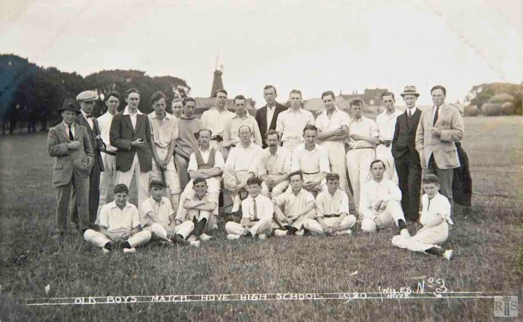
James Gray: Hove High School old Boys Match, photograph taken in Jackass Field. jgc_36_075
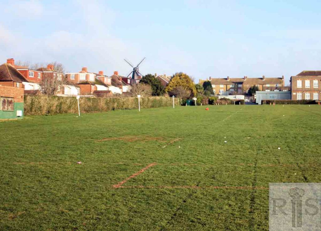
2019: Jackass Field is actually further west, behind the row of trees that now line the east side of Holmes Avenue. This photograph was taken from the playing fields of Blatchington Mill School looking north. The name Hove High School was first used at 49 Clarendon Villas, Hove in 1908. It was formerly known as Gloucester House School. (Photographer: Alan Hobden)
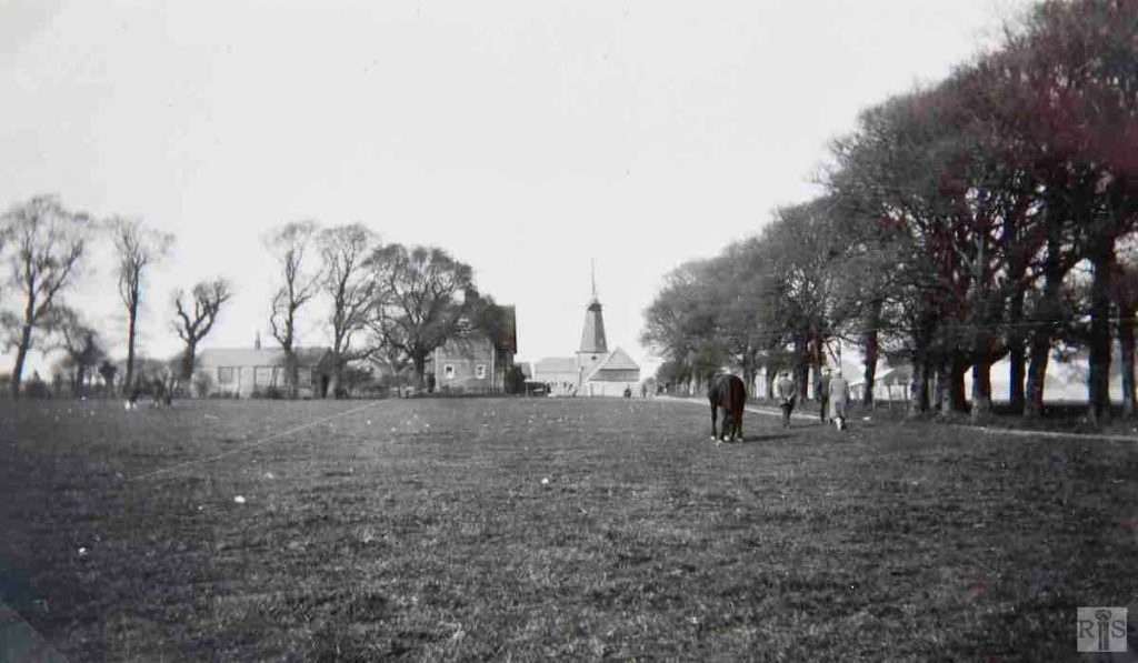
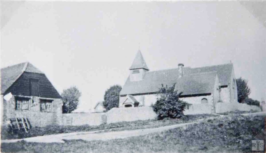
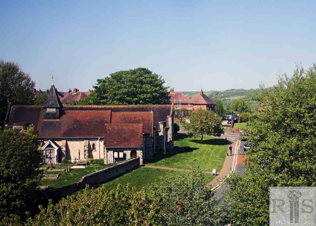
James Gray: The church and barn in 1937. jgc_36_076
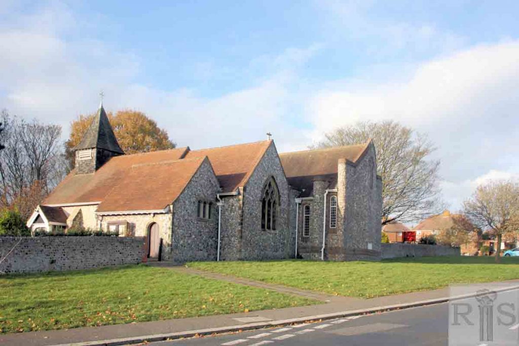
2018: The three cars are parked partly on the pavement in Holmes Avenue, with the windmill behind the photographer. The north extension to St Peter’s Church, completed by 1962, can be seen on the extreme right. On the left, behind the site of the barn pictured in the 1920 photograph, is the church hall. (Photographer: Alan Hobden)
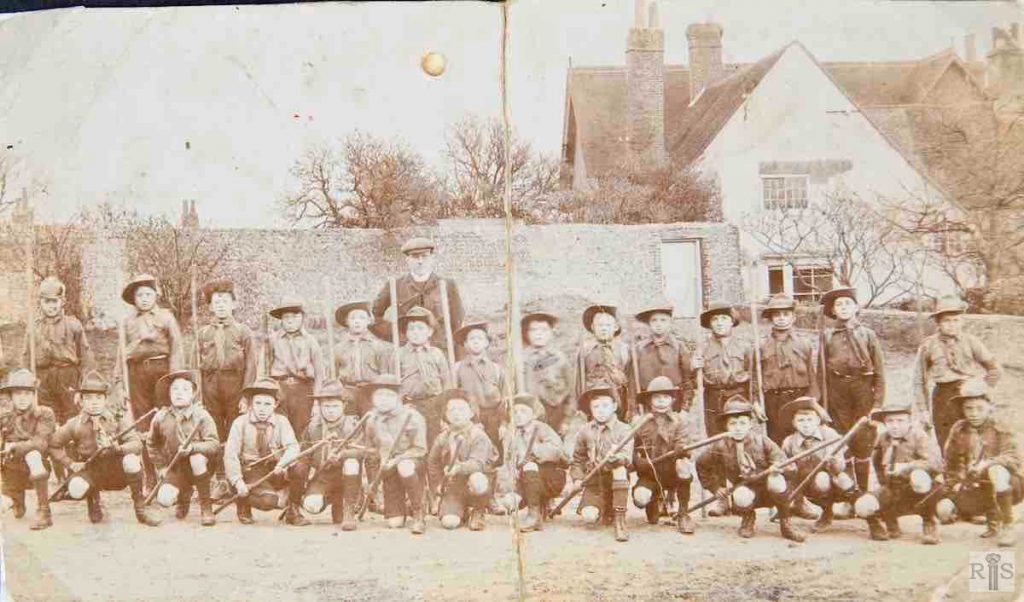
James Gray: Scouts assembled outside Blatchington Court Farmhouse, about 1910. Where they were then standing, would today (1978) be in the centre of Holmes Avenue. jgc_36_082
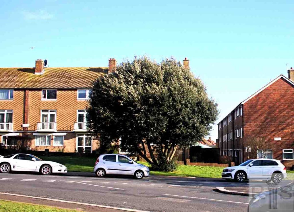
2019: Blatchington Court Farmhouse was demolished in November 1955. Today, the flats of The Mount in Holmes Avenue stand in its place.
James Gray: This distant view is from the spot where Holmes Avenue now crosses Nevill Avenue. There was then a deep pit where the grass bank in front of Tudor Close is now and the slope into this pit can just be seen at the left centre of this photograph. jgc_36_085
2018: This photograph was taken from Holmes Avenue, just below the crossroads with Nevill Avenue, looking north-east towards West Blatchington windmill. The large tree on the left stands on the slope which led into the old pit in 1930. Bishop Hannington Church is just out of shot to the right of the photographer. (Photographer: Alan Hobden)
James Gray: In March 1931, the farm was then in full operation, unthreatened by building development, which by then had not even crossed Old Shoreham Road. The photographs are looking east and in this one is a glimpse of the farmhouse. jgc_36_090
2019: The 1931 scene is unrecognisable today. Holmes Avenue now crosses the photograph, with the flats of The Mount on the left.
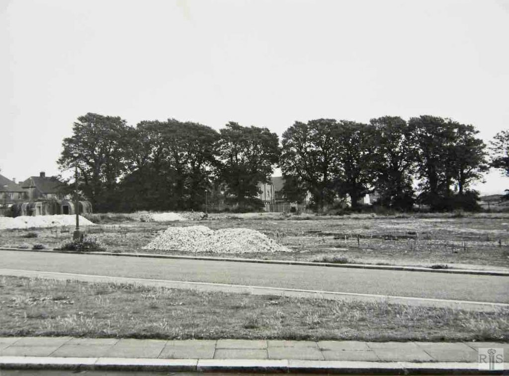
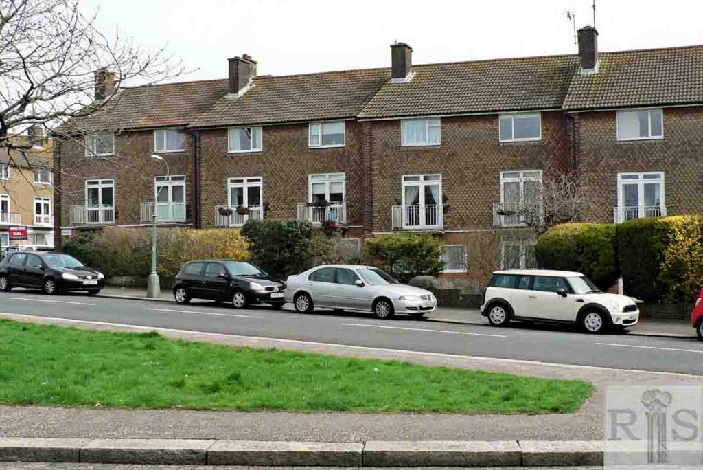
James Gray: Holmes Avenue just south of the windmill, June 1957. The ground is being laid out for the flats known as The Mount and for St Peter’s Close. For the benefit of future generations that may see this photograph, the cluster of objects on the left were Anderson air-raid shelters, relicts of the 1939/45 War. jgc_36_099
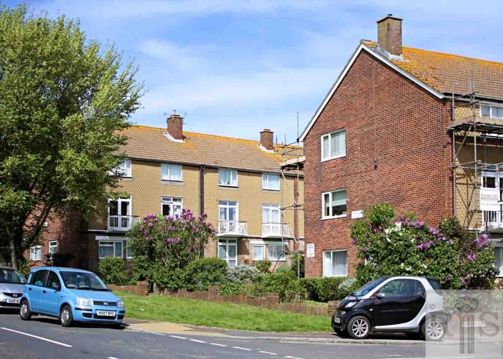
2018: The lamp post remains and behind it are the flats known as The Mount, Nos 151-173 Holmes Avenue.
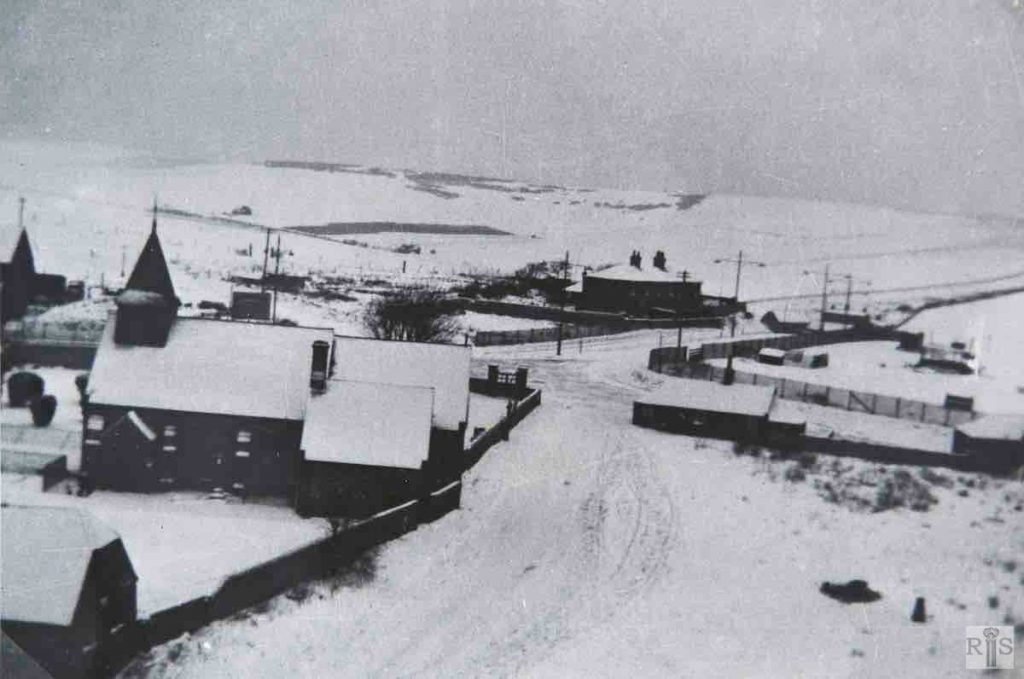
James Gray: View north from the windmill, showing left – New Cottages, centre – Hillside Cottages and in the valley, Toads Hole Cottages. jgc_36_101
2018: In the snowy 1938 view, Court Farm Road can be seen running from the gates at the church entrance to the lower right of the photograph.
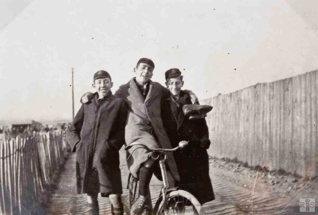
James Gray: The access lane from Old Shoreham Road. This led first through extensive allotments below the present Nevill Avenue, and then into the fields. This access lane is that part of the present Holmes Avenue which lies above Elm Drive and Cranmer Avenue. Beyond the picket fence at the left was Gibbets Farm, and the larger fence at the right can be clearly seen in the large photograph overleaf (jgc_37_106). The school was housed at 49 Clarendon Villas, Hove. jgc_37_105 and jgc_37_106
2019: James Gray’s caption refers to the playing fields of Hove High School. Images of the playing fields (jgc_102 and 103) can be found on the Nevill Avenue page. Holmes Avenue is now a residential road. Bishop Hannington Church’s Youth and Community Centre is located on the immediate left of the photo. (Photographer: Mark Stephenson)
James Gray: View from the south-west showing part of the north wing, the oldest part of the building. jgc_36_108
2018: The blocks of flats comprising The Mount development now cover the site of Blatchington Court. It extends from Court Farm Road at the north down to the south side of St Peter’s Close, seen on the right. (Photographer: Alan Hobden)
James Gray: From the south-east. It can be seen how the last extension was built on to the earlier building. Part of the outside wall can be seen on the earlier photograph showing the kitchen and domestic quarters. In recent times the house had been occupied by tenant farmers, who farmed the neighbouring Court Farm. This was broken up for building in the late 1930s.
James Gray: Demolition of the long barn in progress and some of the massive oak beams – 19 April 1939. By now ownership of the windmill and associated buildings had passed to Hove Corporation. jgc_36_110
2019: View taken from the north-east. The houses in Holmes Avenue can still be seen on the left.
James Gray: Demolition of the long barn in progress and some of the massive oak beams – 19 April 1939. By now ownership of the windmill and associated buildings had passed to Hove Corporation. jgc_36_111
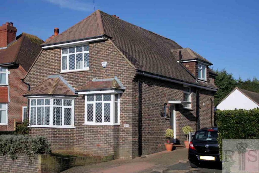
2019: In 1939 the houses in Hangleton Road had yet to extend this far east. The brick-built detached house shown here (No 20 Windmill Close) can also be seen in the background of Gray’s image. (Photographer: Alan Hobden)
James Gray: The Farmhouse, Blatchington Court, remained for many years after the farm was given up (see photograph on other pages). This view shows the scene at its demolition in November 1955. jgc_36_112
2018: This photograph was taken from the central green area between two blocks of flats called The Mount in Holmes Avenue, built on the site of Blatchington Court Farmhouse. (Photographer: Alan Hobden)
