Historic and Contemporary Images of Brighton and Hove
Based on the Regency Society James Gray Collection
  • Home page
    • James Gray
    • Project volunteers
    • Acknowledgements and copyright
    • Contact us
  • Master map
  • Street Index
  • Find a place
    • Neighbourhoods
    • Images of the seafront
    • Parks and Open Spaces
    • Redeveloped areas
    • Royal Pavilion Estate
    • Brighton Station
    • Street Index
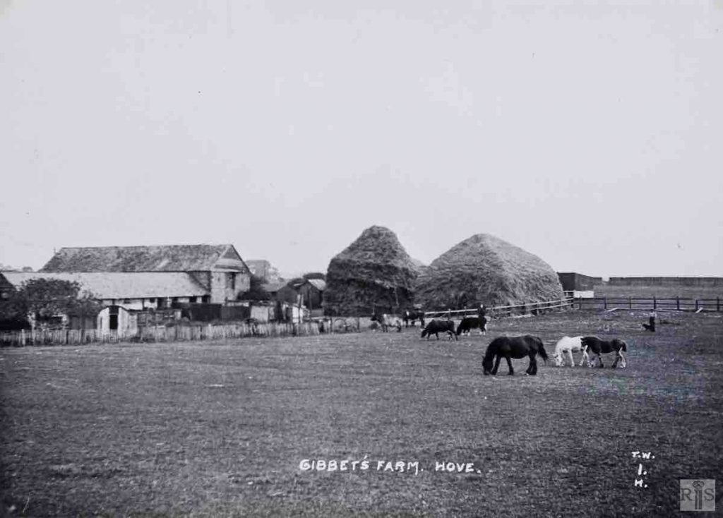
GIBBETT’S FARM

Elm Drive

Neighbourhood:
West Blatchington
1912
Unknown
Unknown
1910
1912
2019

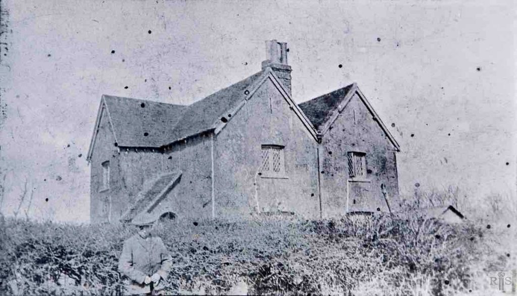
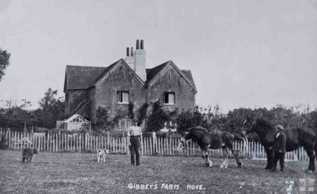
James Gray: The farmhouse [Gibbet’s Farm] in 1912. Originally two cottages occupied by workers on Hangleton Farm, Mr S Holmes, the last tenant of Gibbet’s Farm, converted it to a farmhouse. jgc_37_109

James Gray: The farm and buildings, here shown, stood on the site of Elm Drive, Hove, and derived its name from the gibbet which existed in the 18th century just north of the Old Shoreham Road approximately where the footpath goes through to Maple Gardens. The farm was established about the middle of the last century on land rented from the Sackville family.

It extended from just opposite St Josephs Home along Old Shoreham Road and thence north of the Dyke Railway line to where this crossed the narrow Hangleton Road. It was approached by the path running along the fence in the background, which also led across a stile, through allotments to Jackass Field and West Blatchington. In 1930 the land was sold by the Sackville Estate to Braybons Ltd., who laid out the whole area for building. Holmes Avenue which covers the site of the old footpath was named after the last farmer, Mr Holmes who had the farm from 1902 until 1930. The meadow was used as a football pitch in the winter and I played here many times for Hove Belmont F.C. in the season 1923 – 1924. jgc_37_107

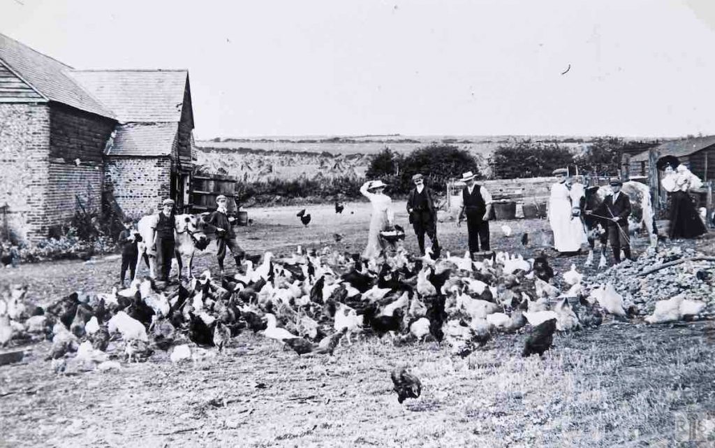
James Gray: Looking north to the farm buildings in 1912. The nearest hedge can be seen to this day at the back of the houses on the north-east side of Elm Drive. The long hedge in the distance marks the line of the present Nevill Avenue. jgc_37_108

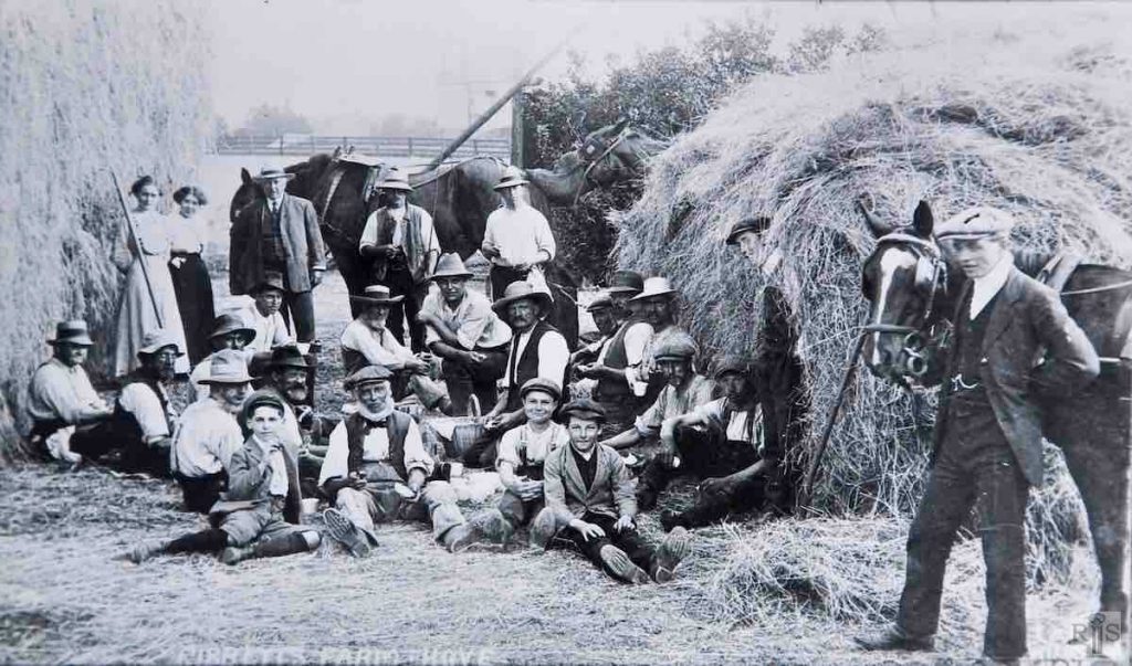
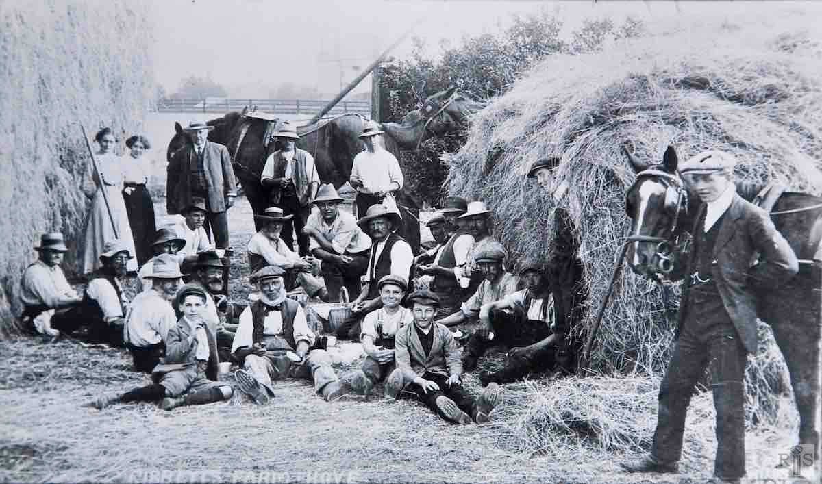
James Gray: Haymaking north of the meadow in 1910. In the distance the wooden railings on either side of the Dyke Railway line. Beyond the high building was Rookes in Old Shoreham Road. This was the stonemason’s office with living accommodation above, called the Eyrie. jgc_37_111

James Gray: The farmhouse, converted from two farm workers cottages, from the high hedge which screened it from the meadow and railway line. Period not known. jgc_37_112

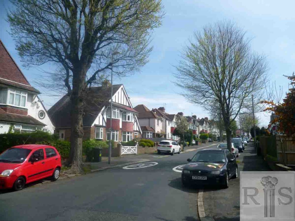
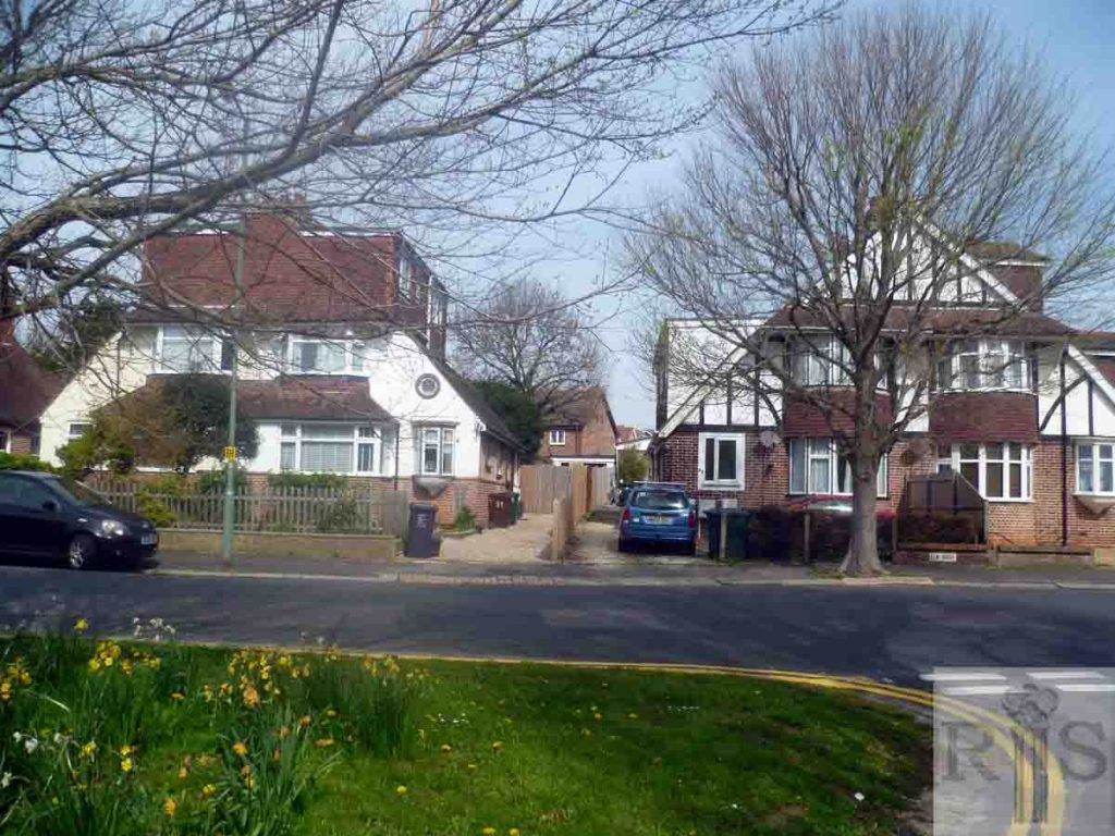
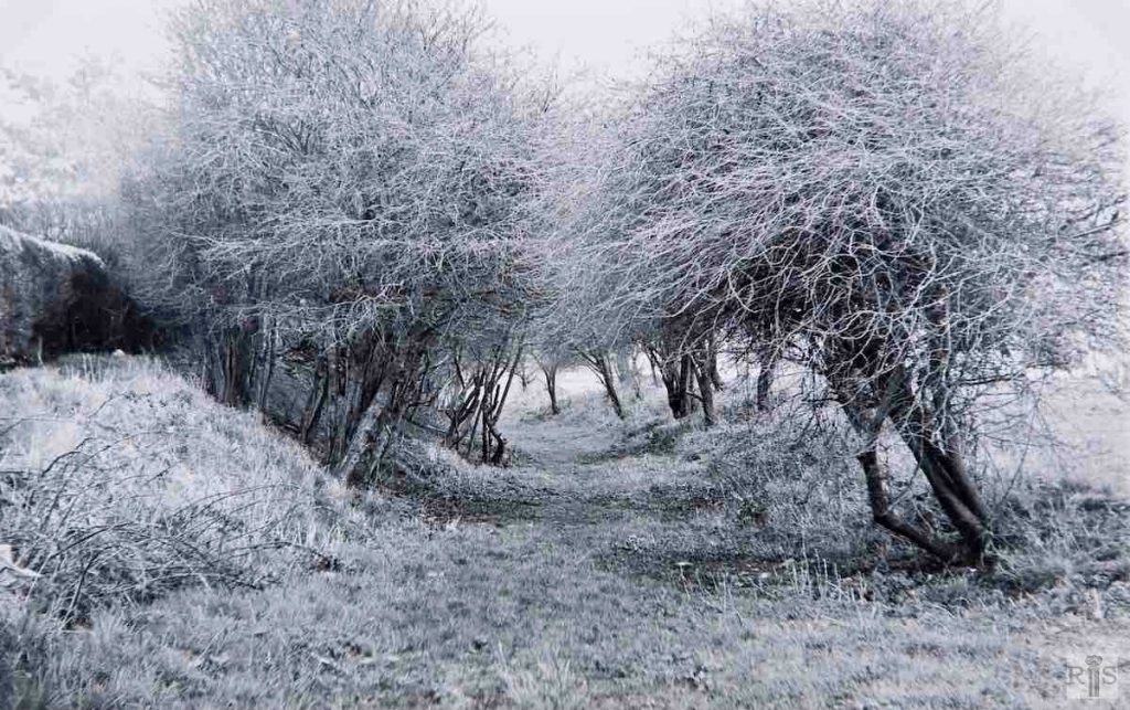
2019: The houses in Elm Drive were built in the 1930s. The land between Elm Drive and Nevill Avenue up to the 1970s was used as allotments and had small fields growing cereals. The whole area is now filled in with houses, Goldstone Primary School, Martlets Hospice and the vast Hove Polyclinic. (Photographer: Mark Stephenson)

More
1954
2019

James Gray: The site of the old farmhouse. The land was sold for building in 1930 and in the following year the building of Elm Drive commenced. The houses shown here are numbers 47 to 53 Elm Drive. jgc_37_110

2019: The land behind the houses has been built over. (Photographer: Mark Stephenson)

1938
2019

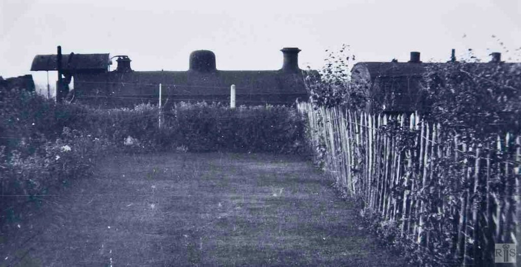
James Gray: An amateur’s photograph of the engine and train at rest, halted by signals, and seen from the garden of 59 Elm Drive, Hove. It is said that the photograph was taken on the final day of the railway and if this were so, it would be on 31 December 1938. jgc_37_137

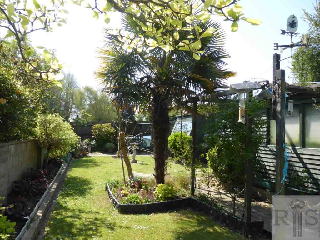
2019: James Gray was incorrect in stating the photo was taken from the garden of 59 Elm Drive (since No 59 faces east). The photo was taken from the garden of 28 Elm Drive (opposite No 59). The railway no longer runs along the bottom of the garden (outside the house boundary), though the current house owner, who has lived there many years, recalls an embankment of chalk which was removed while she and her husband were away for a few days. The garden is now a pleasant, well-maintained mature suburban garden. (Photographer: Alison Minns)

1973
2019

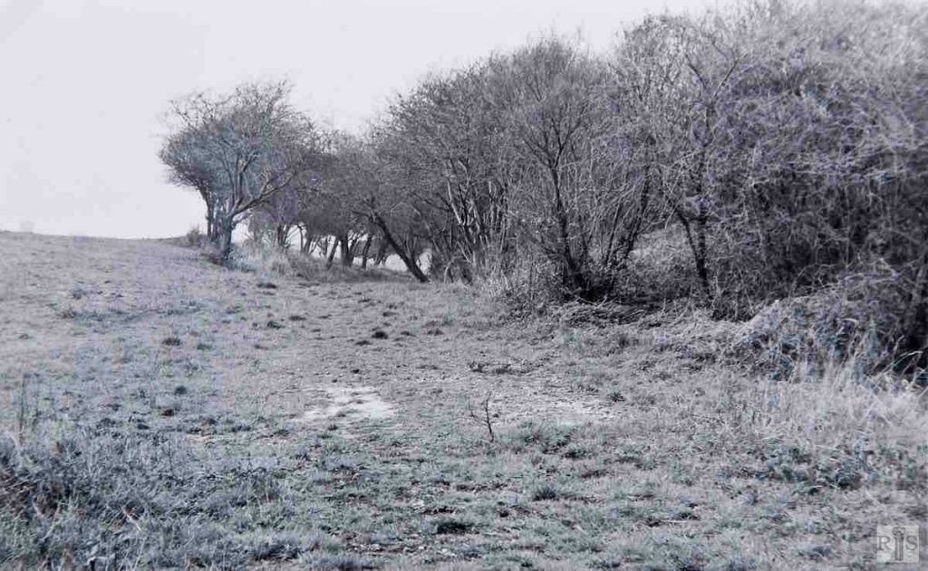
James Gray: Here are two photographs of the line of the old railway track, this one looking north-west and the next one [jgc_37_146] south-east. The scene is about 200 yards north of the Old Shoreham Road, adjoining part of Hove Cemetery, and the date of the photographs is 11 February 1973. At this point the track was on a steep gradient which had climbed up from the main Hove-Portslade line, after first passing under Old Shoreham Road in a cutting near where Harringtons Motor Works are today. During the 34 years since the line was closed in 1938 the once trim track has reverted to nature. jgc_37_145
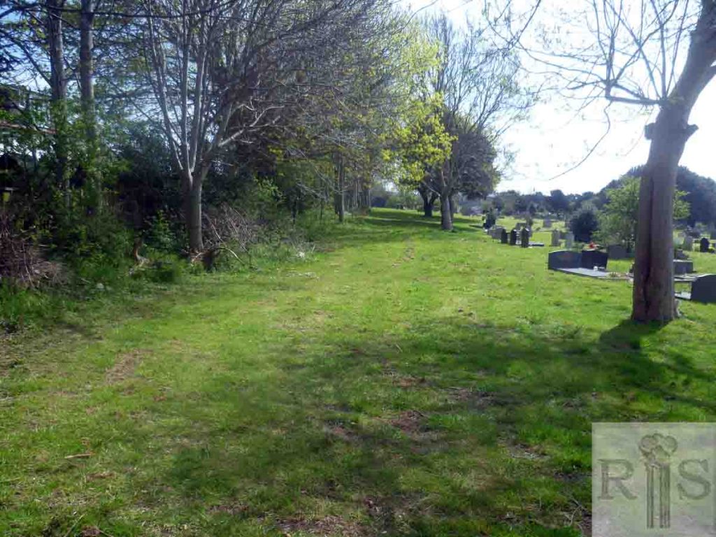
2019: The railway cutting ran from the embankment where Hove Community Fire Station is built to just before the entrance to Knoll Park – the site of the former Rowan Halt. Hove Council filled the cutting in with waste in the 1980s. Behind the photographer stands the fire station. I spent my summer school holidays picking blackberries on the embankment that stood there. (Photographer: Mark Stephenson)

More
1973
2019

James Gray: See jgc_37_145 for caption. jgc_37_146

2019: Behind the photographer is the site of the former Rowan Halt.  (Photographer: Mark Stephenson)

Historic and Contemporary Images of Brighton and Hove
This website has been prepared by the Regency Society of Brighton and Hove. All historic maps are provided with kind permission of the National Library of Scotland (https://www.nls.uk/) regencysociety.org

Search