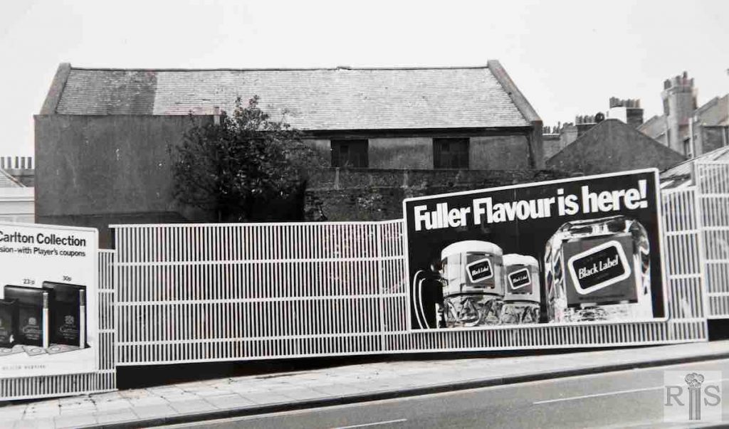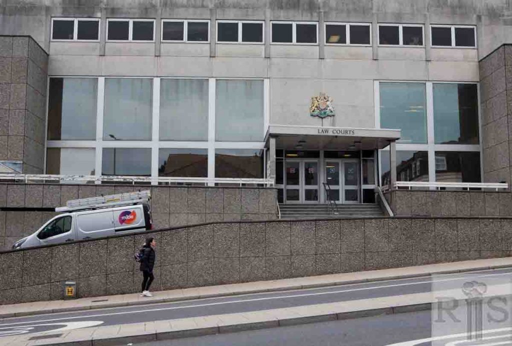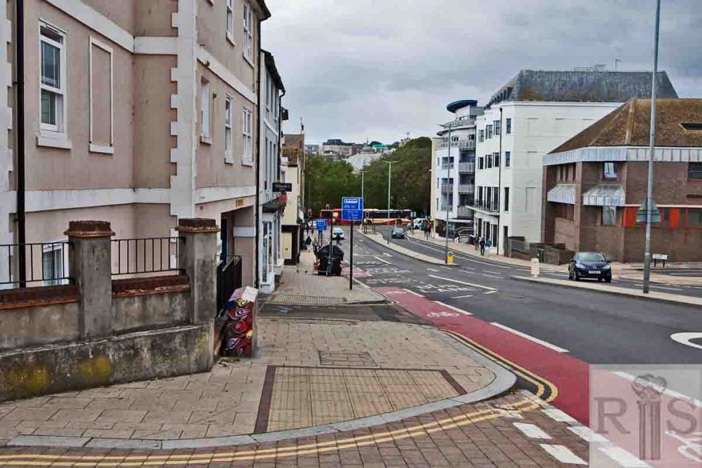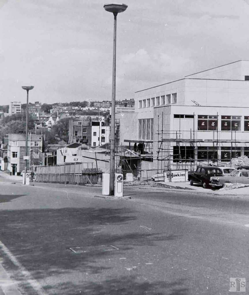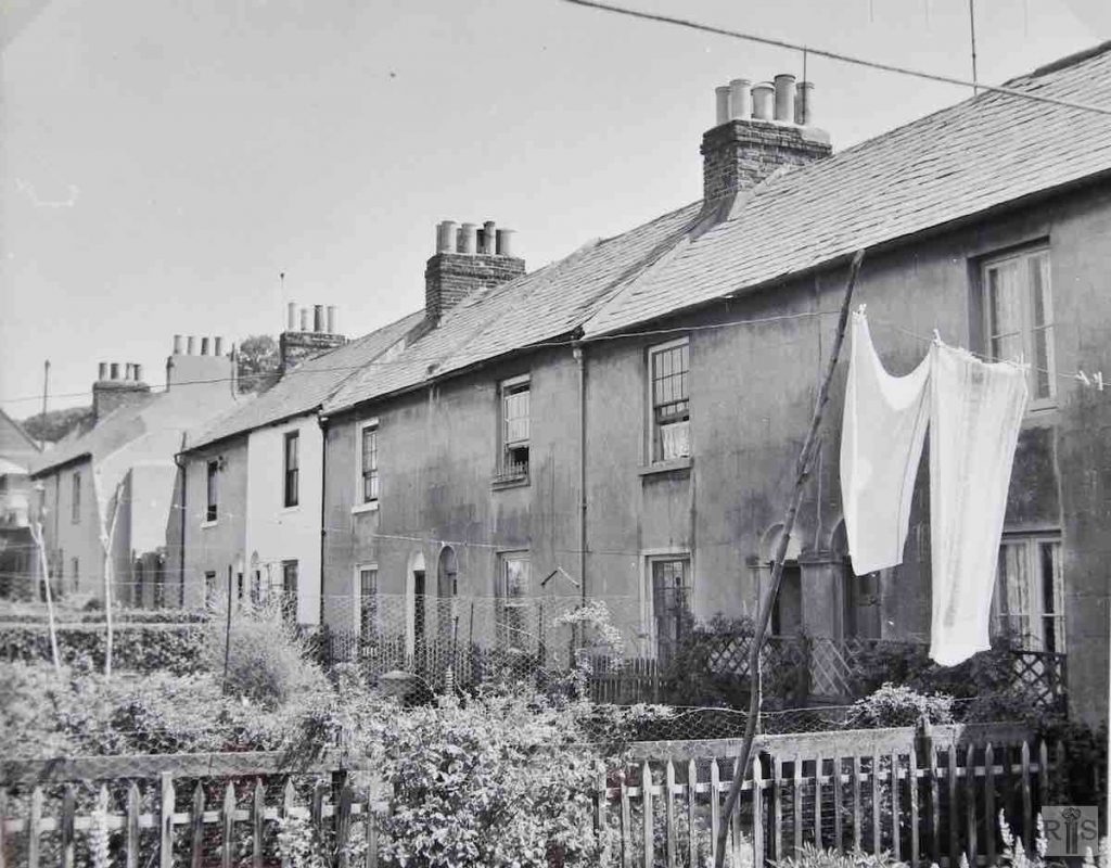
James Gray: The cleared site of old buildings in Edward Street, removed for road widening, 22 October 1972. In the rear, the side wall of the Spiritualist church, (Mighell Street Hall), since demolished and replaced by the present church. jgc_22_046
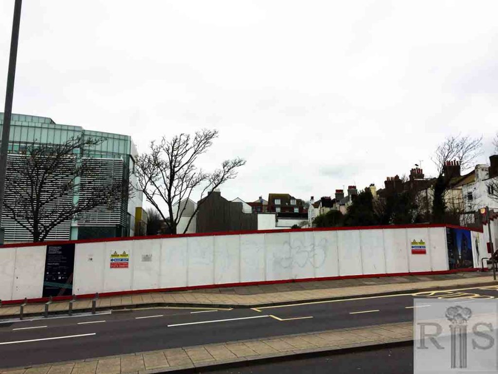
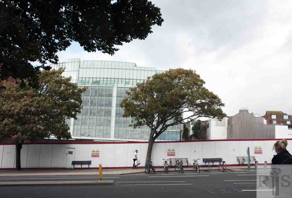
2018: Much has changed since the original image was taken – yet again the view is of hoardings. Amex House [popularly known as the ‘Wedding Cake’] was completed in 1977.
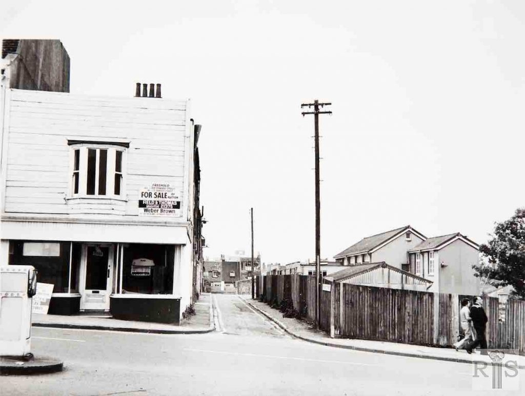
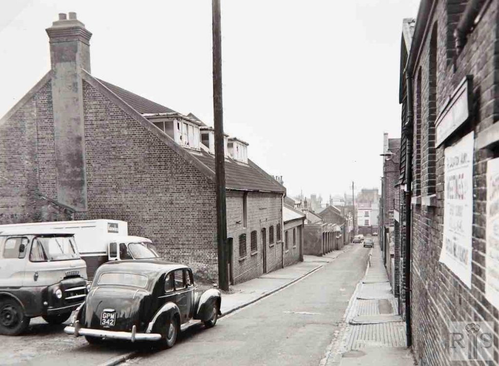
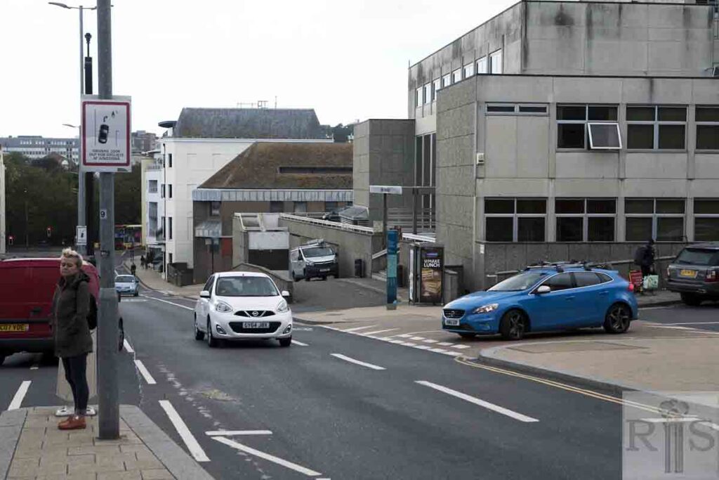
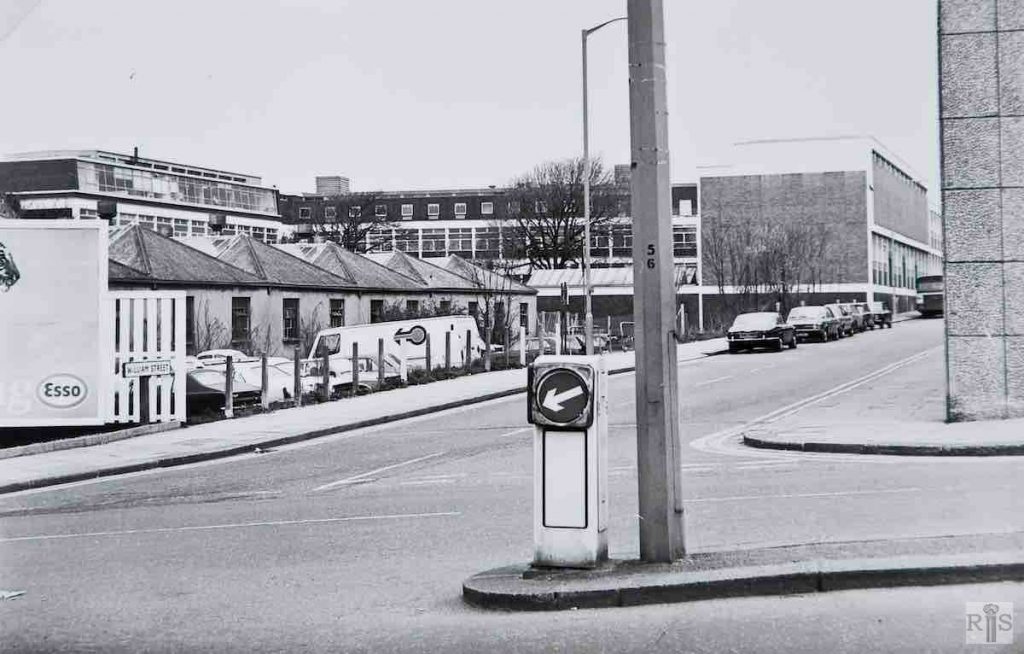
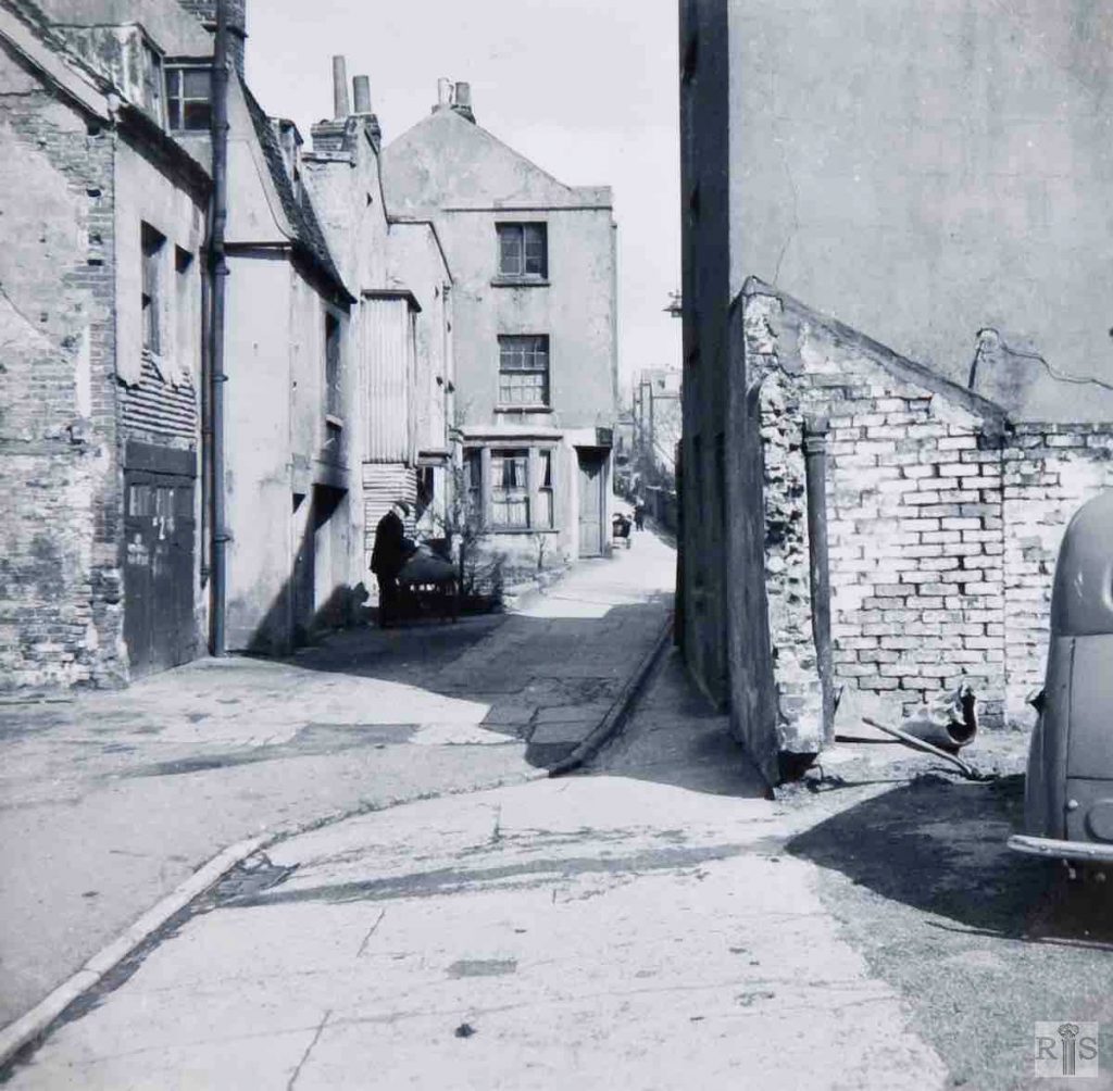
James Gray: At the time of these photographs – 10 June 1979 – little remained of the original street [Dorset Street], and what there was, was under threat of early demolition. This was a very old street, dating from the early years of last century, about 1810. As late as the 1920s about ten houses were in occupation, but these were condemned as unfit for human living during the 1930s, and taken over for business use. All now demolished. This is the view from Edward Street looking south. jgc_22_055
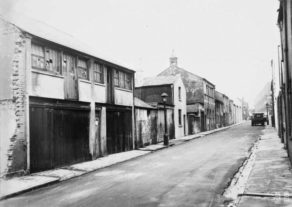
James Gray: Looking south down Mount Street, towards St James’s Street, on 19 March 1967. Later this street was stopped up and has now disappeared, swallowed up in the large mass of new houses and flats, which have been built in this area. jgc_22_200
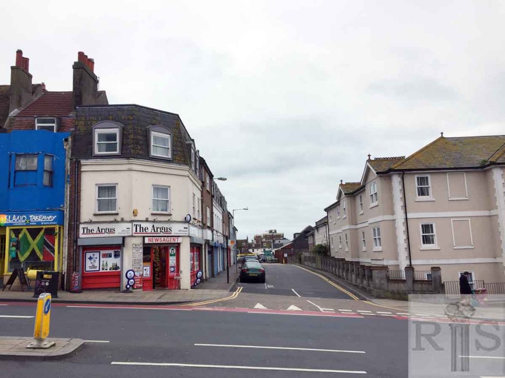
2019: General view looking south from Edward Street, just west of Lavender Street.
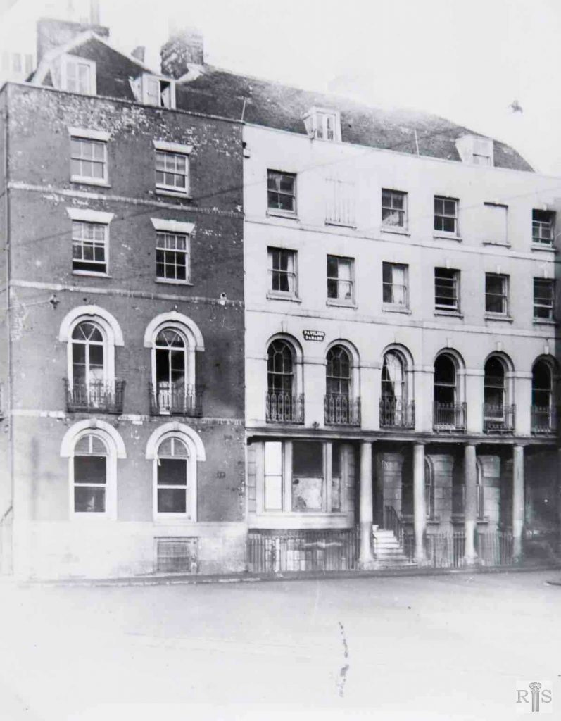
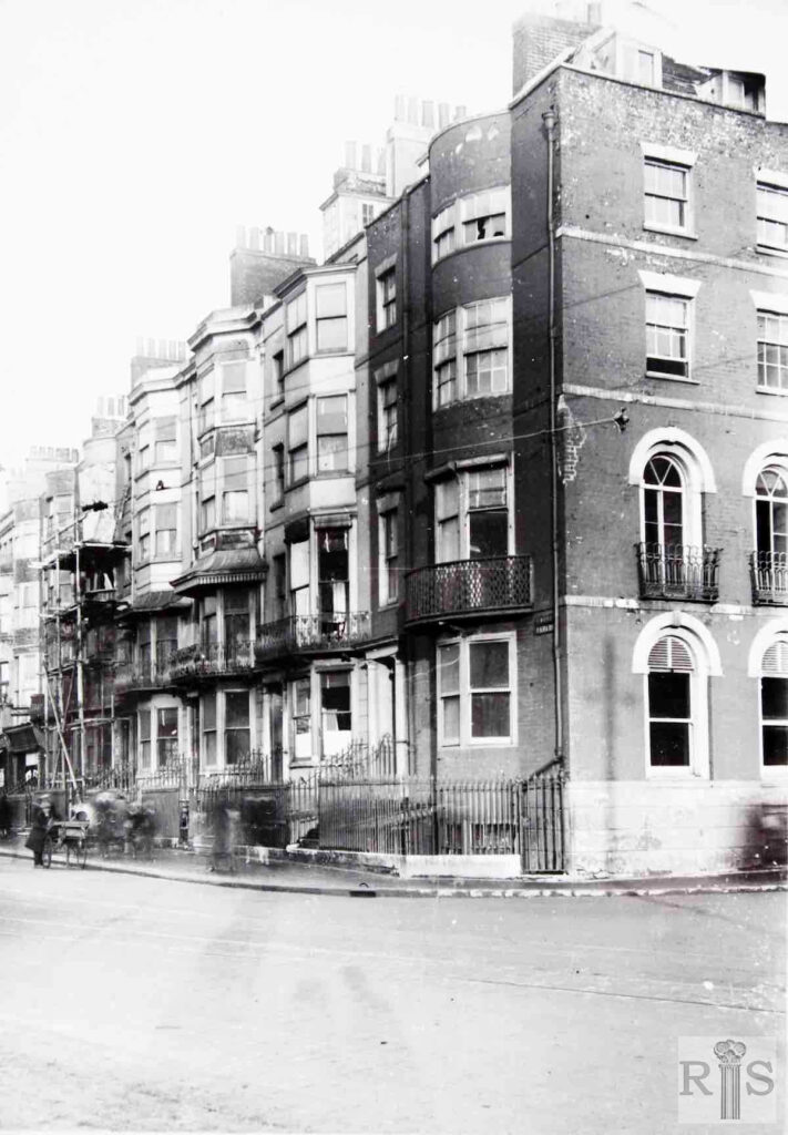
James Gray: 1 and 2 Pavilion Parade, in 1927, during which year they were demolished as the first stage towards widening Edward Street, and rounding off the corner. The building to the left is the side wall of 83 Grand Parade. jgc_24_001
James Gray: October 1963, showing cars parked in the derelict land between Edward Street and Grand Parade, the gardens of which extended to the old wall seen at the right. In the last century this land was occupied by extensive livery stables which were given up in the 1880s. jgc_ 24_013
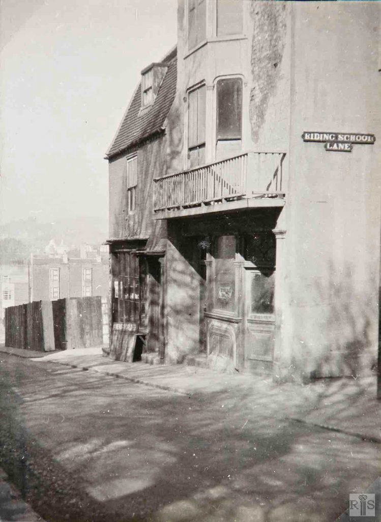
James Gray: 28 and 29 Edward Street at the corner of Riding School Lane. The corner house was for many years a public house known as the Painters Arms. Riding School Lane was best known for its slaughter houses to which droves of sheep and cattle were driven up Edward Street in the olden days. Photographed in 1942 and demolished January, 1946. jgc_24_082
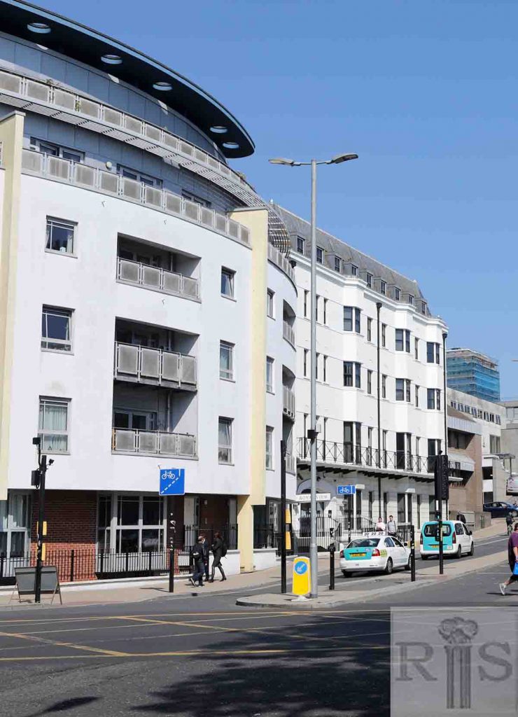
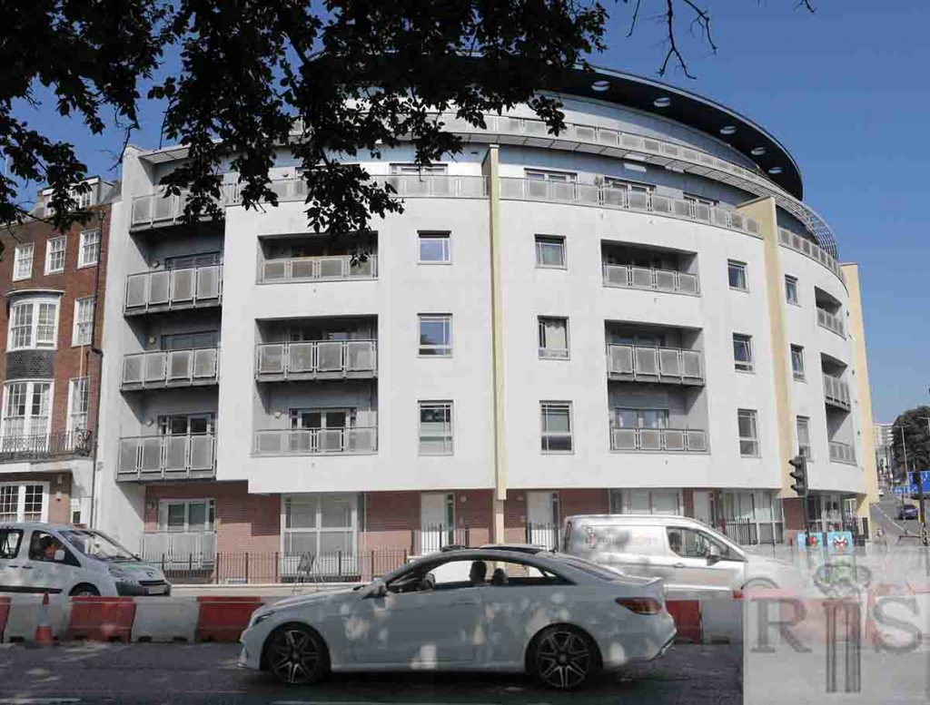
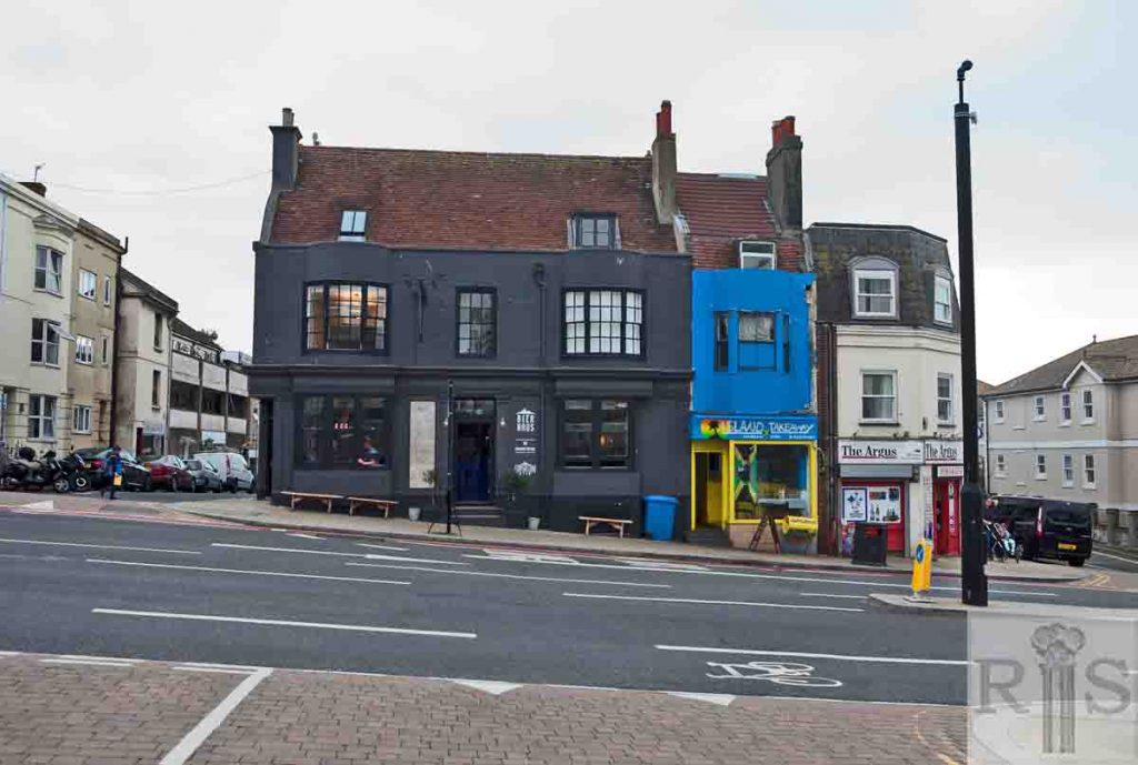
2019: Edward Street has been widened. Nos 1 and 2 Pavilion Parade faced south and their façades would have been approximately in line with the pedestrian refuge in the middle of the street. All the original buildings were removed to make way for the rounded corner on the left-hand side of Edward Street. Royal View flats on the left of the image are numbered 80 Grand Parade and curve into Edward Street. (Photographer: Ruthie Martin)
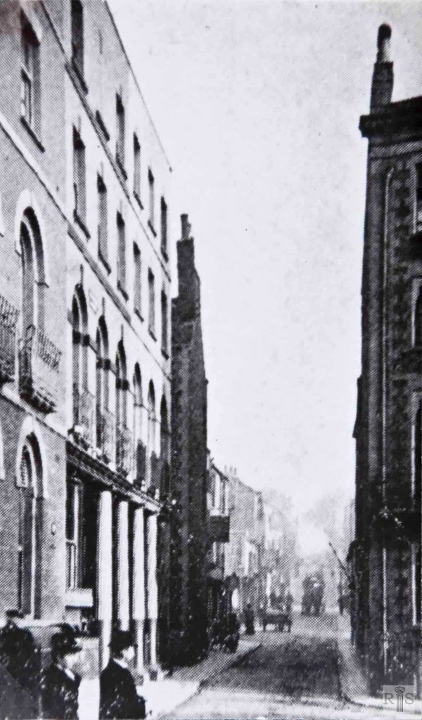
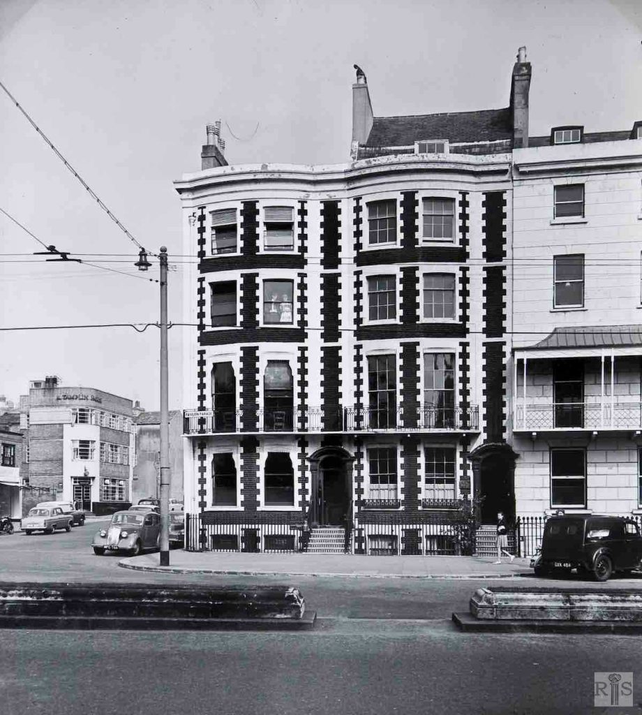
James Gray: Pavilion Parade and the bottom of Edward Street, in 1907. The photograph gives a good view of the very narrow Edward Street of this period. jgc_24_002
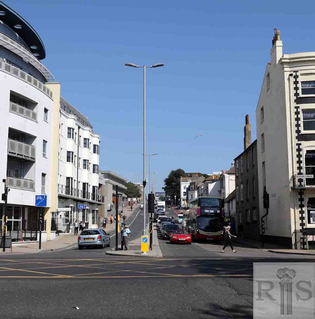
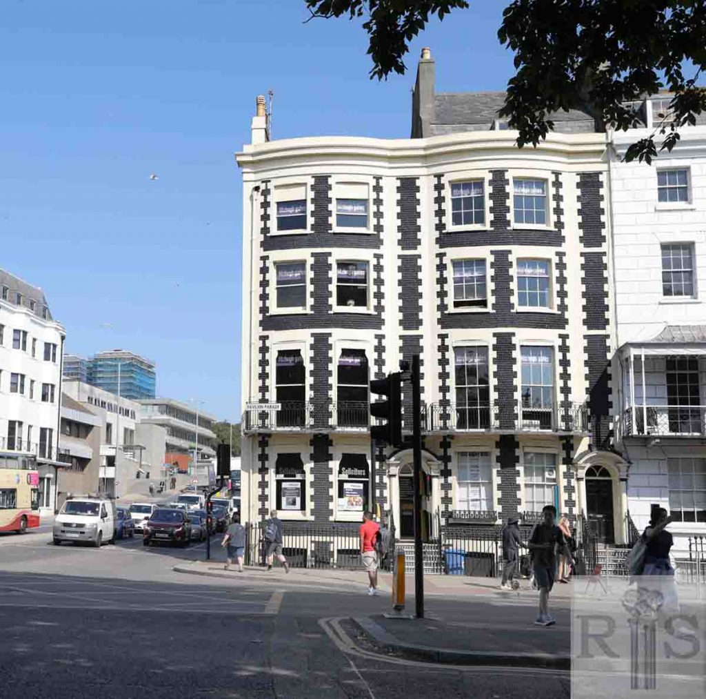
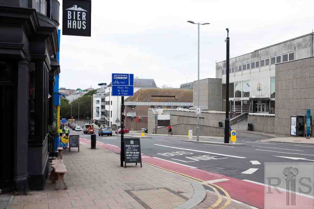
2019: Edward Street has been widened and there is now a busy pedestrian crossing just before traffic coming down the street turns out into Pavilion Parade. Old buildings including 1 and 2 Pavilion Parade were demolished to make way for the increased width of the road on the left-hand side, while those on the right [3 and 4 Pavilion Parade] remain intact. (Photographer: Ruthie Martin)
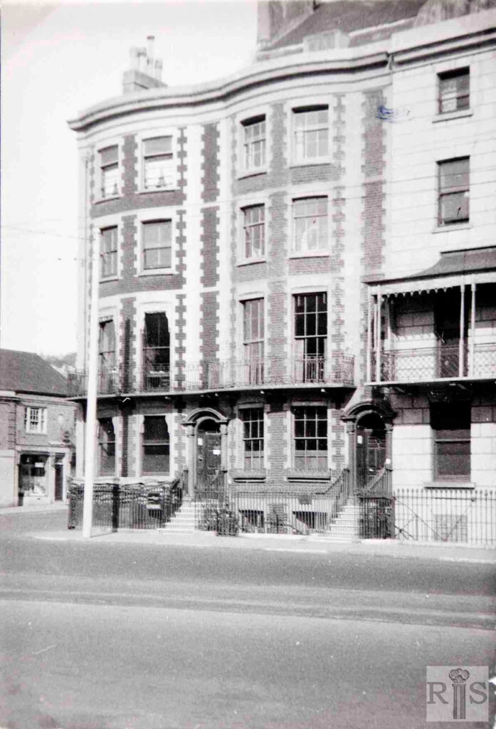
James Gray: The exact dates of this photograph is not known. The Trolley-bus wires can be seen in the one above and the trolleys last ran on June 30, 1961, so this may date from the late 1950s. jgc_24_005
James Gray: 3, 4 and 5 Pavilion Parade, photographed in 1942. Note the sandbagged basement used as an air-raid shelter. These buildings are little changed today. jgc_30_158
2019: Nos 3 and 4 Pavilion Parade remain intact and as striking as ever. Looking into the north side of Edward Street, all the buildings are new. There’s a lot more traffic, and uncluttered skies above as the trolley bus wires are no longer to be seen, the cream and red painted Brighton & Hove bus service being the contemporary equivalent of the trolley buses. (Photographer: Ruthie Martin)
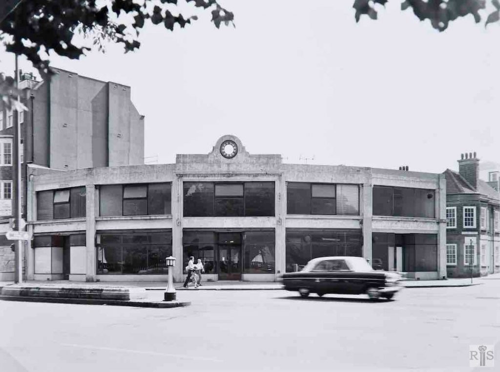
James Gray: Following the 1927/8 demolitions of houses in Grand Parade and Pavilion Parade this rather ugly rounded building was erected in 1930/1. It was put to a variety of uses, offices, furniture store etc but never looked to be of a permanent nature. Photographed on July 2, 1967, when almost empty and likely to be demolished, it is still here as I write in 1991, even more derelict. Sometime surely this prime site will be redeveloped! Additional Information: Redeveloped in 2005 as flats. jgc_24_006
2019: Contemporary apartment block Royal View at 80 Grand Parade is so named because most of the flats have views over Pavilion Gardens. It has replaced the dilapidated building seen in the original photograph. (Photographer: Ruthie Martin)
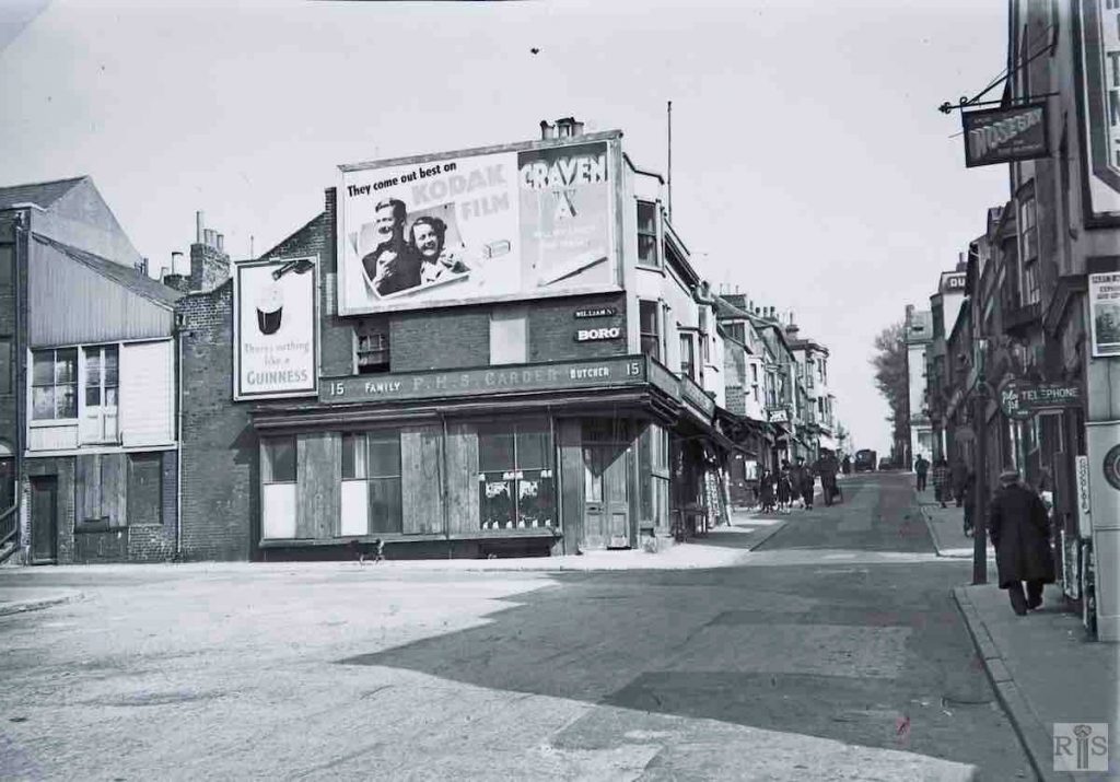
James Gray: Looking west in this narrow, though busy street, about 1939. By then widening was under way at the western end up to William Street while shop premises abutting on Henry Street and John Street await demolition. jgc_24_008
2018: This photograph was taken from the corner of George Street, looking west down Edward Street.
James Gray: Looking east in this narrow, though busy street, about 1939. By then widening was under way at the western end up to William Street while shop premises abutting on Henry Street and John Street await demolition. jgc_24_009
2018: The widening of Edward Street long since complete and with it, sadly, a loss of warmth and soul.
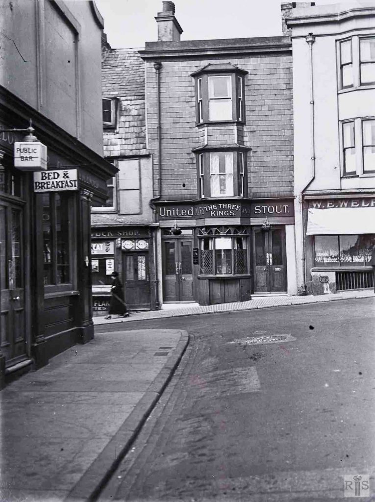
James Gray: Looking from George Street across to the north side of this street, in 1939. The Thurlow Arms Inn is at the left, while directly opposite was the Three Kings Public House. This was a relic of the days when almost one in every three premises in Edward Street was an Inn or Beerhouse. jgc_24_010
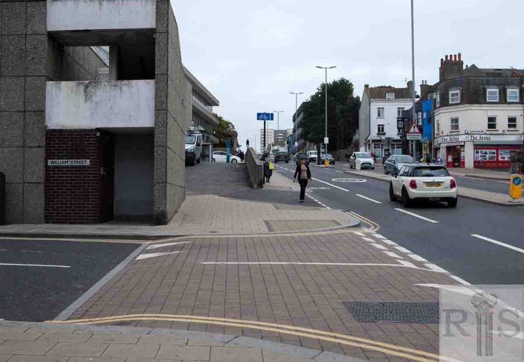
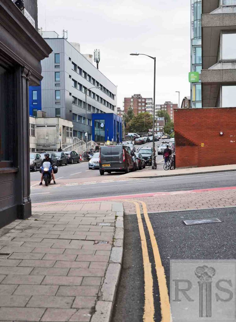
2018: This view from George Street across to the north side of Edward Street has completely changed, with the Three Kings Pub opposite and surrounding small shops long since demolished as part of the widening of Edward Street. This has enabled a clearer view into William Street and the newly refurbished entrance (2018) to the police station behind the Family and Youth Court. Directly opposite George Street is the corner of Brighton Job Centre Plus. (Photographer: Ruthie Martin)
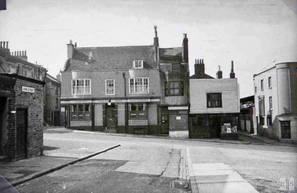
James Gray: A later photograph of about 1955, taken in the opposite direction to the previous photograph and looking at the Thurlow Arms and adjoining buildings between George Street and Dorset Street. Henry Street is the cleared street in the foreground. jgc_24_011
2018: Looking across Edward Street from John Street and taking in what was once Henry Street. (Photographer: Ruthie Martin)
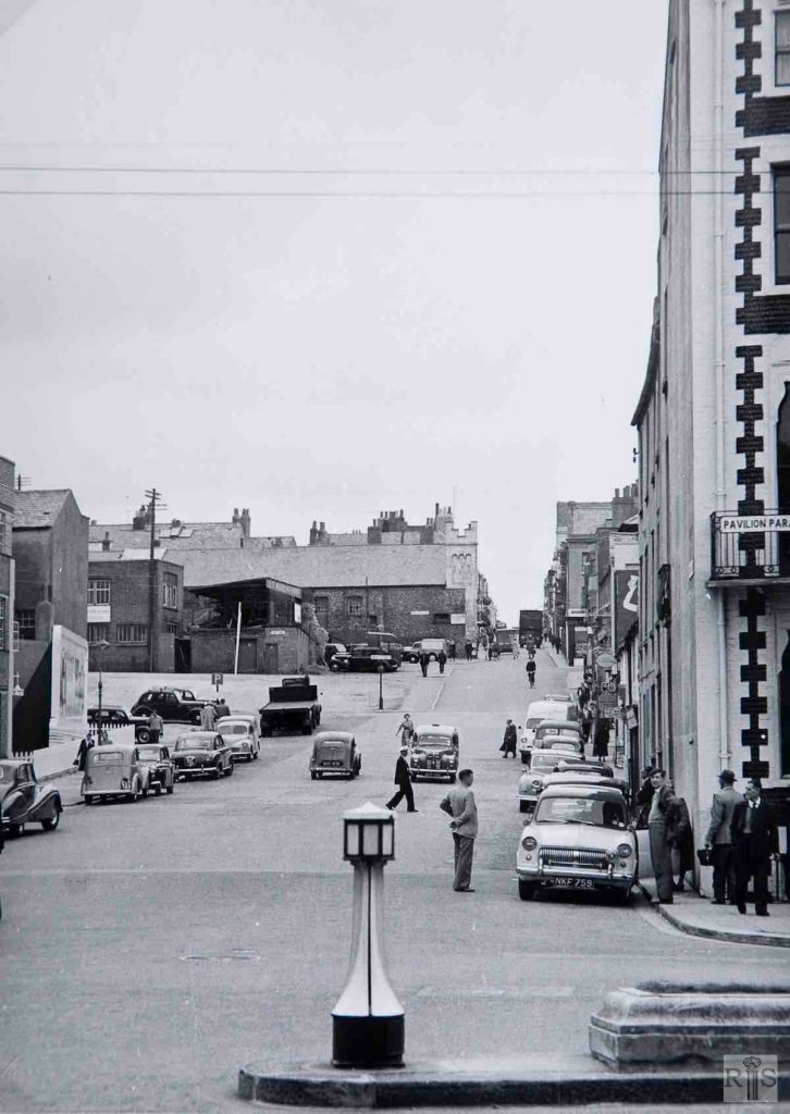
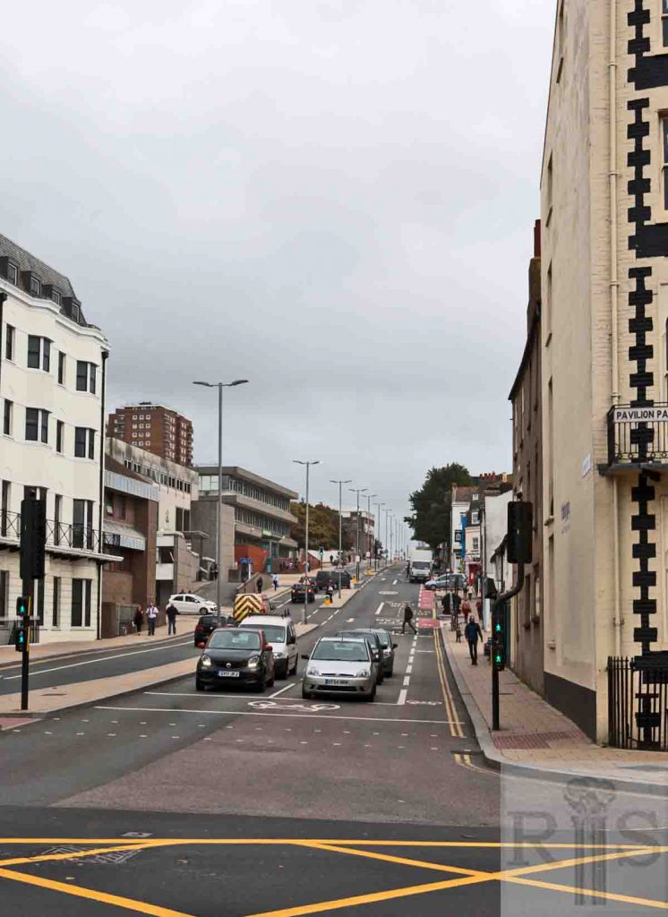
James Gray: View up Edward Street, from Pavilion Parade, in 1957. By then sufficient of the buildings in William Street, Henry Street and John Street had been removed to permit of the widening (first started in 1927) to continue east as far as the Salvation Army Citadel. The narrow entrances to George Street Gardens and Riding School Lane seem also to have gone. Few parking problems then! jgc_24_012
2018: Interestingly, the road looks about as busy as in the original image. However the addition of a central island and modern street furniture and markings has completely changed the look and feel. Flats, the law courts and Jobcentre Plus now dominate the north side. (Photographer: Ruthie Martin)
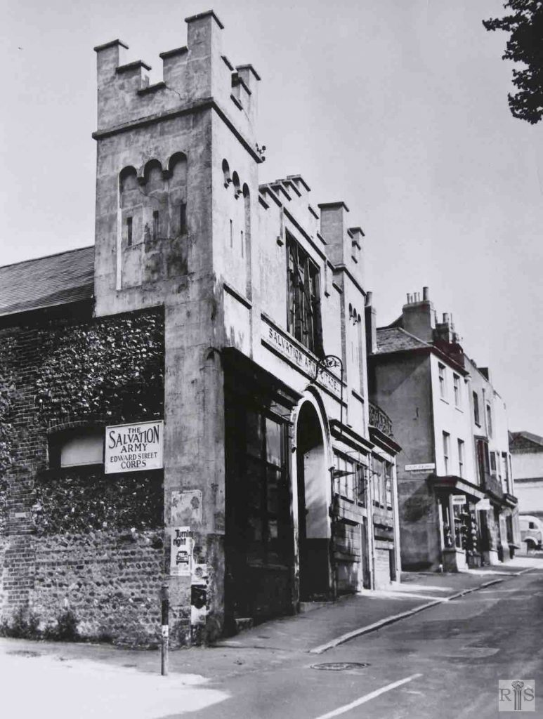
James Gray: A press photograph of the Salvation Army Citadel in 1965, shortly before it was demolished. Originally a Riding School (hence nearby Riding School Lane) it then became King Solomon’s ‘Abode of Love’ before being taken over by the Salvation Army in 1890. jgc_24_014
2018: Since 1965, the European headquarters of American Express has been built (1977) and then demolished (2017). The site now lies waiting for its next building instalment of offices, restaurants and green spaces which is to be known as the Edward Street Quarter. (Photographer: Ruthie Martin)
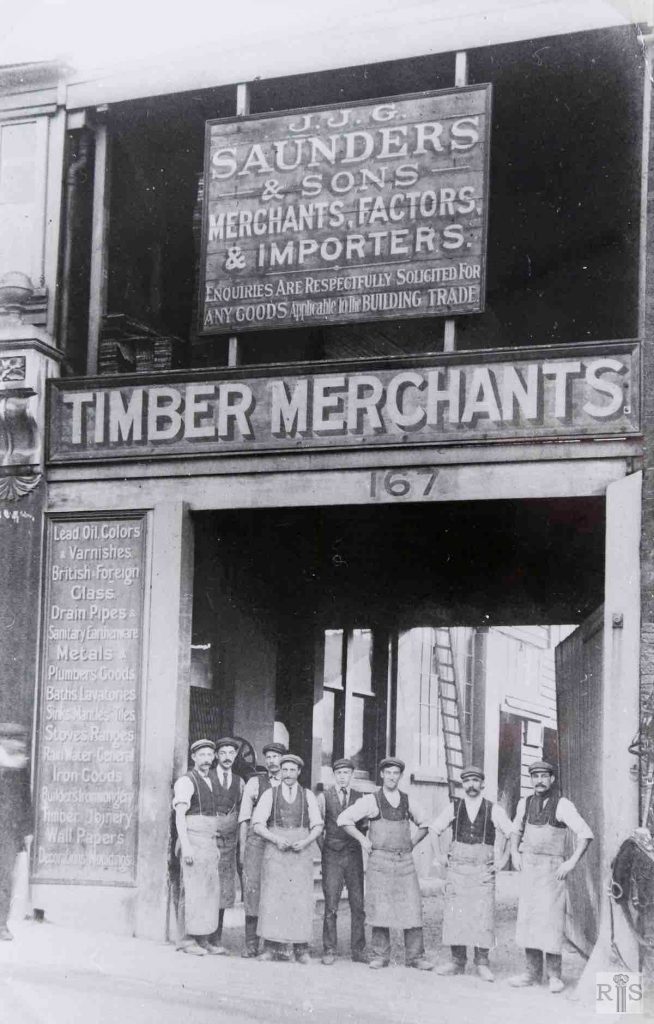
James Gray: The premises of the old established J J G Saunders & Sons at 167, Edward Street, just below Dorset Street, about 1913. jgc_24_016
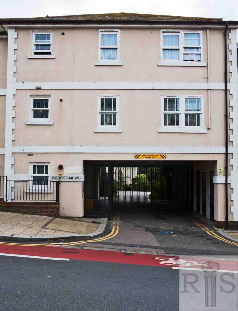
2018: Just over a hundred years later. What a transformation! The comparatively quiet Dorset Mews flats now exist where a bustling and busy timber merchants once traded. (Photographer: Ruthie Martin)
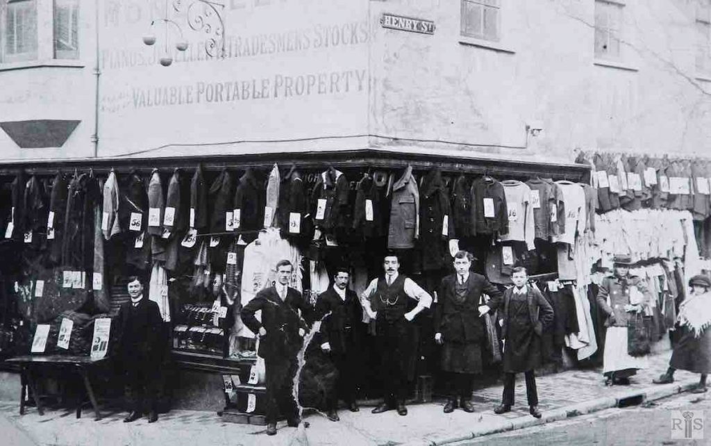
James Gray: Almost exactly opposite the previous photograph, at the corner of Henry Street, the pawnbroking and furniture dealing business of T P Lucas at 17 & 18, Edward Street, is seen here, about 1909. A study of the prices shown is of interest. When the premises were removed in 1939, Mr Lucas simply moved across the street to 170, almost next door to the building seen in the previous photograph. jgc_24_017
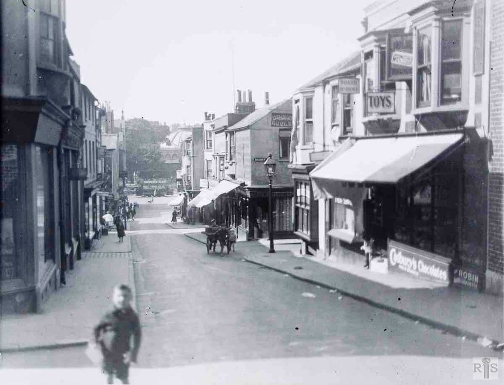
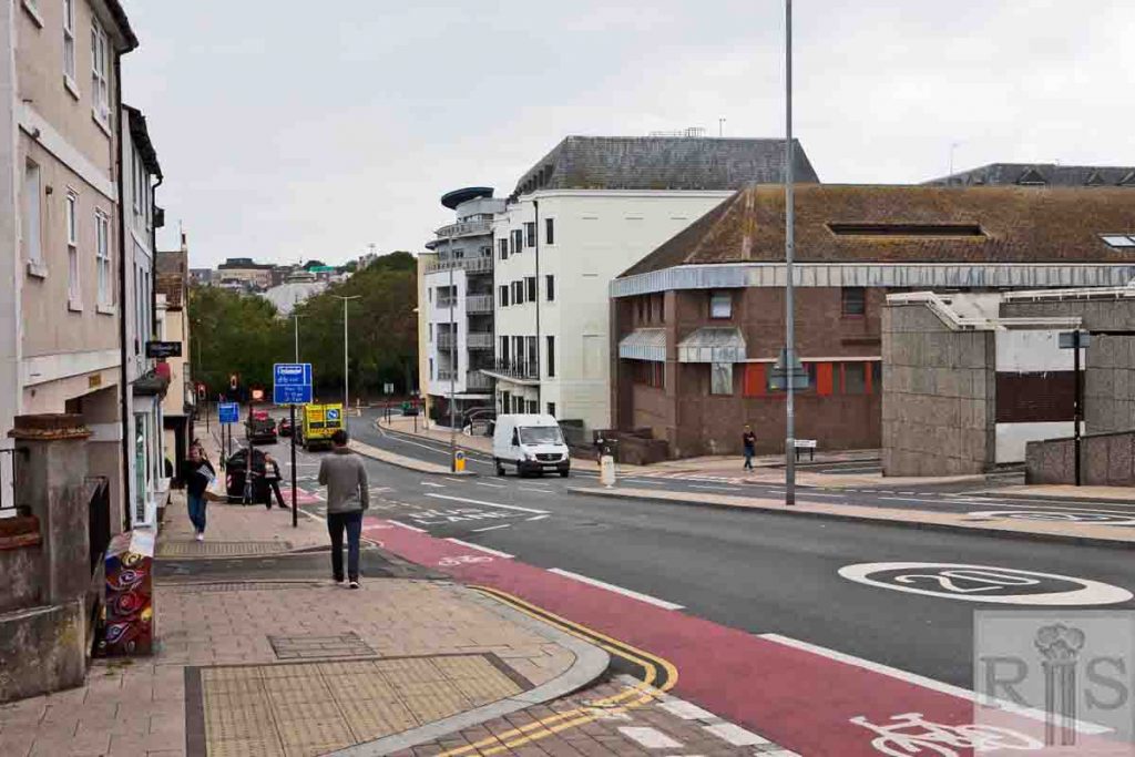
James Gray: View down the street, from the corner of Dorset Street. This was before slum clearance had started and the only widening was at the extreme foot of the street where the corner had been rounded off by the removal of Grand Parade houses. jgc_24_018
2018: The distant view of the Dome proves this is Edward Street but otherwise one might not recognise it from the original photograph.
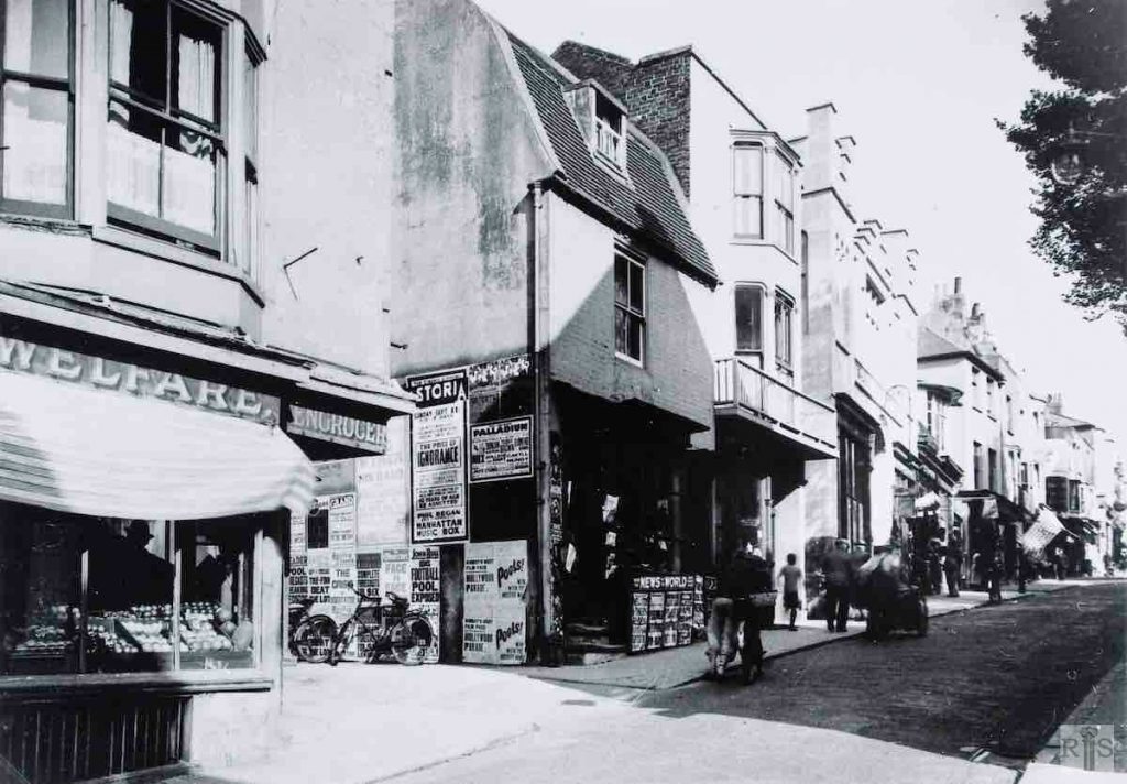
James Gray: This photograph of September 1938, shows an early nineteenth century street which somehow had lingered on into the twentieth. The heavily placarded wall was at the entrance to George Street Gardens. Just beyond the running boy was Riding School Lane and then the Salvation Army Citadel. Next came Boss’s Gardens and Dorset Buildings and so on up the hill. Many of these houses survived the War but all have now gone. What a contrast to the present Edward Street! jgc_24_019
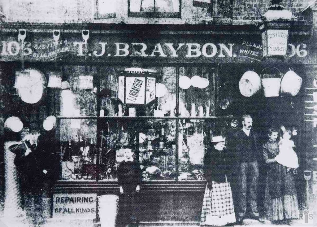
James Gray: T J Braybon’s shop at 106, Edward Street. He had this shop in 1897 but the photograph may date from a little after this. Mr Braybon was Mayor of Brighton in 1931-1932. jgc_24_020
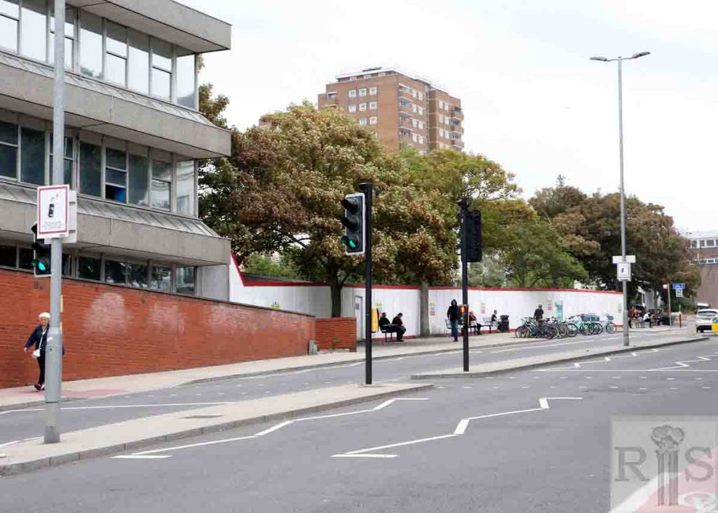
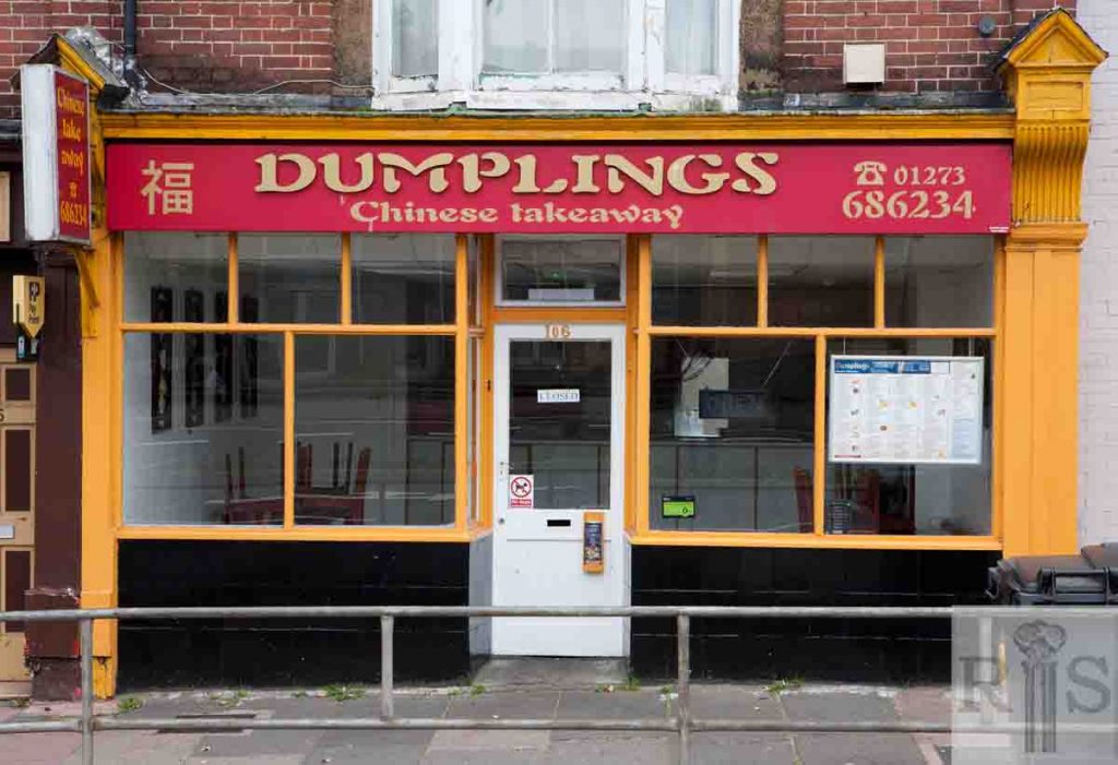
2018: Since the time of T J Braybon, the windows of this premises have been changed, the door has been moved and the lantern light removed. Only the bay window above remains the same. (Photographer: Ruthie Martin)
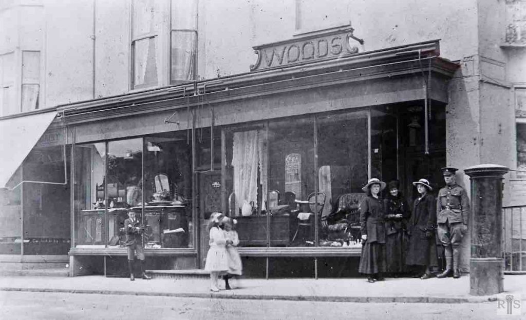
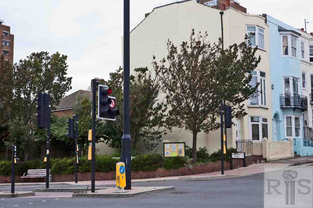
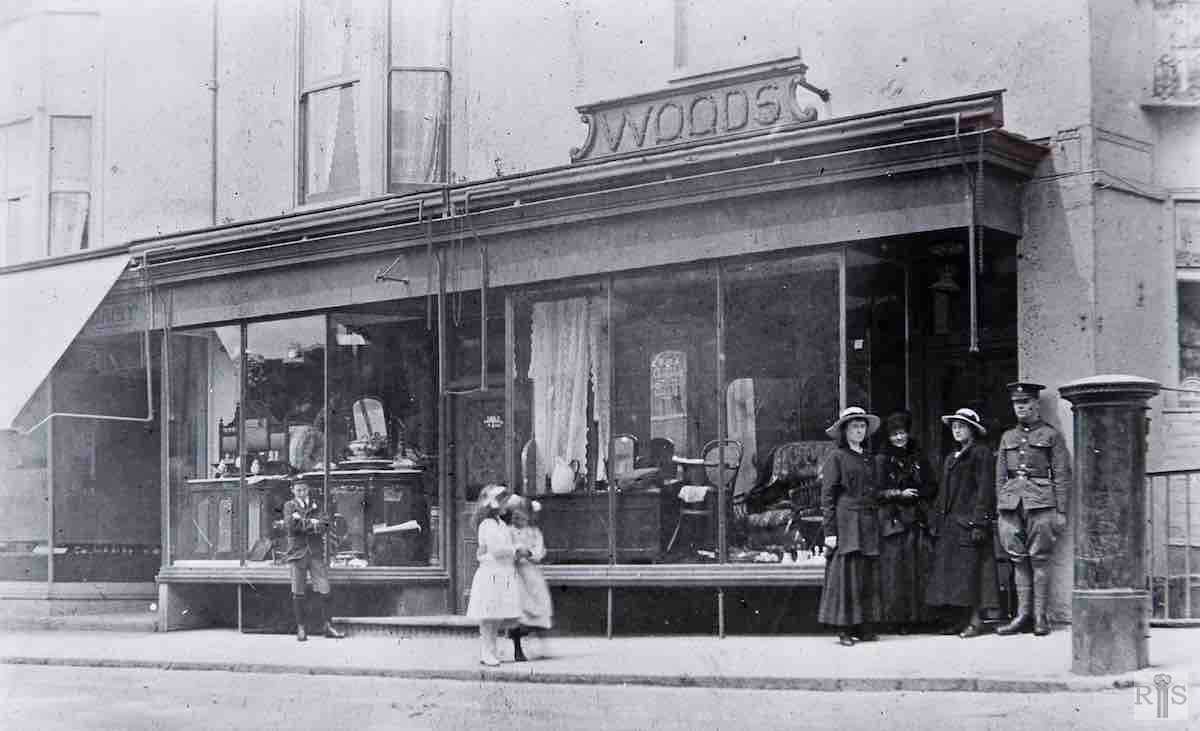
James Gray: Woods furniture shop, 75 Edward Street at the corner of Egremont Place, in 1916. The building was demolished some 15 years ago and the site remained derelict. Recently the whole area was cleared as part of the Edward Street widening. jgc_24_023
2018: No building has replaced Woods furniture shop and the site remains a small green space on the corner with Egremont Place, with some planting and a community notice board. (Photographer: Ruthie Martin)
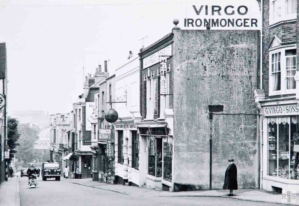
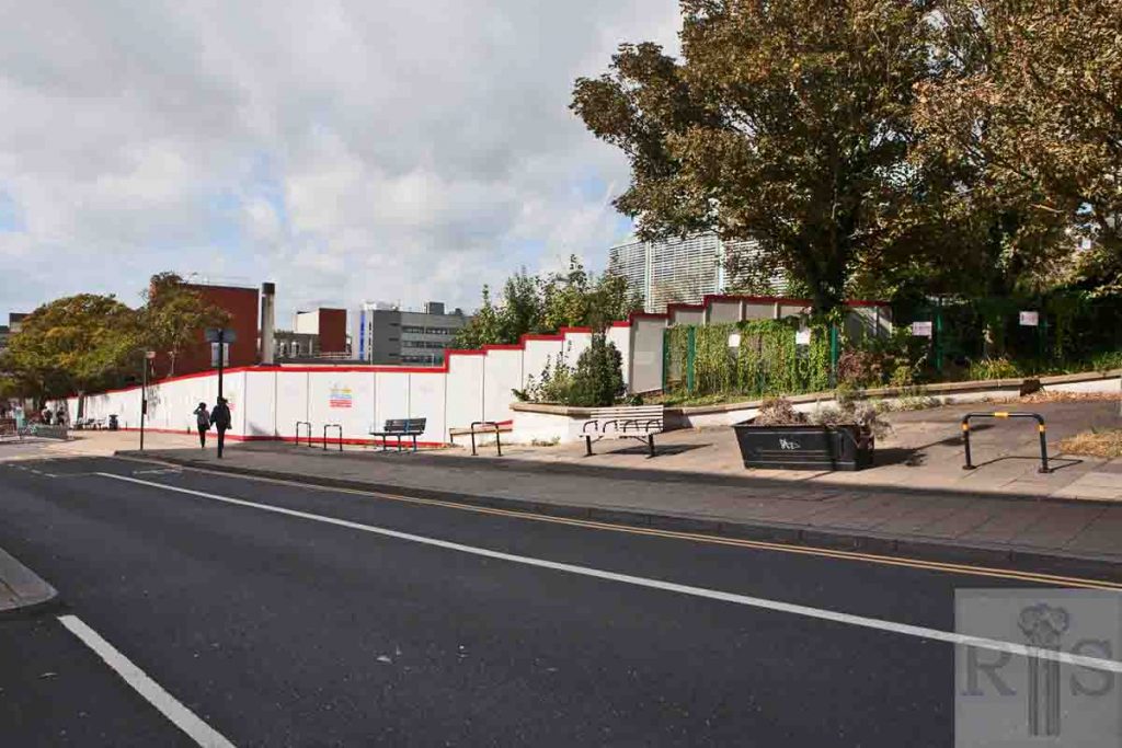
James Gray: This has been a long drawn out affair. It could be said to have started with the demolition of 1 and 2, Pavilion Parade, as long ago as 1927. It continued at intervals until the war but then there was a long delay until the 1960s. From Virgo’s down to the Salvation Army Citadel, June 4, 1961, showing the earlier widening of 1896. jgc_24_024
2018: The area has been long since cleared in the process of widening Edward Street.
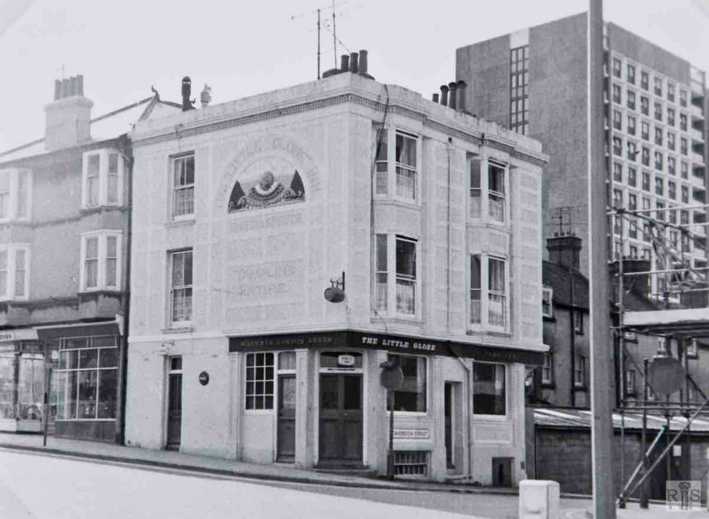
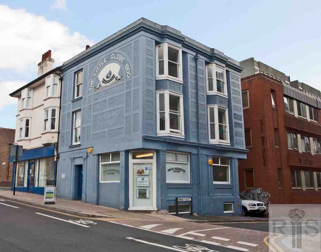
James Gray: Two buildings between High Street and Cavendish Street, photographed on May 17 1970. The Little Globe Inn was one of the best known of Edward Street’s many public houses and beer houses. The building still stands, reconstructed and now offices of the Halifax Building Society. jgc_24_028
2018: The reconstructed Little Globe building remains and is now the offices of Alex Sherwood, Solicitors. (Photographer: Ruthie Martin)
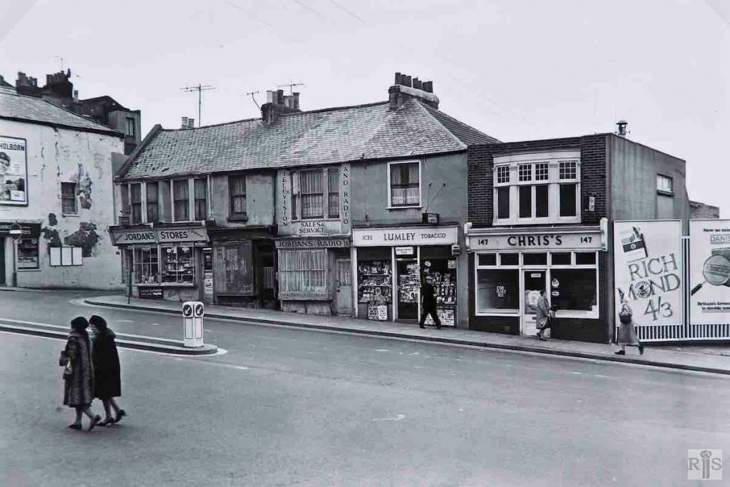
James Gray: Old houses, 142/147, Edward Street, between Chapel Street and High Street. When I had these photographed on March 19, 1967, they seemed destined for early removal but they are still with us as I write in 1983. No longer can 20 cigarettes be bought for 4/3d. [21p.] jgc_24_029
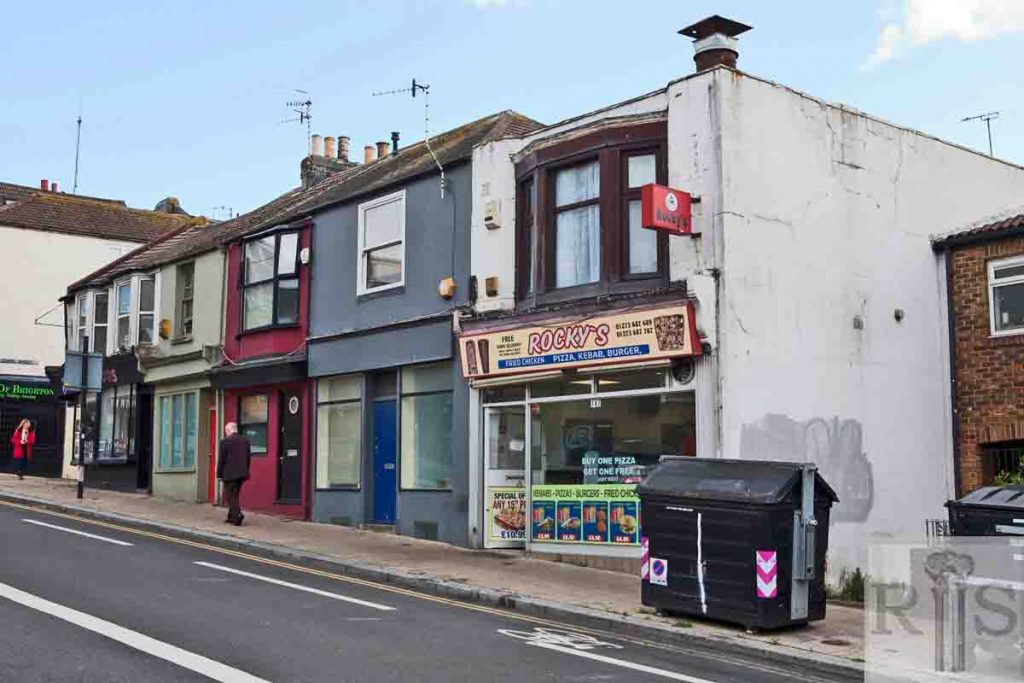
2018: The old houses at 142-147 Edward Street, are still standing – only the shopfronts have changed. (Photographer: Ruthie Martin)
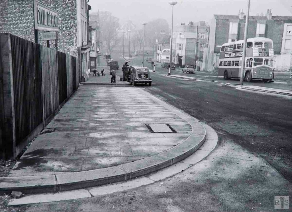
James Gray: Looking down towards the Pavilion Grounds, from what appears to be the corner of Dorset Street. In 1963, this was the early days of the new, widened street and there were several features of the old street still visible, notably the backs of tall houses in William Street. Note also the sparsity of traffic. jgc_24_030
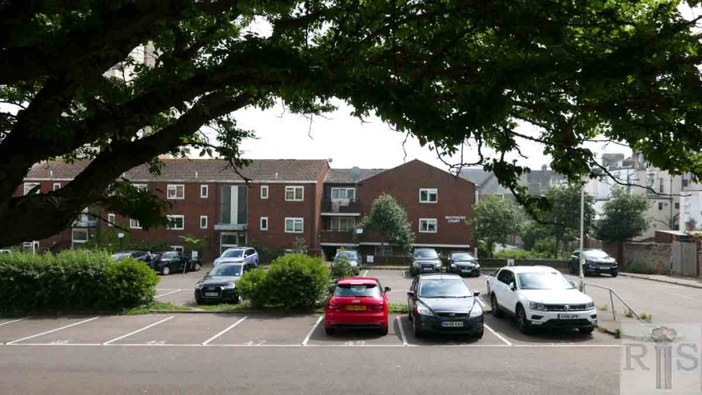
2018: Dorset Mews flats now occupies the site just below the corner of Dorset Street and Edward Street. Edward Street is busier these days, as evidenced by additional road markings.
James Gray: Looking down the street in 1967, when the new Police Station in John Street was under construction. jgc_24_033
2018: The same view down Edward Street, showing Brighton Magistrates’ Court. The original 1960s building housing Brighton Police station has now been redeveloped and updated. (Photographer: Ruthie Martin)
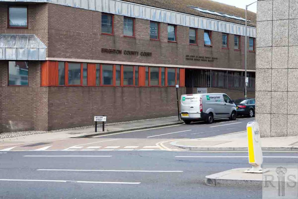
James Gray: A much later photograph, of April 4 1981, looking into William Street, and the empty space used for years as a car park. Two years later, the site is being developed, probably for a new County Court. jgc_24_035
2018: Brighton County Court which was opened in 1985. (Photographer: Ruthie Martin)
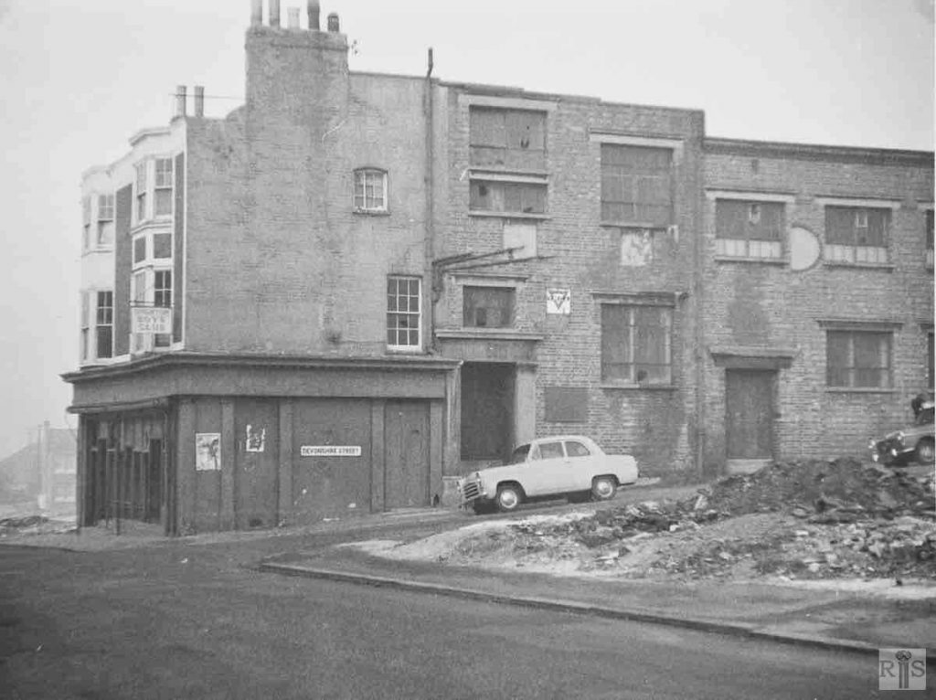
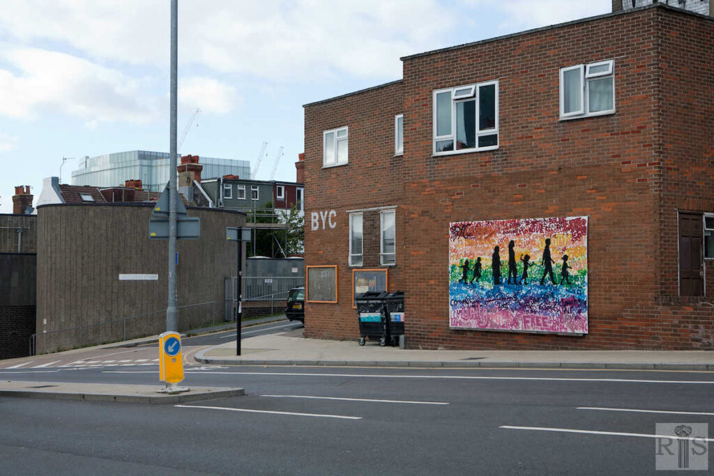
James Gray: A fairly recent photograph of this old street. The clearance around Brighton Boys Club, at the corner of Devonshire Street, in 1962. jgc_24_036
2018: The new purpose-built Brighton Boys Club was constructed in 1963. It changed its name to Brighton Youth Centre in 1977, from which time girls were included as members. Today the youth centre offers activities to over 400 children and young people every week. (Photographer: Ruthie Martin)
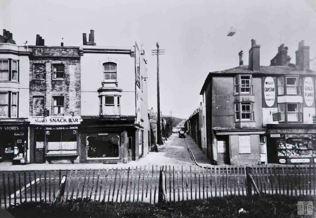
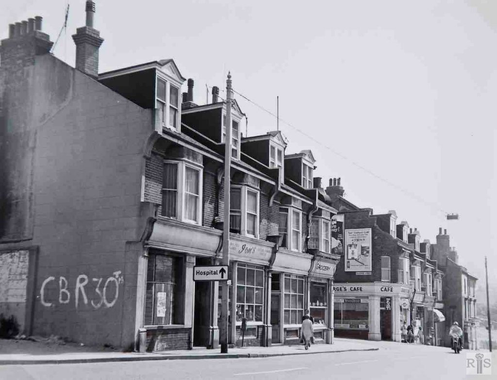
James Gray: Nos 77-81, ancient shops with living accommodation above, showing Leicester Street intact, year probably 1955. jgc_24_037
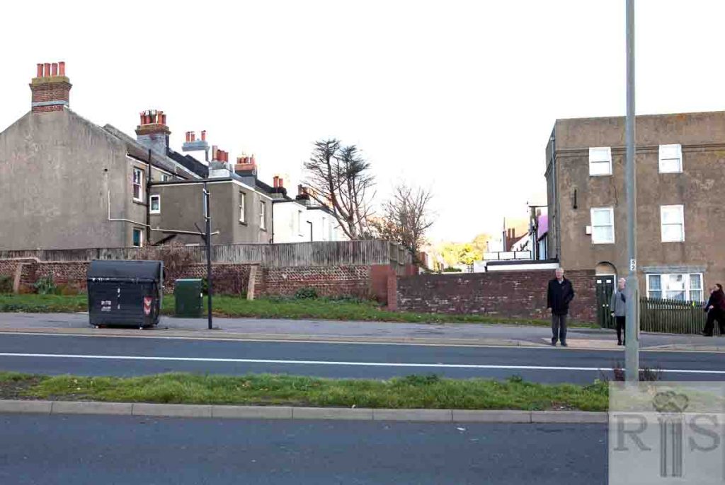
2018: All the old shops along this stretch of Edward Street disappeared when the street was widened in the early 1960s. The entrance to Leicester Street is now only a narrow lane, the main course of the street (where the distant car is parked) having been diverted east into Tillstone Street. (Photographer: Ruthie Martin)
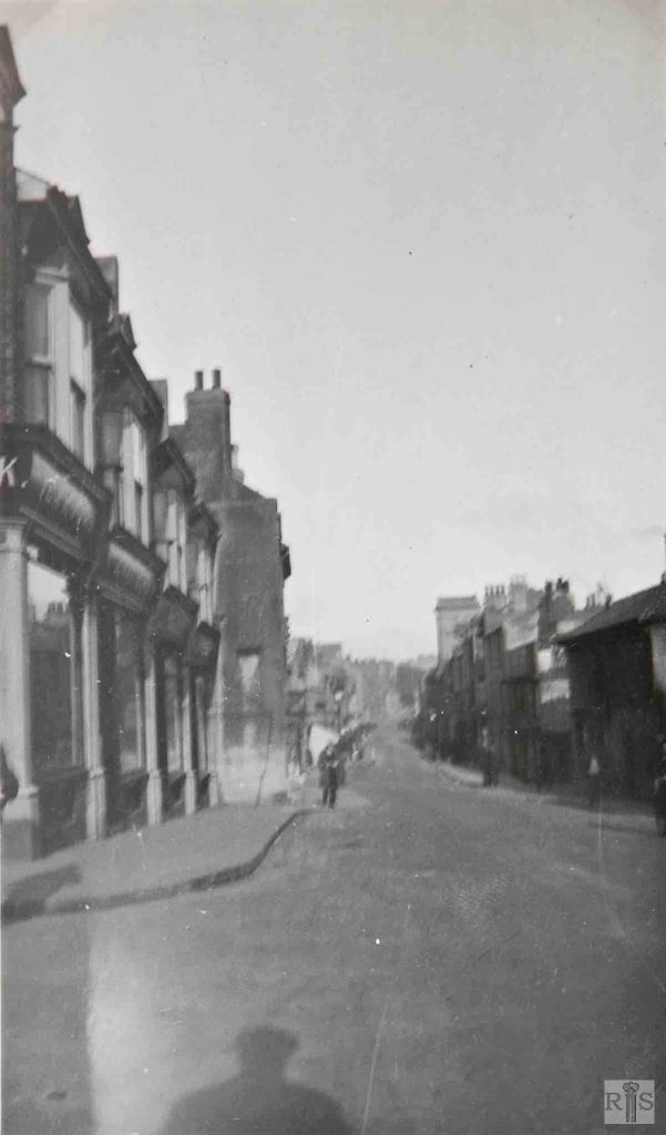
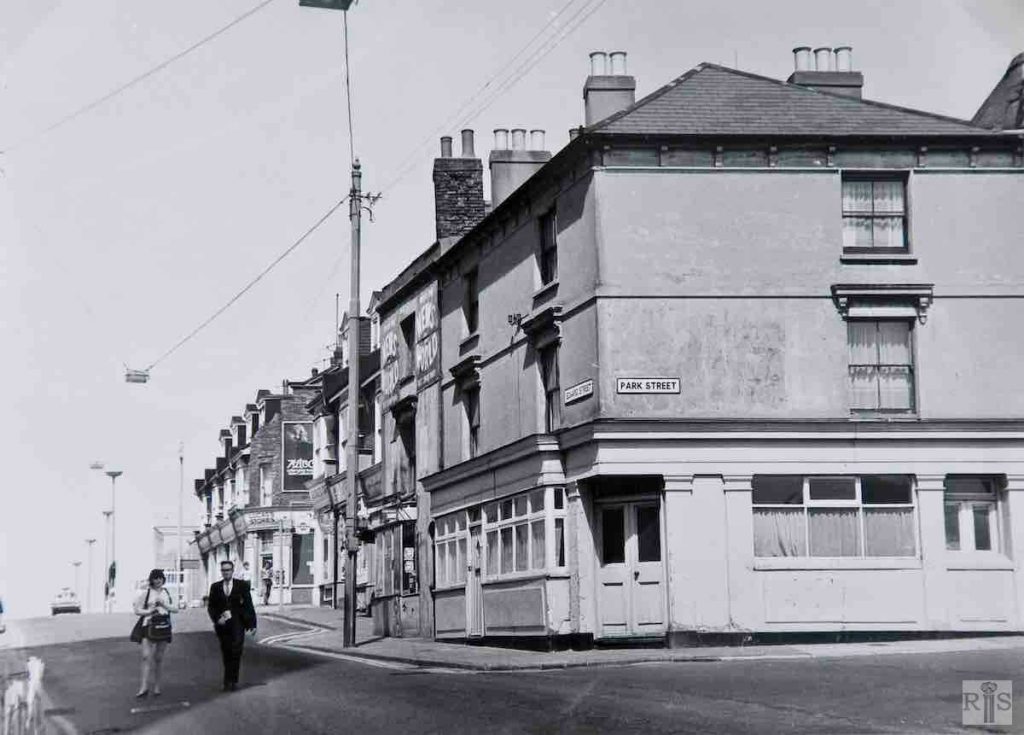
James Gray: One of two photographs [jgc_24_038 and 039] of the same range of buildings, but at a lapse in time of about 45 years. The north side of Edward Street, between Leicester Street and Park Street. jgc_24_038
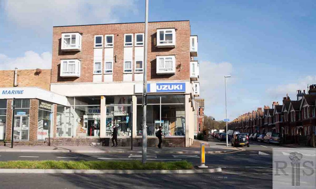
James Gray: Two of two photographs of the same range of buildings, but at a lapse in time of about 45 years. The north side of Edward Street, between Leicester Street and Park Street – June 29, 1969. jgc_24_039
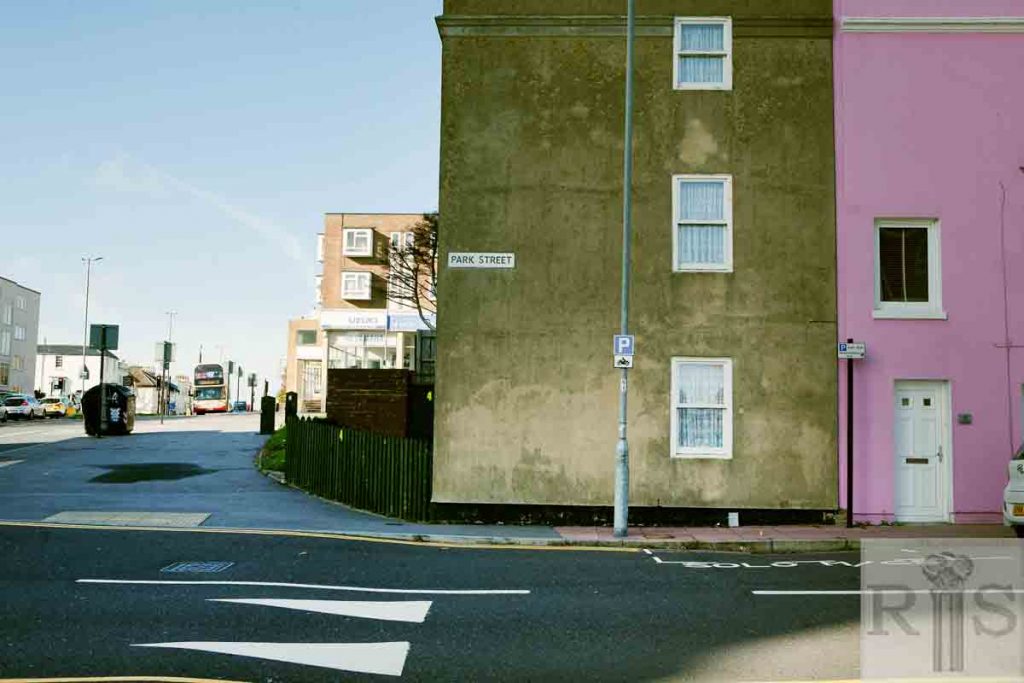
2018: The north side of Edward Street, between what used to be the entrance to Leicester Street and Park Street, has changed dramatically. All the little shops have gone, to be replaced by Outboards Direct and a length of road onto which back the first houses and gardens of Tillstone Street and Park Street. (Photographer: Ruthie Martin)
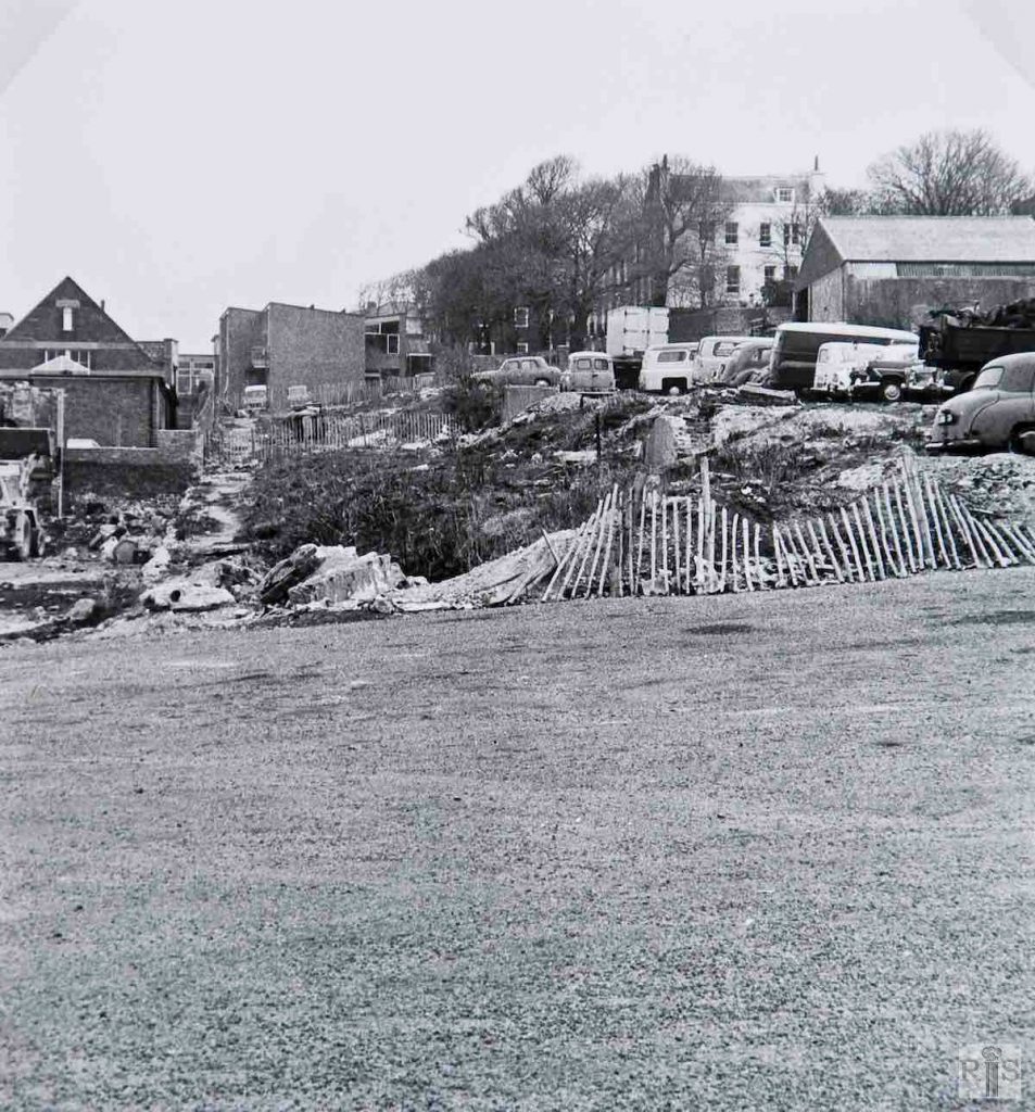
James Gray: View of the same buildings [see jgc_24_038 and 039] from the opposite direction, 1969. These buildings were of much more recent construction than most of this street, dating only from the late 1890s when the slums of Spa Street and Egremont Street were swept away, and Edward Street was slightly widened. In turn, they were demolished in 1972 for road improvements. jgc_24_040
James Gray: Another 1966 photograph of the vast cleared open area on which formerly had been slum and mean streets. Following their clearance, the ground had been a Coach Car Park until Amex House was built here and opened in September, 1967. jgc_24_053
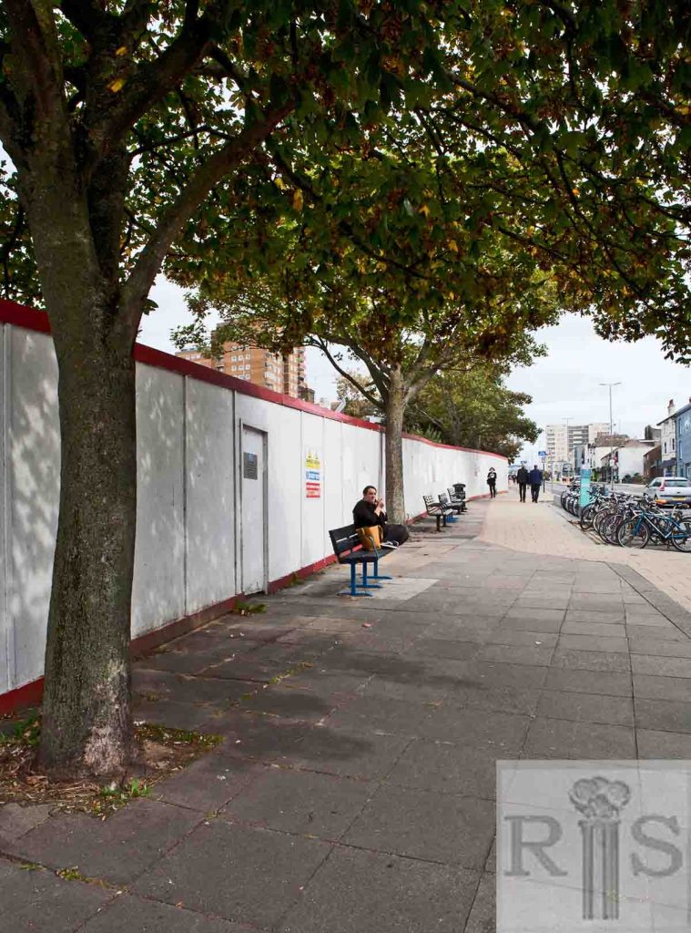
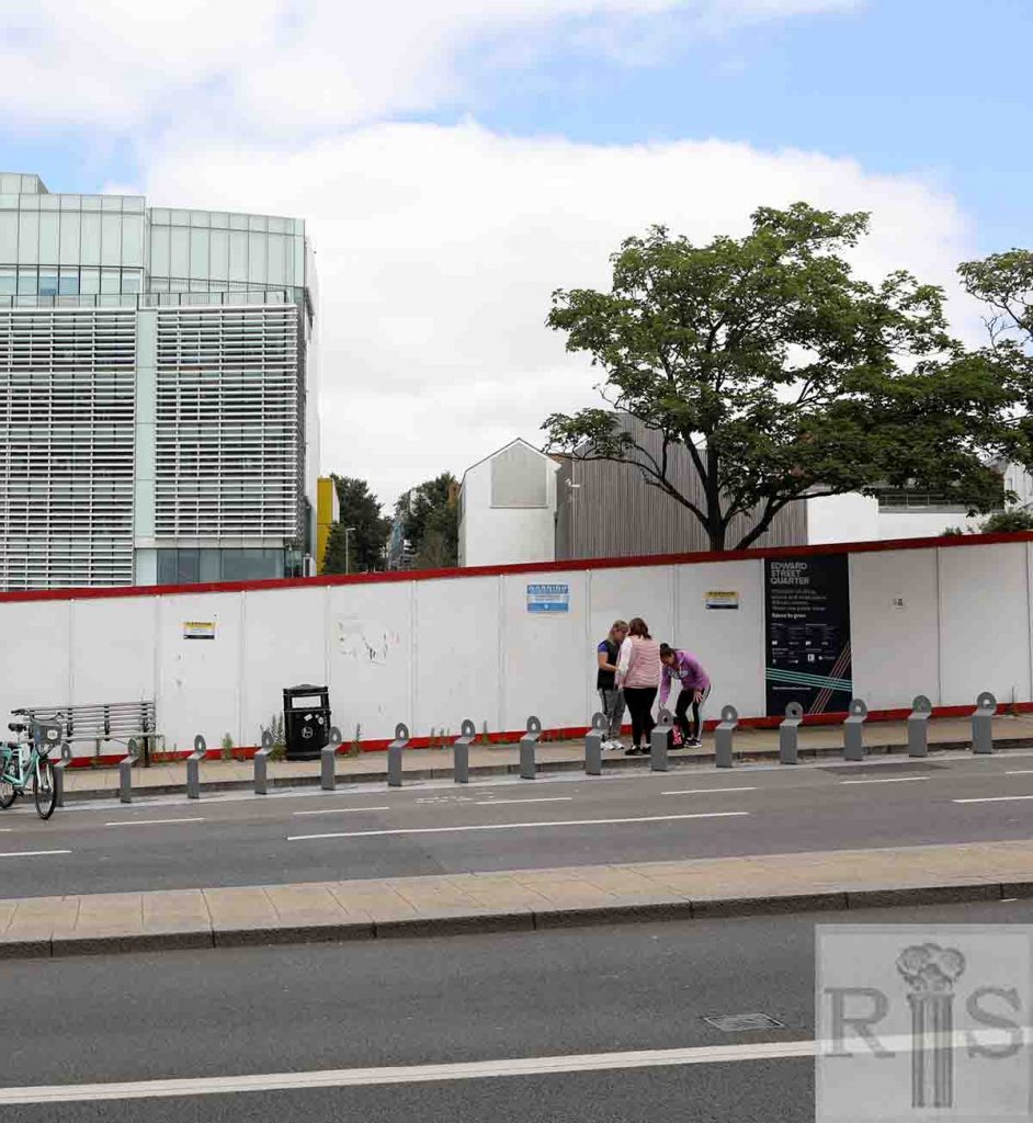
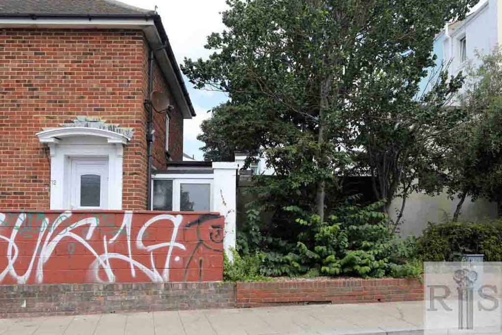
2019: Work is underway to build the Edward Street Quarter – a mixed use redevelopment of this two acre site previously occupied by American Express European Headquarters. The scheme is to include residential, retail, leisure and public space. A high hoarding all along the site prevents a closer look at how much progress has been made so far. (Photographer: Ruthie Martin)
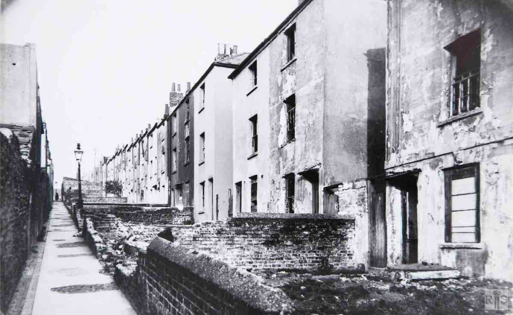
James Gray: Old slum houses in their last few weeks before demolition in 1936. They faced the backs of the houses of Mount Pleasant shown previously. The view here is north from Edward Street to Carlton Hill. One wonders why this was named Park Place as it was some distance from Queens Park. A small part of Upper Park Place still remains above Carlton Hill. jgc_24_058
James Gray: This photograph was, along with several others, the subject of a competition in the summer of 1930, the photographs being displayed in the window of a chemists shop in St James’s Street. The public were invited to identify the locations.
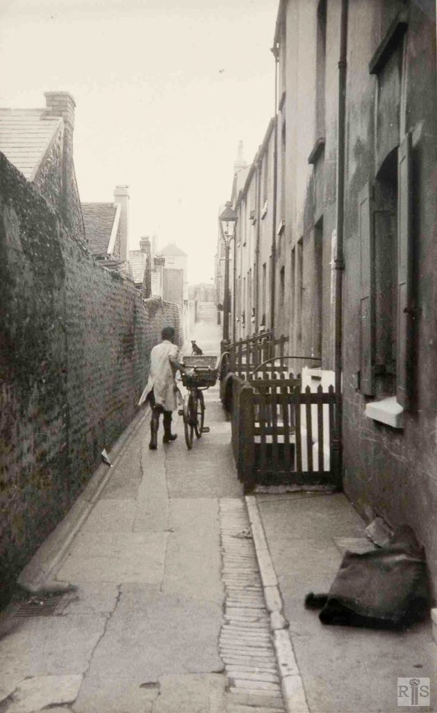
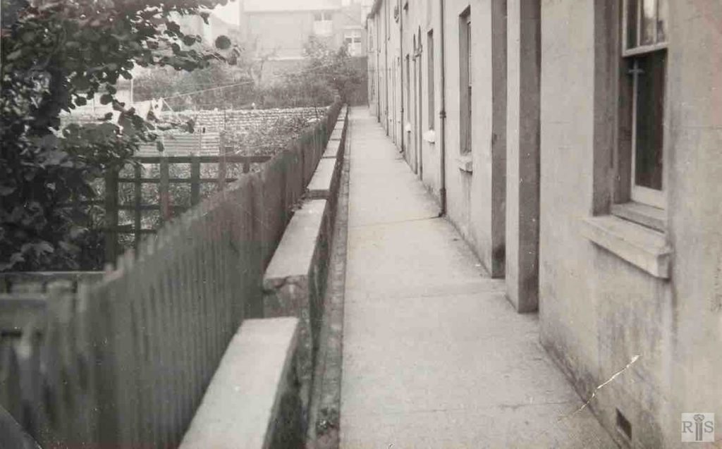
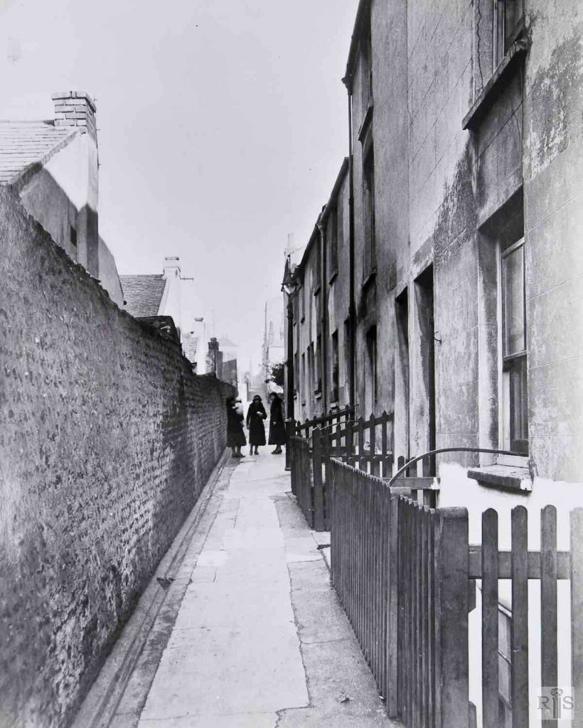
Looking north up Dorset Buildings, from Edward Street to Carlton Hill. Behind the high wall are the backs of the cottages of Boss’s Gardens, with just a foot or two of space in between. jgc_24_071
James Gray: [See caption for jgc_24_071 above.] Looking north along the footway in front of the cottages known as Boss’s Gardens. Each cottage had its trim garden across the path. jgc_24_072
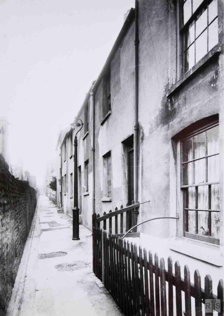
James Gray: A narrow alley of dilapidated cottages, photographed February 7th, 1935. The view is northwards towards Carlton Hill. The house with the wooden fence was No 8 and all those beyond it were removed in 1936. A few cottages nearer to Edward Street and not in the pictures lingered on until the 1950s.
On the left, the rear view of the houses in Boss’s Gardens. jgc_24_078
James Gray: The cleared area of old narrow streets, Riding School Lane, Boss’s Gardens, and Dorset Buildings photographed in 1966. After being derelict for many years, the large American Express building now stands here. Note the distant St John’s Church and Vicarage. jgc_24_034
James Gray: [See caption for jgc_24_078 above.] jgc_24_077
James Gray: Approached by a passage from dingy Dorset Buildings, these old houses have a certain charm when seen from the gardens which face them. They were built about 1830 by George Boss, Riding Master, of 35 Edward Street. Though still with us they are included in the development plan and may go before long. Photographed June 20 1954. jgc_24_074
2018: Amex House was opened in 1977 and demolished in 2016. The newer and taller American Express building shown here was built on the site of the former car park. (Photographer: Ruthie Martin)
James Gray: Old buildings at the corner of Edward Street and George Street Gardens. jgc_24_075
James Gray: This was between William and John Streets, all three being named after Royal Dukes, the brothers of George IV. At one time entirely residential apart from St James’s Mission Room and a small mineral water factory. It was completely demolished by the early 1960s and the site is now covered by the new Police Headquarters and Law Courts. In the distance, Kingswood Flats. jgc_24_098
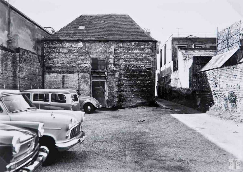
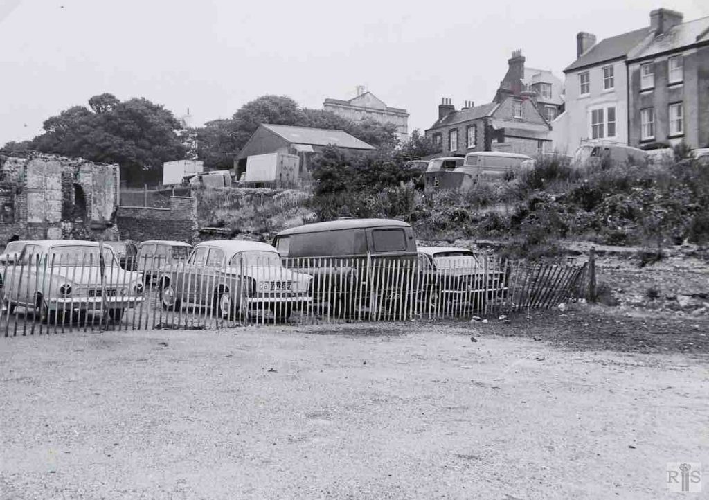
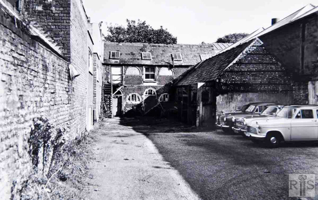
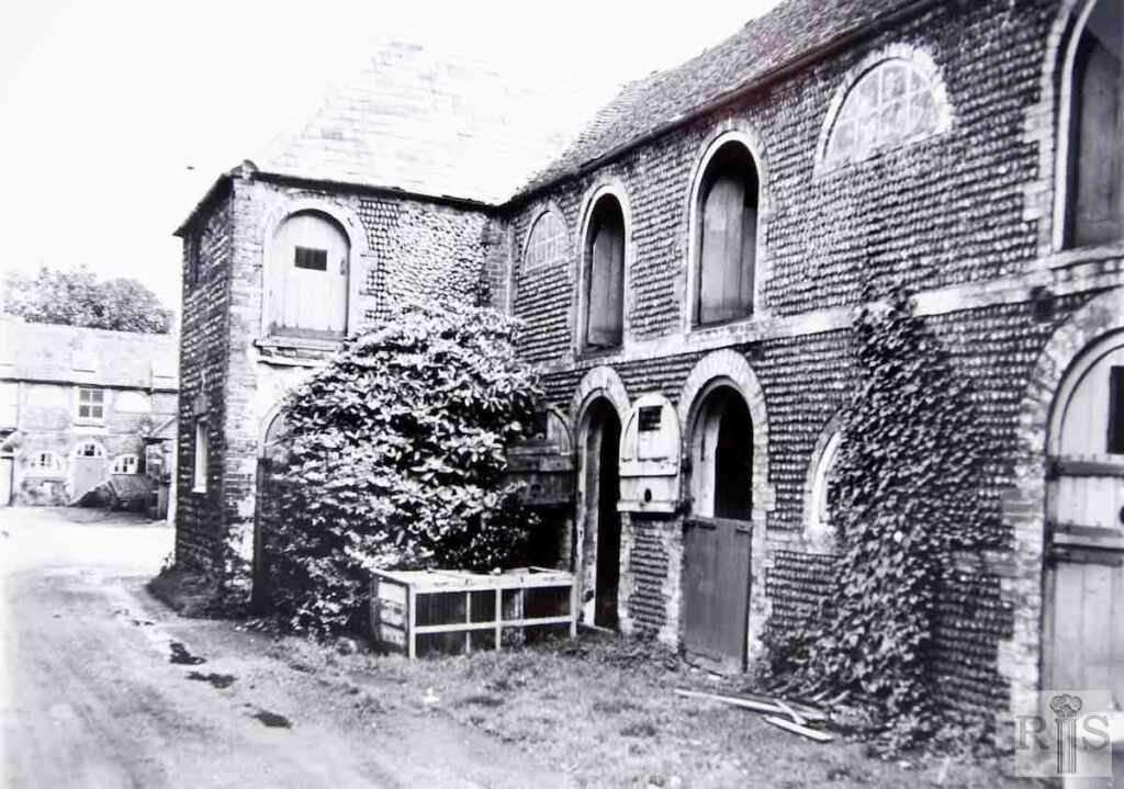
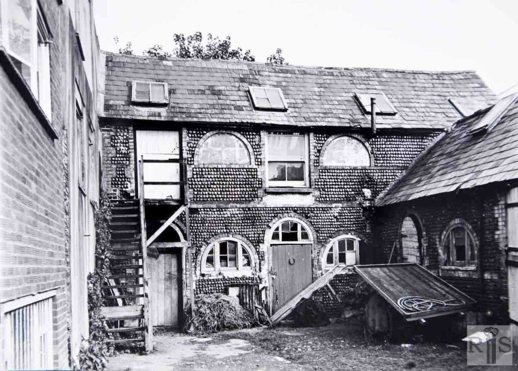
James Gray: Tucked away behind the tall houses at the southern end of Grand Parade, and almost hidden from view but with a narrow entrance from Edward Street, are these old flint buildings, which are still there many years after these photographs were taken in the 1960s. Their origins are not known or documented, but they figure prominently in the mid-Victorian Directories as livery stables run by Charles Shaw for many years, the address being Colonnade Mews. This business was given up in the 1800s [1900s?], after which the Edward Street property became the home of Veterinary Surgeons. As can be seen, in recent years part of the area has been used for the inevitable car-parking. jgc_30_161, 162 and 163
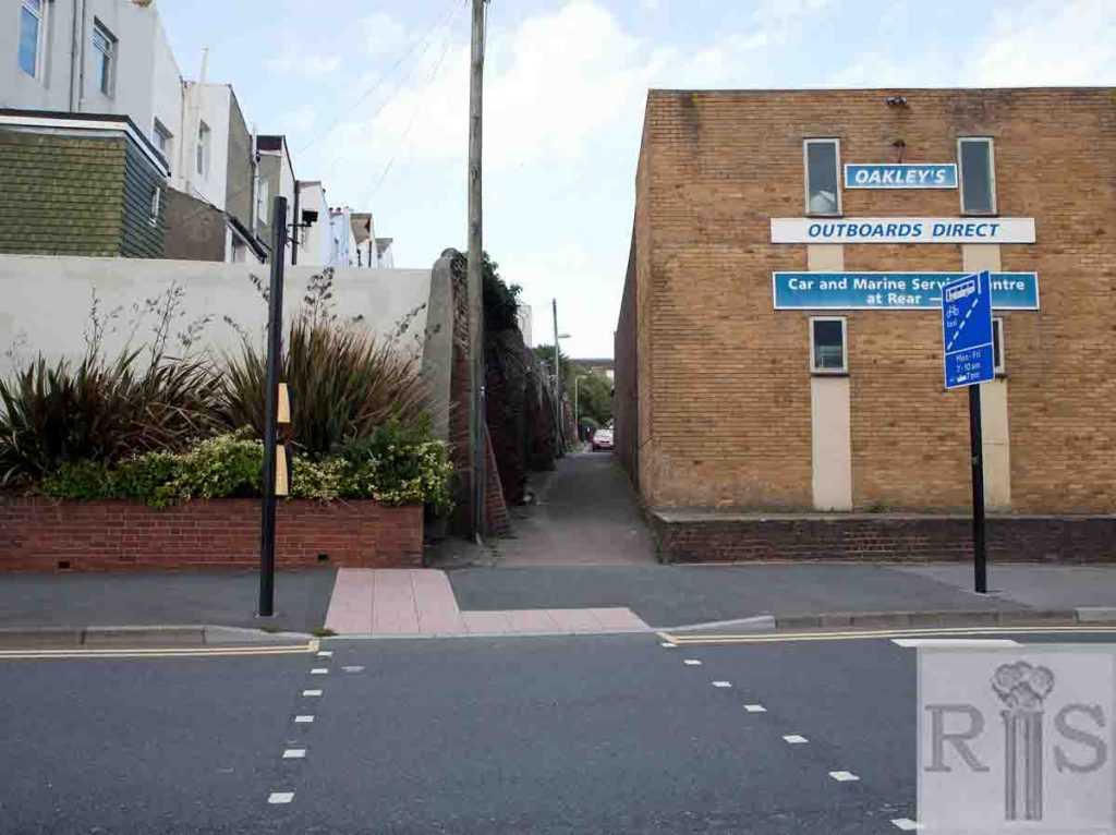
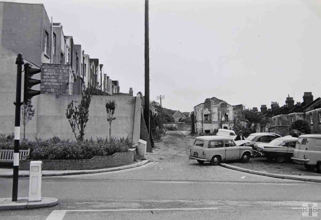
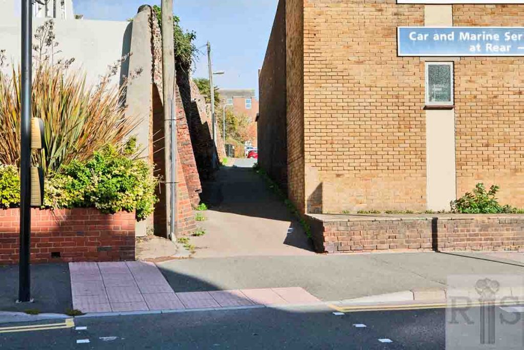
James Gray: Contrasting views [see also jgc_24_046 on the Leicester Street page] of this humble little street, tucked away behind the high wall which flanked the gardens of middle-class Egremont Place. The desolate scene in 1968 when the removal of the houses was all but completed. The considerable widening of the lateral road, Edward Street, makes Leicester Street seem shorter, but the telegraph pole and the buttresses are in the same position in each photograph. jgc_24_047
2019: The direction of Leicester Street has been changed so that it runs into Tillstone Street. The narrow lane which comes out onto Edward Street is all that is left of street in the original photograph. The wall behind the Egremont Place gardens remains on one side of the lane and the car parking area to the right in the original photograph is now occupied by Outboards Direct. (Photographer: Ruthie Martin)
