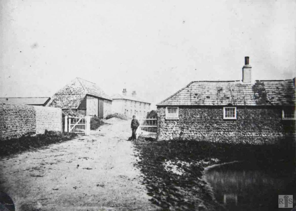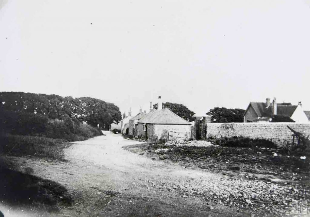
James Gray: Farm cottages at West Blatchington, just before their removal. Court Farm Road was then widened by several feet on the north side. The road turning out at the right, which led from the farm to Toads Hole, is now covered with vegetation and only a footpath remains. At the time of their demolition these cottages were about 120 years old. jgc_36_019
James Gray: Another view. September 1937 jgc_36_020
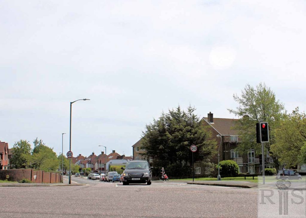
2018: In 2018 nothing remains from the old photo. The cottages were demolished in 1937, and Court Farm Road was subsequently widened, but the old track to Toads Hole, which started close to the wall on the extreme right of the old photo, still exists as a path in 2018.
James Gray: The farm water cart turning out of Court Farm on its way to irrigate the fields. The old cottages just visible were removed early in 1937. The lane turning out to the left is the lane shown in the photograph of 1914. jgc_36_046
2018: The unmade road in the 1953 photo is the present-day Court Farm Road, and the lane turning out to the left is now the busy Hangleton Road.
James Gray: Two photographs [jgc_36_073 and 074] of Parson’s Field, glebe land adjoining the present Court Farm Road, probably taken about 1930. The flats known as King George VI Mansions were built on this field in the mid-1950s. jgc_36_073
James Gray: This unusual looking building, in the last stages of decay, was the bakehouse of Blatchington Court, which it faced across the old farm road. Some of the trees in the background are still standing. jgc_36_102
James Gray: The view directly across the road from the previous photograph. By now the old road had been replaced by Court Farm Road. On this vacant site will later be built a Catholic Church. Date of photograph 20 June 1954. jgc_36_103
2018: In the 1954 photo, what is now Blatchington Mill School can be seen immediately above the lamppost.
James Gray: View of the same area from within the farm, looking north, showing the rear of the cottages and a glimpse of the duck pond. Hillside Cottages in the background outlived the other buildings and were demolished as recently as 1953. The wall on the left is the present Churchyard wall. jgc_36_022
2018: If the pond had still been here in 2018, the photographer would have been standing in it to take the photo! All that remains from 1937 is the churchyard wall on the left, which belongs to the parish church of St Peter’s, West Blatchington. Hillside Cottages have been replaced by Nos 382A to 392A Hangleton Road, on the corner with Clarke Avenue.
James Gray: View from the north-west, at the junction of Court Farm Road and Holmes Avenue. Blatchington Court, demolished in November, 1955, was a building of considerable antiquity. The north wing was thought to be the oldest part of the house and probably dated from the 14th century. Extensive alterations were carried out in Tudor times, whilst further changes took place during the 17th and 18th centuries.
James Gray: Taken from the north-east, showing the Victorian east front. Blatchington Court, demolished in November, 1955, was a building of considerable antiquity. The north wing was thought to be the oldest part of the house and probably dated from the 14th century. Extensive alterations were carried out in Tudor times, whilst further changes took place during the 17th and 18th centuries.
.James Gray: The old St Peter’s church in ruins during the 19th century. After being in this condition for more than 100 years, the church was rebuilt at a cost of over £2000 and re-opened on St Peter’s day, 1891. Date of photograph unknown. Note the interesting comparison with the next photograph (jgc_36_115) taken in 1920. jgc_36_114
James Gray: A small snapshot of the churchyard, with just a few memorial stones. Thought to have been taken in 1930. jgc_36_113
James Gray: Taken during the 1890s, not long after the Church was rebuilt. jgc_36_118
James Gray: Some of the original stonework was retained in the rebuilt church. Both photographs were taken looking towards the east and show the wall of Blatchington Court. jgc_36_115
James Gray: This photograph shows the church in 1906, before any graves were in the churchyard. jgc_36_120
James Gray: A photograph of the old church. The date is not known, but seemingly taken while West Blatchington was still a hamlet. jgc_36_124
2018: There have been substantial changes since the rebuilt St Peter’s church opened in 1891. The photo taken in 2018 shows the churchyard full of gravestones, but the main changes have been to the church itself. A large extension on the north side, commenced in 1960, was completed by 1962. The western end of the extension, which included a larger nave and chancel, can be seen on the left of the 2018 photo. To the right of the church is the most northerly block of flats comprising The Mount, in Holmes Avenue. (Photographer: Alan Hobden)
James Gray: No comment. jgc_36_122
2019:The 1930s photo was taken from the first floor rear balcony of the semi-detached house at 44 Court Farm Road, looking west over next door’s rear garden at No 46. In the background from left to right are the chalet bungalow at 156 Holmes Avenue, the West Blatchington Windmill and West Blatchington Court farmhouse.
James Gray: This photograph was taken on 15 February 1960, not long before the present church hall was started jgc_36_126
2018: The same view of St Peter’s Church in May 2018 is obscured by the mature trees in the grounds of The Mount in the foreground, so the present-day photo was taken closer to the most northerly block of flats in this development.
James Gray: The empty site in Court Farm Road, behind the Nevill Hotel, then used as a general car park. Photographed in February 1964. Later a small block of flats was built here and, taken over by Hove Council, was named Howard Court. jgc_36_155
2018: The rear of the eastern end of the Nevill Hotel in Nevill Road (which, in 2018, advertises itself as ‘The Nevill of Hove’) can still be seen in the background on the right in the present-day photo.
James Gray: The peaceful scene in the 1890s. The view is from old, narrow Hangleton Road looking towards the farm cottages and the belt of trees that formerly screened the hamlet of West Blatchington from the urban area of Hove. On the left, facing the cottages was the large field, known as Parson’s field, on which have recently been built the blocks of flats. jgc_36_018
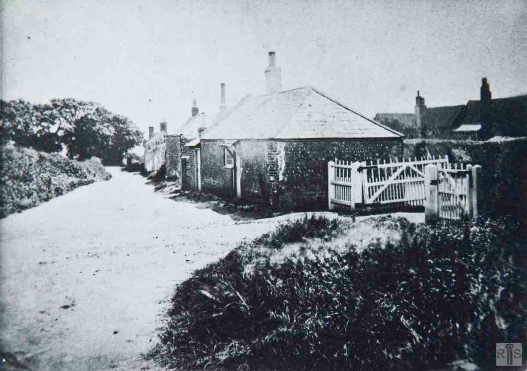
James Gray: Ancient cottages at the north entrance to Court Farm. The site is roughly the junction of the present Holmes Avenue and Court Farm Road. A few of the trees in the distance are still standing – 1954. The old cottages were removed early in 1937. jgc_36_021
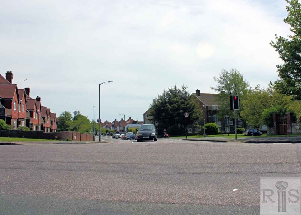
2019: The 1937 photo is a close up of the view seen in jgc_36_018, taken in the 1890s. St Peter’s Church northern boundary wall is just out of shot to the right. In the 2018 photo, some of the trees still stand on the left, beyond the flats of King George VI Mansions. The view is to the south-east, from Hangleton Road, looking down Court Farm Road, with Holmes Avenue leading off to the right a few yards from the traffic lights. (Photographer: Alan Hobden)


